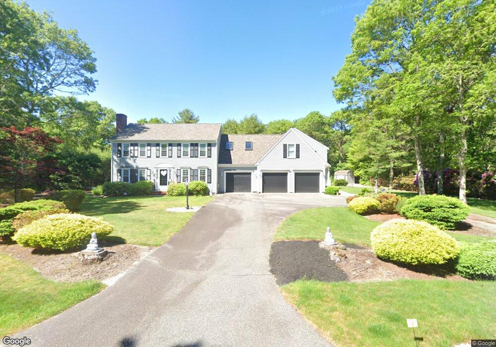
3 Kalmia Path Unit 2 Sandwich, MA 02563
Estimated Value: $1,630,000 - $2,048,000
5
Beds
5
Baths
3,766
Sq Ft
$505/Sq Ft
Est. Value
About This Home
This home is located at 3 Kalmia Path Unit 2, Sandwich, MA 02563 and is currently estimated at $1,901,056, approximately $504 per square foot. 3 Kalmia Path Unit 2 is a home located in Barnstable County with nearby schools including Sandwich Middle High School and Sandwich Montessori School.
Ownership History
Date
Name
Owned For
Owner Type
Purchase Details
Closed on
Nov 1, 2019
Sold by
Mccarthy Charles R and Mccarthy Morrissey
Bought by
Grasso Laura S
Current Estimated Value
Purchase Details
Closed on
Aug 9, 2004
Sold by
Mccarthy Kathleen M
Bought by
Kathleen M Mccarthy Rt and Mccarthy Kathleen M
Purchase Details
Closed on
Dec 20, 1996
Sold by
Motta Barry J and Leary Lois J
Bought by
Mulvaney Robert J and Mulvaney Kathleen M
Purchase Details
Closed on
Sep 15, 1995
Sold by
Stanton Michael J and Stanton Marianne
Bought by
Motta Barry J and Motta Lois J
Purchase Details
Closed on
May 27, 1993
Sold by
Dacey Brian T
Bought by
Stanton Michael J and Stanton Marianne
Create a Home Valuation Report for This Property
The Home Valuation Report is an in-depth analysis detailing your home's value as well as a comparison with similar homes in the area
Home Values in the Area
Average Home Value in this Area
Purchase History
| Date | Buyer | Sale Price | Title Company |
|---|---|---|---|
| Grasso Laura S | -- | -- | |
| Mccarthy Charles R | -- | -- | |
| Kathleen M Mccarthy Rt | -- | -- | |
| Mulvaney Robert J | $160,500 | -- | |
| Motta Barry J | $159,830 | -- | |
| Stanton Michael J | $147,300 | -- |
Source: Public Records
Mortgage History
| Date | Status | Borrower | Loan Amount |
|---|---|---|---|
| Previous Owner | Stanton Michael J | $55,000 | |
| Previous Owner | Stanton Michael J | $20,000 | |
| Previous Owner | Stanton Michael J | $88,000 |
Source: Public Records
Tax History Compared to Growth
Tax History
| Year | Tax Paid | Tax Assessment Tax Assessment Total Assessment is a certain percentage of the fair market value that is determined by local assessors to be the total taxable value of land and additions on the property. | Land | Improvement |
|---|---|---|---|---|
| 2025 | $10,562 | $999,200 | $205,600 | $793,600 |
| 2024 | $10,493 | $971,600 | $183,600 | $788,000 |
| 2023 | $10,280 | $893,900 | $166,900 | $727,000 |
| 2022 | $9,833 | $747,200 | $149,000 | $598,200 |
| 2021 | $9,424 | $684,400 | $148,300 | $536,100 |
| 2020 | $9,312 | $650,700 | $148,200 | $502,500 |
| 2019 | $8,801 | $614,600 | $145,500 | $469,100 |
| 2018 | $8,130 | $568,900 | $132,700 | $436,200 |
| 2017 | $7,994 | $535,400 | $128,400 | $407,000 |
| 2016 | $7,199 | $497,500 | $124,000 | $373,500 |
| 2015 | $6,931 | $467,700 | $100,900 | $366,800 |
Source: Public Records
Map
Nearby Homes
- 58 Southpoint Dr Unit J
- 59 Southpoint Dr Unit 59
- 93 Deerfield Rd
- 185 Cotuit Rd Unit BE4
- 185 Cotuit Rd Unit JP1
- 185 Cotuit Rd Unit C5 Aspen
- 22 Sconset Cir
- 96 Pimlico Pond Rd
- 84 Harlow Rd
- 5 Aviators Ln
- 18 Katian Way
- 3 Glenwood Ln
- 86 Greenville Dr
- 10 Wintergreen Ln
- 15 Hunters Tr
- 15 Hunters Trail
- 186 Quaker Meeting House Rd
- 11 Joe Jay Ln
- 6 Southfield Ln
- 7 Open Trail Rd