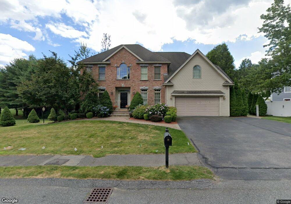
3 Katie Path Natick, MA 01760
Estimated Value: $1,608,508 - $1,802,000
5
Beds
5
Baths
4,100
Sq Ft
$420/Sq Ft
Est. Value
About This Home
This home is located at 3 Katie Path, Natick, MA 01760 and is currently estimated at $1,723,377, approximately $420 per square foot. 3 Katie Path is a home located in Middlesex County with nearby schools including Natick High School, J F Kennedy Middle School, and Johnson Elementary School.
Ownership History
Date
Name
Owned For
Owner Type
Purchase Details
Closed on
Nov 30, 2006
Sold by
Fourreau Jean D and Fourreau Mardi C
Bought by
Coveney Jeffrey D and Coveney Rachel C
Current Estimated Value
Home Financials for this Owner
Home Financials are based on the most recent Mortgage that was taken out on this home.
Original Mortgage
$417,000
Outstanding Balance
$250,006
Interest Rate
6.36%
Mortgage Type
Purchase Money Mortgage
Estimated Equity
$1,473,371
Purchase Details
Closed on
May 14, 2003
Sold by
Meadows Rt
Bought by
Fourreau Jean D and Fourreau Mardi C
Home Financials for this Owner
Home Financials are based on the most recent Mortgage that was taken out on this home.
Original Mortgage
$655,000
Interest Rate
5.84%
Mortgage Type
Purchase Money Mortgage
Create a Home Valuation Report for This Property
The Home Valuation Report is an in-depth analysis detailing your home's value as well as a comparison with similar homes in the area
Home Values in the Area
Average Home Value in this Area
Purchase History
| Date | Buyer | Sale Price | Title Company |
|---|---|---|---|
| Coveney Jeffrey D | $846,450 | -- | |
| Fourreau Jean D | $835,000 | -- |
Source: Public Records
Mortgage History
| Date | Status | Borrower | Loan Amount |
|---|---|---|---|
| Open | Coveney Jeffrey D | $417,000 | |
| Previous Owner | Fourreau Jean D | $655,000 |
Source: Public Records
Tax History
| Year | Tax Paid | Tax Assessment Tax Assessment Total Assessment is a certain percentage of the fair market value that is determined by local assessors to be the total taxable value of land and additions on the property. | Land | Improvement |
|---|---|---|---|---|
| 2025 | $17,909 | $1,497,400 | $487,900 | $1,009,500 |
| 2024 | $17,406 | $1,419,700 | $462,200 | $957,500 |
| 2023 | $16,072 | $1,271,500 | $430,300 | $841,200 |
| 2022 | $15,729 | $1,179,100 | $388,300 | $790,800 |
| 2021 | $11,349 | $1,124,800 | $383,100 | $741,700 |
| 2020 | $14,448 | $1,061,600 | $367,800 | $693,800 |
| 2019 | $13,493 | $1,061,600 | $367,800 | $693,800 |
| 2018 | $11,130 | $974,300 | $355,000 | $619,300 |
| 2017 | $12,838 | $951,700 | $343,600 | $608,100 |
| 2016 | $12,839 | $946,100 | $343,600 | $602,500 |
| 2015 | $12,408 | $897,800 | $343,600 | $554,200 |
Source: Public Records
Map
Nearby Homes
- 5 Lanes End
- 34 Walden Dr Unit 5
- 30 Walden Dr Unit 7
- 8 Walden Dr Unit 13
- 46 Silver Hill Ln Unit 1
- 1 Post Oak Ln Unit 19
- 36 Silver Hill Ln Unit 21
- 3 Silver Hill Ln Unit 6
- 28 Sylvester Rd
- 79 Speen St
- 26 Wellesley Ave Unit B
- 52 Village Brook Ln Unit 14
- 27 Stillman St
- 57 Village Brook Ln Unit 5
- 8 Village Way Unit 11
- 15 Village Way Unit 8
- 44 Village Hill Ln
- 1 Fern St
- 29 Village Rock Ln Unit 6
- 4 Village Rock Ln Unit 9
- 1 Katie Path
- 30 Pheasant Hollow Rd
- 5 Katie Path
- 4 Katie Path
- 4 Karen Ln
- 2 Katie Path
- 6 Katie Path
- 32 Pheasant Hollow Rd
- 2 Karen Ln Unit LOT7C
- 2 Karen Ln
- 28 Pheasant Hollow Rd
- 33 Pheasant Hollow Rd
- 31 Pheasant Hollow Rd
- 34 Prescott Ave
- 7 Karen Ln
- 34 Pheasant Hollow Rd
- 8 Karen Ln
- 9 Karen Ln
- 5 Karen Ln
- 13 Samuel Path
Your Personal Tour Guide
Ask me questions while you tour the home.