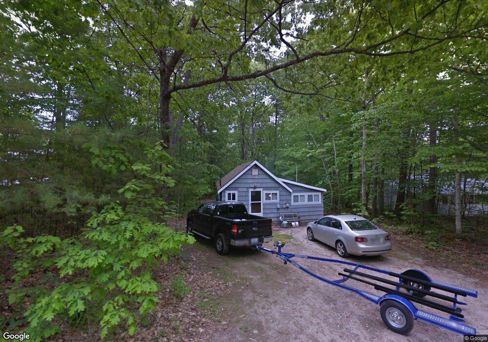
3 Kentwood Rd Raymond, ME 04071
Estimated Value: $337,000 - $534,000
2
Beds
1
Bath
704
Sq Ft
$587/Sq Ft
Est. Value
About This Home
This home is located at 3 Kentwood Rd, Raymond, ME 04071 and is currently estimated at $412,965, approximately $586 per square foot. 3 Kentwood Rd is a home located in Cumberland County with nearby schools including Gray-New Gloucester High School.
Ownership History
Date
Name
Owned For
Owner Type
Purchase Details
Closed on
Oct 9, 2025
Sold by
Mckew Deborah A
Bought by
Mckew Deborah A and Mckew John A
Current Estimated Value
Purchase Details
Closed on
Jul 17, 2020
Sold by
Reid Christine F
Bought by
Mckew Deborah A
Home Financials for this Owner
Home Financials are based on the most recent Mortgage that was taken out on this home.
Original Mortgage
$187,000
Interest Rate
3.1%
Mortgage Type
New Conventional
Create a Home Valuation Report for This Property
The Home Valuation Report is an in-depth analysis detailing your home's value as well as a comparison with similar homes in the area
Home Values in the Area
Average Home Value in this Area
Purchase History
| Date | Buyer | Sale Price | Title Company |
|---|---|---|---|
| Mckew Deborah A | -- | -- | |
| Mckew Deborah A | -- | None Available |
Source: Public Records
Mortgage History
| Date | Status | Borrower | Loan Amount |
|---|---|---|---|
| Previous Owner | Mckew Deborah A | $187,000 |
Source: Public Records
Tax History Compared to Growth
Tax History
| Year | Tax Paid | Tax Assessment Tax Assessment Total Assessment is a certain percentage of the fair market value that is determined by local assessors to be the total taxable value of land and additions on the property. | Land | Improvement |
|---|---|---|---|---|
| 2025 | $3,077 | $317,900 | $202,000 | $115,900 |
| 2024 | $3,038 | $313,200 | $202,000 | $111,200 |
| 2023 | $2,335 | $153,800 | $61,600 | $92,200 |
| 2022 | $2,146 | $153,800 | $61,600 | $92,200 |
| 2021 | $2,035 | $139,300 | $61,600 | $77,700 |
| 2020 | $1,714 | $116,200 | $61,600 | $54,600 |
| 2019 | $1,714 | $116,200 | $61,600 | $54,600 |
| 2018 | $1,627 | $116,200 | $61,600 | $54,600 |
| 2017 | $1,885 | $99,200 | $60,800 | $38,400 |
| 2016 | $1,815 | $99,200 | $60,800 | $38,400 |
| 2015 | $1,793 | $98,500 | $60,800 | $37,700 |
| 2014 | $1,793 | $98,500 | $60,800 | $37,700 |
| 2012 | $1,561 | $98,499 | $60,800 | $37,699 |
Source: Public Records
Map
Nearby Homes
- M011-006 Westwood Rd
- 11-007 Westwood Rd
- 56 Qualey Rd
- 21 Westwood Rd
- 7 Gore Rd
- 0 Heidi Way
- 12 Presidential View
- 74 May Meadow Dr
- 15 Worcester Dr
- 24 Suckerville Rd
- 157 Egypt Rd
- 15 May Meadow Dr
- 4 Chelsey Ln
- 112 N Raymond Rd
- 35 Webbs Mills Rd
- 00 N Shore Rd
- 107 Harvest Hill Rd
- 7 Salmon Run
- 2 Flynn Rd
- 20 Ramsdell Rd