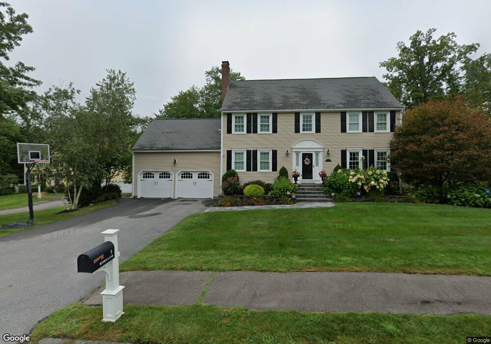
3 Kings Ln Medway, MA 02053
Estimated Value: $871,240 - $1,020,000
4
Beds
3
Baths
3,080
Sq Ft
$299/Sq Ft
Est. Value
About This Home
This home is located at 3 Kings Ln, Medway, MA 02053 and is currently estimated at $921,810, approximately $299 per square foot. 3 Kings Ln is a home located in Norfolk County with nearby schools including John D. McGovern Elementary School, Burke-Memorial Elementary, and Medway Middle School.
Ownership History
Date
Name
Owned For
Owner Type
Purchase Details
Closed on
May 30, 2003
Sold by
Sia James A and Sia Cynthia M
Bought by
Hansen Jon R and Hansen Amy C
Current Estimated Value
Purchase Details
Closed on
Feb 26, 1993
Sold by
Kelley One Rt
Bought by
Sia James A and Sia Cynthia M
Create a Home Valuation Report for This Property
The Home Valuation Report is an in-depth analysis detailing your home's value as well as a comparison with similar homes in the area
Home Values in the Area
Average Home Value in this Area
Purchase History
| Date | Buyer | Sale Price | Title Company |
|---|---|---|---|
| Hansen Jon R | $447,500 | -- | |
| Sia James A | $229,900 | -- |
Source: Public Records
Mortgage History
| Date | Status | Borrower | Loan Amount |
|---|---|---|---|
| Open | Sia James A | $268,000 | |
| Closed | Sia James A | $270,000 | |
| Closed | Sia James A | $282,000 |
Source: Public Records
Tax History Compared to Growth
Tax History
| Year | Tax Paid | Tax Assessment Tax Assessment Total Assessment is a certain percentage of the fair market value that is determined by local assessors to be the total taxable value of land and additions on the property. | Land | Improvement |
|---|---|---|---|---|
| 2025 | $11,201 | $786,000 | $338,000 | $448,000 |
| 2024 | $11,318 | $786,000 | $338,000 | $448,000 |
| 2023 | $11,128 | $698,100 | $307,600 | $390,500 |
| 2022 | $10,112 | $597,300 | $227,500 | $369,800 |
| 2021 | $9,984 | $571,800 | $212,300 | $359,500 |
| 2020 | $9,959 | $569,100 | $212,300 | $356,800 |
| 2019 | $9,289 | $547,400 | $203,600 | $343,800 |
| 2018 | $9,374 | $530,800 | $195,000 | $335,800 |
| 2017 | $9,309 | $519,500 | $190,600 | $328,900 |
| 2016 | $8,883 | $490,500 | $175,500 | $315,000 |
| 2015 | $8,814 | $483,200 | $173,300 | $309,900 |
| 2014 | $7,969 | $423,000 | $173,300 | $249,700 |
Source: Public Records
Map
Nearby Homes
- 280 Village St Unit D2
- 4 Shaw St
- 22 Sunset Dr
- 28 Wellington St
- 3 Meryl St
- 20 Broad St Unit 6
- 20 Broad St Unit A
- 20 Broad St Unit 4
- 176 Main St Unit 3
- 14 Heritage Dr
- 14 Sanford St Unit 15
- 9 Sanford St
- 50 Main St
- 12 Lovering St
- 106 Holliston St
- 36 Lovering St
- 21 Riverside Rd
- 0 Elm St
- 841 Lincoln St
- 7 Gloucester Dr