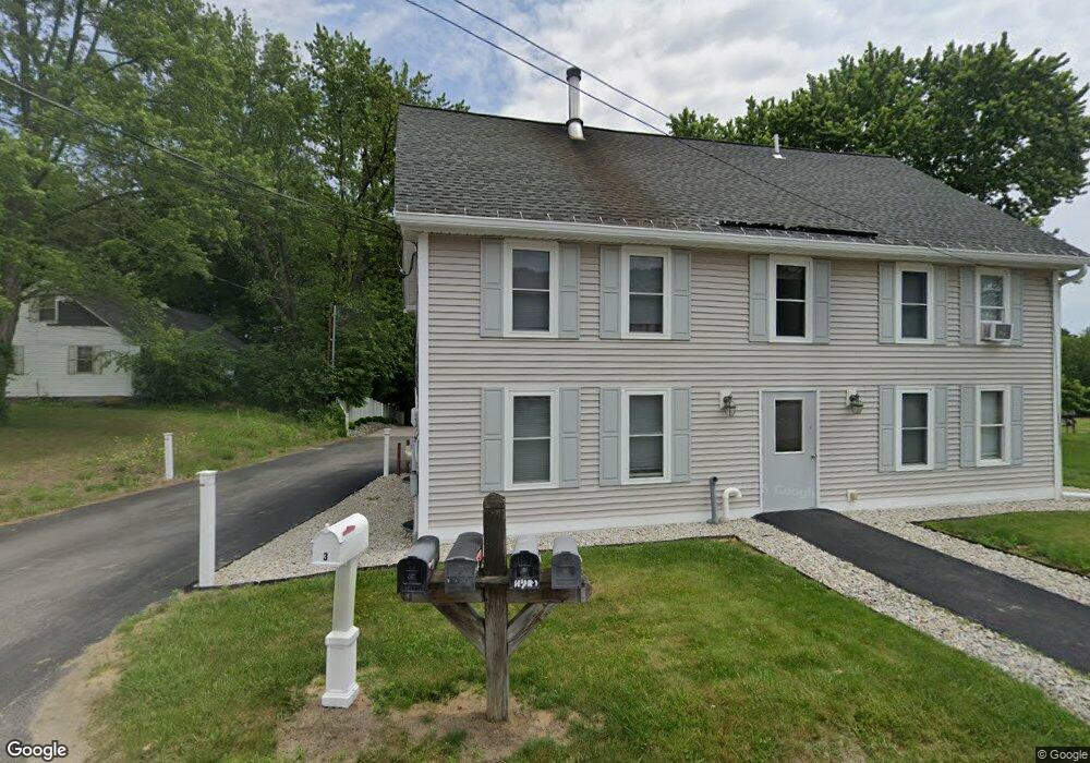
3 Loop Rd MerriMacK, NH 03054
Estimated Value: $538,000 - $591,000
3
Beds
1
Bath
2,429
Sq Ft
$229/Sq Ft
Est. Value
About This Home
This home is located at 3 Loop Rd, MerriMacK, NH 03054 and is currently estimated at $555,915, approximately $228 per square foot. 3 Loop Rd is a home located in Hillsborough County with nearby schools including James Mastricola Elementary School, James Mastricola Upper Elementary School, and Merrimack Middle School.
Ownership History
Date
Name
Owned For
Owner Type
Purchase Details
Closed on
Dec 31, 2007
Sold by
Bank Of New York
Bought by
Scott Shane and Scott Crystal
Current Estimated Value
Home Financials for this Owner
Home Financials are based on the most recent Mortgage that was taken out on this home.
Original Mortgage
$130,526
Interest Rate
6.27%
Mortgage Type
Purchase Money Mortgage
Purchase Details
Closed on
Jul 19, 2007
Sold by
Eschelbach Donna and Eschelbach Joseph C
Bought by
Cwabs 2005-01 Inc
Create a Home Valuation Report for This Property
The Home Valuation Report is an in-depth analysis detailing your home's value as well as a comparison with similar homes in the area
Home Values in the Area
Average Home Value in this Area
Purchase History
| Date | Buyer | Sale Price | Title Company |
|---|---|---|---|
| Scott Shane | $130,000 | -- | |
| Cwabs 2005-01 Inc | $152,900 | -- |
Source: Public Records
Mortgage History
| Date | Status | Borrower | Loan Amount |
|---|---|---|---|
| Open | Cwabs 2005-01 Inc | $137,500 | |
| Closed | Cwabs 2005-01 Inc | $130,526 | |
| Previous Owner | Cwabs 2005-01 Inc | $165,000 | |
| Previous Owner | Cwabs 2005-01 Inc | $41,400 |
Source: Public Records
Tax History
| Year | Tax Paid | Tax Assessment Tax Assessment Total Assessment is a certain percentage of the fair market value that is determined by local assessors to be the total taxable value of land and additions on the property. | Land | Improvement |
|---|---|---|---|---|
| 2025 | $8,090 | $365,900 | $149,500 | $216,400 |
| 2024 | $7,570 | $365,900 | $149,500 | $216,400 |
| 2023 | $7,117 | $365,900 | $149,500 | $216,400 |
| 2022 | $6,359 | $365,900 | $149,500 | $216,400 |
| 2021 | $6,283 | $365,900 | $149,500 | $216,400 |
| 2020 | $6,412 | $266,500 | $110,000 | $156,500 |
| 2019 | $6,204 | $257,100 | $104,500 | $152,600 |
| 2018 | $5,905 | $244,800 | $104,500 | $140,300 |
| 2017 | $4,214 | $180,300 | $104,500 | $75,800 |
| 2016 | $4,109 | $180,300 | $104,500 | $75,800 |
| 2015 | $4,138 | $167,400 | $96,200 | $71,200 |
| 2014 | $4,033 | $167,400 | $96,200 | $71,200 |
| 2013 | $4,003 | $167,400 | $96,200 | $71,200 |
Source: Public Records
Map
Nearby Homes
- 31 McElwain St
- 10 Killian Ct
- 1 Killian Ct
- 3 Independence Dr
- 25 Independence Dr
- 53 E Ridge Rd Unit 53
- 1 Juniper Way
- 21 Arlington St Unit B
- 87A E Ridge Rd
- 8 Franconia Dr
- 51 Joppa Rd
- 16 Tallarico St Unit 24
- 26 Tallarico St Unit 21
- 0 Tallarico St Unit 3 5032471
- 0 Tallarico St Unit 5 5032751
- 0 Tallarico St Unit 26
- 0 Tallarico St Unit 12 5033131
- 1 Tallarico St Unit 14
- 18 Northwood Dr
- 166 Turkey Hill Rd
- 5 Loop Rd
- 7 Loop Rd
- 9 Loop Rd
- 15 Loop Rd
- 448 Daniel Webster Hwy
- 448 Daniel Webster Hwy Unit 201
- 448 Daniel Webster Hwy Unit 2
- 448 Daniel Webster Highway Unit 2 Hwy
- 11 Loop Rd
- 19A Loop Rd
- 442 Daniel Webster Hwy
- 19 Loop Rd
- 17 Loop Rd
- 21 Loop Rd
- 5 Woodbury St
- 23 Loop Rd
- 6 Woodbury St
- 431 Daniel Webster Hwy
- 429 Daniel Webster Hwy Unit 3
- 429 Daniel Webster Hwy
Your Personal Tour Guide
Ask me questions while you tour the home.