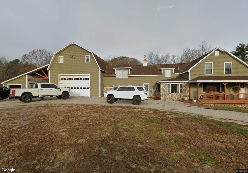
3 Louden Rd Saco, ME 04072
North Saco NeighborhoodEstimated Value: $652,000 - $859,000
6
Beds
4
Baths
3,017
Sq Ft
$246/Sq Ft
Est. Value
About This Home
This home is located at 3 Louden Rd, Saco, ME 04072 and is currently estimated at $743,047, approximately $246 per square foot. 3 Louden Rd is a home located in York County with nearby schools including C K Burns School, Saco Middle School, and Florence Lombard Christian School.
Ownership History
Date
Name
Owned For
Owner Type
Purchase Details
Closed on
Apr 29, 2014
Sold by
Gorham Lorne P Est
Bought by
Swett Justin A
Current Estimated Value
Home Financials for this Owner
Home Financials are based on the most recent Mortgage that was taken out on this home.
Original Mortgage
$169,900
Outstanding Balance
$129,629
Interest Rate
4.36%
Mortgage Type
New Conventional
Estimated Equity
$613,418
Create a Home Valuation Report for This Property
The Home Valuation Report is an in-depth analysis detailing your home's value as well as a comparison with similar homes in the area
Home Values in the Area
Average Home Value in this Area
Purchase History
| Date | Buyer | Sale Price | Title Company |
|---|---|---|---|
| Swett Justin A | -- | -- |
Source: Public Records
Mortgage History
| Date | Status | Borrower | Loan Amount |
|---|---|---|---|
| Open | Swett Justin A | $169,900 |
Source: Public Records
Tax History
| Year | Tax Paid | Tax Assessment Tax Assessment Total Assessment is a certain percentage of the fair market value that is determined by local assessors to be the total taxable value of land and additions on the property. | Land | Improvement |
|---|---|---|---|---|
| 2024 | $8,115 | $577,600 | $155,000 | $422,600 |
| 2023 | $8,520 | $577,600 | $155,000 | $422,600 |
| 2022 | $7,592 | $414,200 | $117,900 | $296,300 |
| 2021 | $7,397 | $391,800 | $106,600 | $285,200 |
| 2020 | $7,028 | $357,300 | $94,100 | $263,200 |
| 2019 | $6,924 | $357,300 | $94,100 | $263,200 |
| 2018 | $7,341 | $378,800 | $85,400 | $293,400 |
| 2017 | $6,729 | $347,200 | $78,400 | $268,800 |
| 2016 | $5,261 | $270,900 | $62,100 | $208,800 |
| 2015 | $5,155 | $268,200 | $62,100 | $206,100 |
| 2014 | $4,994 | $268,200 | $62,100 | $206,100 |
| 2013 | $4,907 | $264,100 | $62,100 | $202,000 |
Source: Public Records
Map
Nearby Homes
- 4 Primrose Ln
- 0 Simpson Rd
- 5 Coltons Way
- 130 Heath Rd
- 18 Buxton Rd
- 4 Spool St Unit 101
- 48 Hillview Ave
- 43 New County Rd
- 51 Sancho Dr
- 8 Nottingham Dr
- 4 Lebanon Rd
- 9 Nottingham Dr
- 00 Cottonwood Dr
- 6 Lina Ave
- 7 Hubbard St
- 8 Oakland St
- TBD Oakland St
- 5 Brentwood Cir
- 22 Tasker St Unit 11
- 7 Pleasant View Dr
- 0 Louden Rd
- 203 Buxton Rd
- 213 Buxton Rd
- 216 Buxton Rd
- 21 Tall Pines Dr
- 217A Buxton Rd
- 199 Buxton Rd
- 11 Louden Rd
- 25 Tall Pines Dr
- 23 Tall Pines Dr
- 10 Louden Rd
- 219 Buxton Rd
- 222 Buxton Rd
- 195 Buxton Rd
- 27 Tall Pines Dr
- 196 Buxton Rd
- 29 Tall Pines Dr
- 21A Tall Pines Dr
- 31 Tall Pines Dr
- 3 Tall Pines Dr
Your Personal Tour Guide
Ask me questions while you tour the home.