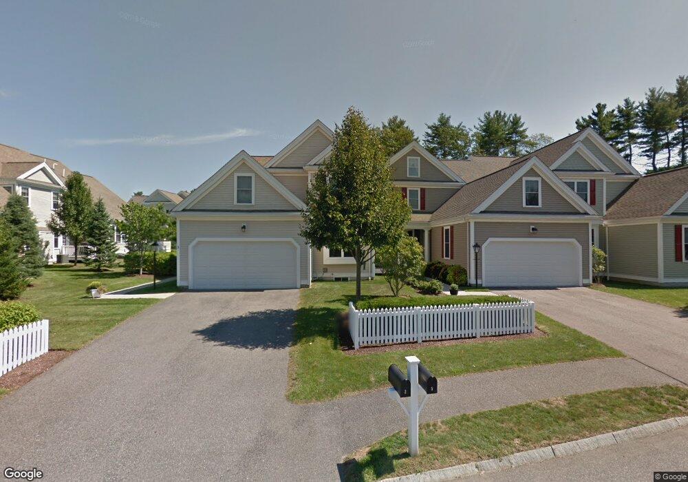
3 Margauxs Way Norfolk, MA 02056
Estimated Value: $695,772 - $919,000
2
Beds
3
Baths
2,540
Sq Ft
$303/Sq Ft
Est. Value
About This Home
This home is located at 3 Margauxs Way, Norfolk, MA 02056 and is currently estimated at $770,693, approximately $303 per square foot. 3 Margauxs Way is a home located in Norfolk County with nearby schools including H. Olive Day School, Freeman-Kennedy School, and Woodside Montessori Academy.
Ownership History
Date
Name
Owned For
Owner Type
Purchase Details
Closed on
Jul 7, 2014
Sold by
Sullivan 3Rd Lawrence P and Sullivan Frances T
Bought by
L P Sullivan 3Rd Ft and Sullivan L P
Current Estimated Value
Purchase Details
Closed on
Mar 4, 2005
Sold by
Holbrook Common Llc
Bought by
Sullivan Frances T and Sullivan Lawrence P
Home Financials for this Owner
Home Financials are based on the most recent Mortgage that was taken out on this home.
Original Mortgage
$300,000
Interest Rate
5.66%
Mortgage Type
Purchase Money Mortgage
Create a Home Valuation Report for This Property
The Home Valuation Report is an in-depth analysis detailing your home's value as well as a comparison with similar homes in the area
Home Values in the Area
Average Home Value in this Area
Purchase History
| Date | Buyer | Sale Price | Title Company |
|---|---|---|---|
| L P Sullivan 3Rd Ft | -- | -- | |
| Sullivan Frances T | $576,929 | -- |
Source: Public Records
Mortgage History
| Date | Status | Borrower | Loan Amount |
|---|---|---|---|
| Previous Owner | Sullivan Frances T | $300,000 | |
| Previous Owner | Sullivan Frances T | $100,000 |
Source: Public Records
Tax History Compared to Growth
Tax History
| Year | Tax Paid | Tax Assessment Tax Assessment Total Assessment is a certain percentage of the fair market value that is determined by local assessors to be the total taxable value of land and additions on the property. | Land | Improvement |
|---|---|---|---|---|
| 2025 | $9,496 | $594,600 | $0 | $594,600 |
| 2024 | $9,193 | $590,400 | $0 | $590,400 |
| 2023 | $8,789 | $535,600 | $0 | $535,600 |
| 2022 | $9,262 | $508,900 | $0 | $508,900 |
| 2021 | $9,510 | $528,600 | $0 | $528,600 |
| 2020 | $8,858 | $475,200 | $0 | $475,200 |
| 2019 | $8,706 | $476,000 | $0 | $476,000 |
| 2018 | $7,770 | $417,300 | $0 | $417,300 |
| 2017 | $7,687 | $421,900 | $0 | $421,900 |
| 2016 | $7,478 | $413,600 | $0 | $413,600 |
| 2015 | $7,525 | $426,100 | $0 | $426,100 |
| 2014 | $7,505 | $430,600 | $0 | $430,600 |
Source: Public Records
Map
Nearby Homes
- 29 Wildwood Rd Unit 29
- 98 Myrtle St
- 1 Granite Dr
- 12 Ariana Ln
- 48 River Rd
- 145 Acorn St
- 10 Medway St
- 2 Gerald Ave
- 41 Myrtle St
- 27 Whichita Rd
- 292 Main St
- 23 Algonquin Rd
- 60 Spencer St
- 99 Leland Rd
- 16 Keeney Pond Rd
- 10 Populatic Street Extension
- 16 Lexington Ln
- 18 Keeney Pond Rd
- 7 Malcolm St
- 10 Silver Fox Rd