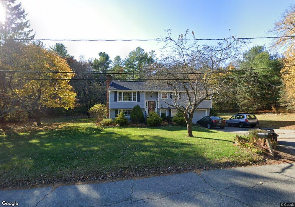
3 Marked Tree Rd Sudbury, MA 01776
Estimated Value: $810,625 - $1,320,000
4
Beds
3
Baths
1,446
Sq Ft
$694/Sq Ft
Est. Value
About This Home
This home is located at 3 Marked Tree Rd, Sudbury, MA 01776 and is currently estimated at $1,002,906, approximately $693 per square foot. 3 Marked Tree Rd is a home located in Middlesex County with nearby schools including Peter Noyes Elementary School, Ephraim Curtis Middle School, and Lincoln-Sudbury Regional High School.
Ownership History
Date
Name
Owned For
Owner Type
Purchase Details
Closed on
Feb 27, 1998
Sold by
Tribou Arthur L and Tribou Christine A
Bought by
Wolfe David A and Wolfe Deborah
Current Estimated Value
Home Financials for this Owner
Home Financials are based on the most recent Mortgage that was taken out on this home.
Original Mortgage
$234,600
Interest Rate
6.85%
Mortgage Type
Purchase Money Mortgage
Create a Home Valuation Report for This Property
The Home Valuation Report is an in-depth analysis detailing your home's value as well as a comparison with similar homes in the area
Home Values in the Area
Average Home Value in this Area
Purchase History
| Date | Buyer | Sale Price | Title Company |
|---|---|---|---|
| Wolfe David A | $293,333 | -- | |
| Wolfe David A | $293,333 | -- |
Source: Public Records
Mortgage History
| Date | Status | Borrower | Loan Amount |
|---|---|---|---|
| Open | Wolfe David A | $150,000 | |
| Closed | Wolfe David A | $227,000 | |
| Closed | Wolfe David A | $234,600 |
Source: Public Records
Tax History Compared to Growth
Tax History
| Year | Tax Paid | Tax Assessment Tax Assessment Total Assessment is a certain percentage of the fair market value that is determined by local assessors to be the total taxable value of land and additions on the property. | Land | Improvement |
|---|---|---|---|---|
| 2025 | $11,270 | $769,800 | $439,200 | $330,600 |
| 2024 | $10,917 | $747,200 | $426,400 | $320,800 |
| 2023 | $10,809 | $685,400 | $394,800 | $290,600 |
| 2022 | $10,242 | $567,400 | $362,400 | $205,000 |
| 2021 | $10,140 | $538,500 | $362,400 | $176,100 |
| 2020 | $9,935 | $538,500 | $362,400 | $176,100 |
| 2019 | $9,645 | $538,500 | $362,400 | $176,100 |
| 2018 | $9,542 | $532,200 | $386,400 | $145,800 |
| 2017 | $8,946 | $504,300 | $367,600 | $136,700 |
| 2016 | $8,619 | $484,200 | $353,600 | $130,600 |
| 2015 | $8,288 | $470,900 | $340,000 | $130,900 |
| 2014 | $8,278 | $459,100 | $330,000 | $129,100 |
Source: Public Records
Map
Nearby Homes
- 7 Saddle Ridge Rd
- 25 Bridle Path
- 30 Rolling Ln
- 89 Bridle Path
- 14 Tanbark Rd
- 12 Hickory Rd
- 0 Robbins Rd
- 54 Stone Rd
- 270 Old Lancaster Rd
- 143 Peakham Rd
- 21 Summer St
- 7 Adams Rd
- 24 Woodland Rd
- 0 Boston Post Rd
- 24 Goodnow Rd
- 1011 Boston Post Rd
- 36 Old Forge Ln
- 36 Concord Rd
- 47 Fairbank Rd
- 128 Nobscot Rd
- 333 Peakham Rd
- 4 Marked Tree Rd
- 4 Marked Tree Rd
- 342 Peakham Rd
- 342 Peakham Rd Unit 1
- 11 Marked Tree Rd
- 324 Peakham Rd
- 16 Marked Tree Rd
- 319 Peakham Rd
- 18 Noyes Ln
- 22 Newton Rd
- 344 Peakham Rd
- 19 Marked Tree Rd
- 345 Peakham Rd
- 26 Newton Rd
- 321 Peakham Rd
- 311 Peakham Rd
- 357 Peakham Rd
- 356 Peakham Rd
- 15 Noyes Ln