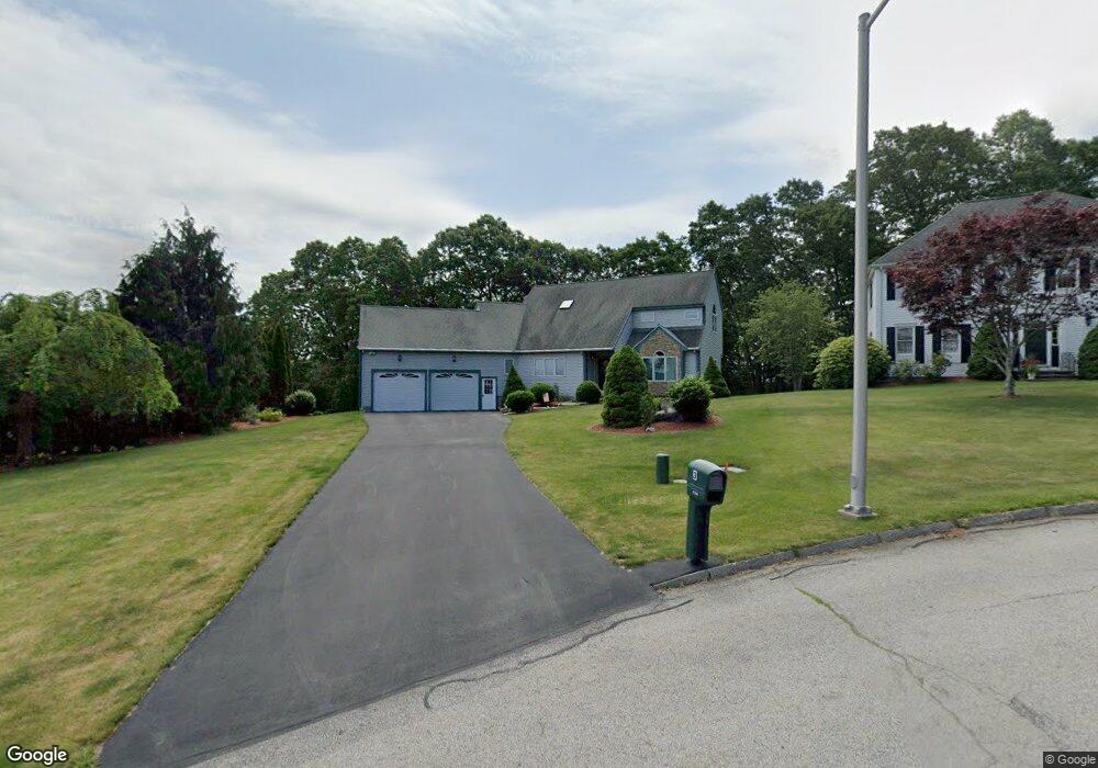
3 Matthew Cir Millbury, MA 01527
Estimated Value: $692,000 - $817,000
3
Beds
3
Baths
2,572
Sq Ft
$292/Sq Ft
Est. Value
About This Home
This home is located at 3 Matthew Cir, Millbury, MA 01527 and is currently estimated at $751,098, approximately $292 per square foot. 3 Matthew Cir is a home located in Worcester County with nearby schools including Elmwood Street Elementary School, Raymond E. Shaw Elementary School, and Millbury Junior/Senior High School.
Ownership History
Date
Name
Owned For
Owner Type
Purchase Details
Closed on
Mar 5, 2018
Sold by
Oday Daniel D and Oday Barbara A
Bought by
Oday Lt and Oday
Current Estimated Value
Purchase Details
Closed on
Apr 25, 1997
Sold by
Longwood Dev Corp
Bought by
Oday Daniel D and Oday Baarbara A
Create a Home Valuation Report for This Property
The Home Valuation Report is an in-depth analysis detailing your home's value as well as a comparison with similar homes in the area
Home Values in the Area
Average Home Value in this Area
Purchase History
| Date | Buyer | Sale Price | Title Company |
|---|---|---|---|
| Oday Lt | -- | -- | |
| Oday Lt | -- | -- | |
| Oday Daniel D | $223,605 | -- | |
| Oday Daniel D | $223,605 | -- |
Source: Public Records
Mortgage History
| Date | Status | Borrower | Loan Amount |
|---|---|---|---|
| Previous Owner | Oday Daniel D | $100,000 | |
| Previous Owner | Oday Daniel D | $167,000 | |
| Previous Owner | Oday Daniel D | $15,500 |
Source: Public Records
Tax History Compared to Growth
Tax History
| Year | Tax Paid | Tax Assessment Tax Assessment Total Assessment is a certain percentage of the fair market value that is determined by local assessors to be the total taxable value of land and additions on the property. | Land | Improvement |
|---|---|---|---|---|
| 2025 | $8,503 | $635,000 | $125,500 | $509,500 |
| 2024 | $7,791 | $588,900 | $116,200 | $472,700 |
| 2023 | $6,819 | $471,900 | $81,300 | $390,600 |
| 2022 | $6,803 | $453,500 | $81,300 | $372,200 |
| 2021 | $6,286 | $407,400 | $81,300 | $326,100 |
| 2020 | $6,150 | $401,200 | $81,300 | $319,900 |
| 2019 | $6,159 | $388,600 | $81,000 | $307,600 |
| 2018 | $5,747 | $351,700 | $81,000 | $270,700 |
| 2017 | $5,313 | $323,400 | $81,000 | $242,400 |
| 2016 | $5,275 | $320,500 | $81,000 | $239,500 |
| 2015 | $5,083 | $308,800 | $82,500 | $226,300 |
| 2014 | $5,458 | $319,200 | $86,300 | $232,900 |
Source: Public Records
Map
Nearby Homes
- 52 Clearview Terrace Unit 39
- 14 Howe Ln
- 12 Alstead Path
- 15 Clearview Terrace Unit 68
- 90 Park Hill Ave
- 64 Millbury Ave
- 123 Riverlin St
- 1 Broadmeadow Ave
- 7 Heather Ave
- 2 Diane St
- 330 Millbury Ave
- 17 Atwood Ave
- 5- 33 Tainter Hill Rd Unit 33A
- 5- 33 Tainter Hill Rd
- 457 Granite St
- 1295 Millbury St Unit B
- 54 Park Hill Rd
- 12 Irene Ct
- 33 Tainter Hill Rd Unit 33B
- 497 Massasoit Rd
- 3 Keith David Dr
- 5 Matthew Cir
- 6 Keith David Dr
- 1 Keith David Dr
- 4 Matthew Cir
- 8 Keith David Dr
- 2 Matthew Cir
- 16 Hayward Glen Dr
- 10 Keith David Dr
- 13 Wingfoot Ln
- 14 Hayward Glen Dr
- 9 Brian Cir
- 13 Keith David Dr
- 7 Pinehurst Cir
- 15 Hayward Glen Dr
- 12 Keith David Dr
- 14 Jaclyn Rae Dr
- 7 Brian Cir
- 12 Hayward Glen Dr
- 10 Wingfoot Ln