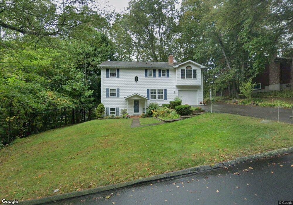
3 Norman Dr Gales Ferry, CT 06335
Estimated Value: $433,000 - $500,912
4
Beds
4
Baths
2,050
Sq Ft
$226/Sq Ft
Est. Value
About This Home
This home is located at 3 Norman Dr, Gales Ferry, CT 06335 and is currently estimated at $462,728, approximately $225 per square foot. 3 Norman Dr is a home located in New London County with nearby schools including Ledyard Middle School, Ledyard High School, and Academy Of St Therese.
Ownership History
Date
Name
Owned For
Owner Type
Purchase Details
Closed on
Jul 20, 2007
Sold by
Mclaughlin Philip G and Mclaughlin Kara L
Bought by
Collantes Elizabeth
Current Estimated Value
Home Financials for this Owner
Home Financials are based on the most recent Mortgage that was taken out on this home.
Original Mortgage
$130,000
Outstanding Balance
$20,107
Interest Rate
6.54%
Estimated Equity
$442,621
Purchase Details
Closed on
Feb 15, 1994
Sold by
Early Alvah E and Early Priscilla Fern
Bought by
Mclaughlin Philip G and Mclaughlin Kara
Home Financials for this Owner
Home Financials are based on the most recent Mortgage that was taken out on this home.
Original Mortgage
$138,720
Interest Rate
7.08%
Mortgage Type
Unknown
Create a Home Valuation Report for This Property
The Home Valuation Report is an in-depth analysis detailing your home's value as well as a comparison with similar homes in the area
Home Values in the Area
Average Home Value in this Area
Purchase History
| Date | Buyer | Sale Price | Title Company |
|---|---|---|---|
| Collantes Elizabeth | $320,000 | -- | |
| Mclaughlin Philip G | $136,000 | -- |
Source: Public Records
Mortgage History
| Date | Status | Borrower | Loan Amount |
|---|---|---|---|
| Open | Mclaughlin Philip G | $130,000 | |
| Previous Owner | Mclaughlin Philip G | $160,000 | |
| Previous Owner | Mclaughlin Philip G | $155,195 | |
| Previous Owner | Mclaughlin Philip G | $138,720 |
Source: Public Records
Tax History Compared to Growth
Tax History
| Year | Tax Paid | Tax Assessment Tax Assessment Total Assessment is a certain percentage of the fair market value that is determined by local assessors to be the total taxable value of land and additions on the property. | Land | Improvement |
|---|---|---|---|---|
| 2025 | $7,464 | $200,970 | $46,550 | $154,420 |
| 2024 | $7,054 | $200,340 | $46,550 | $153,790 |
| 2023 | $6,924 | $200,340 | $46,550 | $153,790 |
| 2022 | $6,775 | $200,340 | $46,550 | $153,790 |
| 2021 | $6,731 | $200,340 | $46,550 | $153,790 |
| 2020 | $6,981 | $199,640 | $48,790 | $150,850 |
| 2019 | $6,999 | $199,640 | $48,790 | $150,850 |
| 2018 | $6,846 | $199,640 | $48,790 | $150,850 |
| 2017 | $6,496 | $199,640 | $48,790 | $150,850 |
| 2016 | $6,369 | $199,640 | $48,790 | $150,850 |
| 2015 | $6,069 | $199,640 | $48,790 | $150,850 |
| 2014 | $6,361 | $209,230 | $48,790 | $160,440 |
Source: Public Records
Map
Nearby Homes
- 10 Crestview Dr
- 5 Ledgewood Dr
- 3 Parkwood Dr
- 18 Richard Rd
- 31 Richard Rd
- 9 West Dr
- 14 Patricia Ct
- 1535 Route 12
- 21 Lincoln Dr
- 16 Marty's Way
- 13 Dock Rd
- 123A Whalehead Rd
- 65 Eagle Ridge Dr
- 184 Kitemaug Rd
- 11 Marty's Way
- 7 Briarwood Ct
- 36 Depot Rd
- 25 Marty's Way
- 18 Marty's Way
- 197 Norwich-New London Turnpike