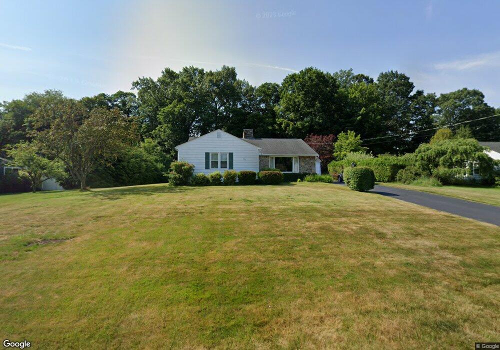
3 Old Orchard Rd Wilbraham, MA 01095
Estimated Value: $416,000 - $472,000
2
Beds
2
Baths
1,848
Sq Ft
$241/Sq Ft
Est. Value
About This Home
This home is located at 3 Old Orchard Rd, Wilbraham, MA 01095 and is currently estimated at $446,250, approximately $241 per square foot. 3 Old Orchard Rd is a home located in Hampden County with nearby schools including Minnechaug Regional High School, Springfield International Charter School, and Wilbraham & Monson Academy.
Ownership History
Date
Name
Owned For
Owner Type
Purchase Details
Closed on
Apr 18, 2023
Sold by
Devine Harold W
Bought by
Devine John W and Otoole Day A
Current Estimated Value
Purchase Details
Closed on
Mar 21, 2018
Sold by
Devine Judith A
Bought by
Devine Harold W
Purchase Details
Closed on
Mar 26, 1968
Bought by
Devine Harold W and Devine Judith A
Create a Home Valuation Report for This Property
The Home Valuation Report is an in-depth analysis detailing your home's value as well as a comparison with similar homes in the area
Home Values in the Area
Average Home Value in this Area
Purchase History
| Date | Buyer | Sale Price | Title Company |
|---|---|---|---|
| Devine John W | -- | None Available | |
| Devine Harold W | -- | -- | |
| Devine Harold W | -- | -- |
Source: Public Records
Mortgage History
| Date | Status | Borrower | Loan Amount |
|---|---|---|---|
| Previous Owner | Devine Harold W | $75,000 | |
| Previous Owner | Devine Harold W | $25,000 |
Source: Public Records
Tax History Compared to Growth
Tax History
| Year | Tax Paid | Tax Assessment Tax Assessment Total Assessment is a certain percentage of the fair market value that is determined by local assessors to be the total taxable value of land and additions on the property. | Land | Improvement |
|---|---|---|---|---|
| 2025 | $6,712 | $375,400 | $96,700 | $278,700 |
| 2024 | $6,686 | $361,400 | $96,700 | $264,700 |
| 2023 | $6,317 | $337,800 | $96,700 | $241,100 |
| 2022 | $6,010 | $293,300 | $96,700 | $196,600 |
| 2021 | $5,719 | $249,100 | $103,700 | $145,400 |
| 2020 | $5,575 | $249,100 | $103,700 | $145,400 |
| 2019 | $5,430 | $249,100 | $103,700 | $145,400 |
| 2018 | $5,128 | $226,500 | $103,700 | $122,800 |
| 2017 | $4,983 | $226,500 | $103,700 | $122,800 |
| 2016 | $4,882 | $226,000 | $115,300 | $110,700 |
| 2015 | $4,719 | $226,000 | $115,300 | $110,700 |
Source: Public Records
Map
Nearby Homes
- 20 Old Orchard Rd
- 2 Bayberry Dr Unit 51
- 474 Mountain Rd
- 28 Decorie Dr
- 8 Patriot Ridge Ln
- 474-480 Mountain Rd
- 6 Hilltop Park
- 79 High Pine Cir
- 69 High Pine Cir
- 54 High Pine Cir
- 2 Vista Rd
- 68 Monson Rd
- 35 Lake Dr
- 4 Hillcrest Dr
- 46 Washington Rd
- 603 Glendale Rd
- 182 Mountain Rd
- 6 Teak Terrace Unit 24
- 99 Sandalwood Dr Unit site 00
- 103 Sandalwood Dr Unit site 00