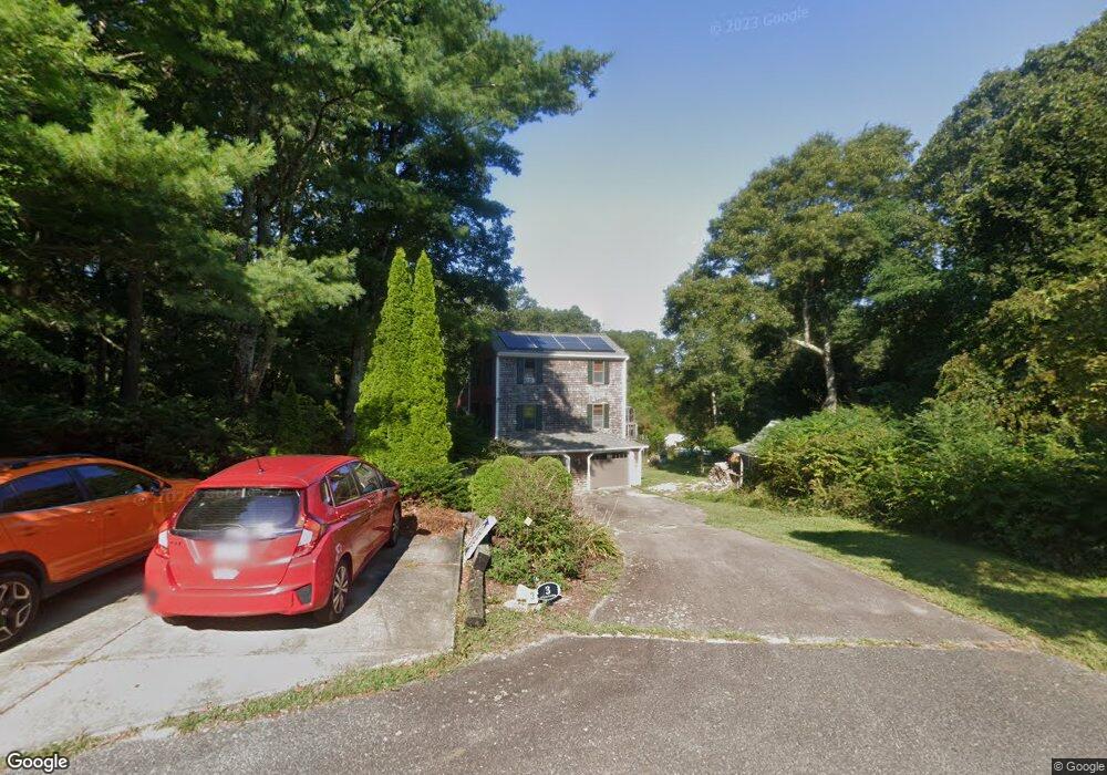
3 Plantes Landing Buzzards Bay, MA 02532
Estimated Value: $666,757 - $837,000
4
Beds
2
Baths
1,700
Sq Ft
$424/Sq Ft
Est. Value
About This Home
This home is located at 3 Plantes Landing, Buzzards Bay, MA 02532 and is currently estimated at $720,189, approximately $423 per square foot. 3 Plantes Landing is a home located in Barnstable County with nearby schools including Bourne High School, St Margaret Regional School, and Cadence Academy Preschool - Bourne.
Ownership History
Date
Name
Owned For
Owner Type
Purchase Details
Closed on
Aug 6, 2003
Sold by
Mcgonagle Andrew and Mcgonagle Eleanor P
Bought by
Brown Norbert and Brown Elizabeth
Current Estimated Value
Home Financials for this Owner
Home Financials are based on the most recent Mortgage that was taken out on this home.
Original Mortgage
$290,000
Outstanding Balance
$124,538
Interest Rate
5.28%
Mortgage Type
Purchase Money Mortgage
Estimated Equity
$595,651
Purchase Details
Closed on
Oct 31, 1995
Sold by
Donovan Constr Co Inc
Bought by
Mcgonagle Andrew and Mcgonagle Eleanor P
Purchase Details
Closed on
Jul 28, 1995
Sold by
Trask Matthew H and Trask Tami M
Bought by
Donovan Constr Co Inc
Create a Home Valuation Report for This Property
The Home Valuation Report is an in-depth analysis detailing your home's value as well as a comparison with similar homes in the area
Home Values in the Area
Average Home Value in this Area
Purchase History
| Date | Buyer | Sale Price | Title Company |
|---|---|---|---|
| Brown Norbert | $410,000 | -- | |
| Brown Norbert | $410,000 | -- | |
| Mcgonagle Andrew | $145,000 | -- | |
| Mcgonagle Andrew | $145,000 | -- | |
| Donovan Constr Co Inc | $157,000 | -- | |
| Donovan Constr Co Inc | $157,000 | -- |
Source: Public Records
Mortgage History
| Date | Status | Borrower | Loan Amount |
|---|---|---|---|
| Open | Donovan Constr Co Inc | $290,000 | |
| Closed | Donovan Constr Co Inc | $290,000 |
Source: Public Records
Tax History Compared to Growth
Tax History
| Year | Tax Paid | Tax Assessment Tax Assessment Total Assessment is a certain percentage of the fair market value that is determined by local assessors to be the total taxable value of land and additions on the property. | Land | Improvement |
|---|---|---|---|---|
| 2025 | $4,266 | $546,200 | $195,700 | $350,500 |
| 2024 | $4,172 | $520,200 | $186,400 | $333,800 |
| 2023 | $4,063 | $461,200 | $164,900 | $296,300 |
| 2022 | $3,891 | $385,600 | $146,000 | $239,600 |
| 2021 | $3,790 | $351,900 | $132,800 | $219,100 |
| 2020 | $3,669 | $341,600 | $131,600 | $210,000 |
| 2019 | $3,474 | $330,500 | $131,600 | $198,900 |
| 2018 | $3,447 | $327,000 | $125,300 | $201,700 |
| 2017 | $3,237 | $314,300 | $124,100 | $190,200 |
| 2016 | $3,155 | $310,500 | $124,100 | $186,400 |
| 2015 | $3,127 | $310,500 | $124,100 | $186,400 |
Source: Public Records
Map
Nearby Homes
- 13 Laurel Hill Ct
- 14 Great Rock Rd
- 44 Cotuit Rd
- 5 Sea Knoll Ct
- 203 County Rd
- 26 Carnoustie Rd
- 85 Waterhouse Rd
- 85 Waterhouse Rd
- 12 Turnberry Rd Unit 12
- 60 Sandwich Rd
- 1 Hollyhock Knoll Ct Unit 1
- 4 Hollyhock Knoll Ct Unit 4
- 4 Hollyhock Knoll Ct Unit 4
- 34 Turnberry Rd
- 405 Village Dr
- 405 Village Dr Unit 405
- 90-92 Sandwich Rd Unit 2
- 12 Beachwood Rd
- 46 Holt Rd
- 46 Holt Rd Unit A