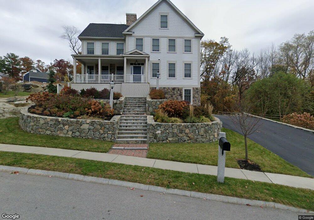
3 Point Shore Rd Amesbury, MA 01913
Estimated Value: $1,470,000 - $1,755,000
4
Beds
4
Baths
2,936
Sq Ft
$536/Sq Ft
Est. Value
About This Home
This home is located at 3 Point Shore Rd, Amesbury, MA 01913 and is currently estimated at $1,572,360, approximately $535 per square foot. 3 Point Shore Rd is a home located in Essex County with nearby schools including Amesbury High School and River Valley Charter School.
Ownership History
Date
Name
Owned For
Owner Type
Purchase Details
Closed on
Aug 12, 2021
Sold by
Eagles Crossing Llc
Bought by
Amanda Lane Rt
Current Estimated Value
Purchase Details
Closed on
Nov 13, 2020
Sold by
Amanda Lane Rt
Bought by
Shaw Kevin M
Home Financials for this Owner
Home Financials are based on the most recent Mortgage that was taken out on this home.
Original Mortgage
$600,000
Interest Rate
2.8%
Mortgage Type
New Conventional
Purchase Details
Closed on
Feb 17, 2020
Sold by
Amanda Lane Rt
Bought by
Eagles Crossing Llc
Purchase Details
Closed on
May 17, 2019
Sold by
Amanda Lane Rt
Bought by
Moran James J
Home Financials for this Owner
Home Financials are based on the most recent Mortgage that was taken out on this home.
Original Mortgage
$591,920
Interest Rate
4%
Mortgage Type
New Conventional
Create a Home Valuation Report for This Property
The Home Valuation Report is an in-depth analysis detailing your home's value as well as a comparison with similar homes in the area
Home Values in the Area
Average Home Value in this Area
Purchase History
| Date | Buyer | Sale Price | Title Company |
|---|---|---|---|
| Amanda Lane Rt | $250,000 | None Available | |
| Shaw Kevin M | $1,050,000 | None Available | |
| Eagles Crossing Llc | -- | None Available | |
| Moran James J | $739,900 | -- |
Source: Public Records
Mortgage History
| Date | Status | Borrower | Loan Amount |
|---|---|---|---|
| Previous Owner | Shaw Kevin M | $600,000 | |
| Previous Owner | Moran James J | $591,920 |
Source: Public Records
Tax History Compared to Growth
Tax History
| Year | Tax Paid | Tax Assessment Tax Assessment Total Assessment is a certain percentage of the fair market value that is determined by local assessors to be the total taxable value of land and additions on the property. | Land | Improvement |
|---|---|---|---|---|
| 2025 | $19,810 | $1,294,800 | $513,600 | $781,200 |
| 2024 | $19,068 | $1,219,200 | $484,500 | $734,700 |
| 2023 | $17,941 | $1,098,000 | $440,300 | $657,700 |
| 2022 | $17,248 | $975,000 | $377,400 | $597,600 |
| 2021 | $8,428 | $461,800 | $162,000 | $299,800 |
| 2020 | $2,008 | $116,900 | $116,900 | $0 |
| 2019 | $2,147 | $116,900 | $116,900 | $0 |
| 2018 | $2,114 | $111,300 | $111,300 | $0 |
| 2017 | $2,220 | $111,300 | $111,300 | $0 |
| 2016 | $2,257 | $111,300 | $111,300 | $0 |
Source: Public Records
Map
Nearby Homes
- 486 Main St
- 473 Main St
- 18 Hawkswood Estates
- 2 Birchwood Ct Unit 101
- 25 Clarks Rd Unit 307
- 435 Main St
- 434 Main St
- 394 Main St
- 356 Main St
- 30 Dorothy e Lucey Dr
- 47 Macy St
- 510 Merrimac St Unit 512
- 45 Macy St Unit 302C
- 191 Elm St
- 35 Merrimac St
- 8 Brown Ave
- 492 Merrimac St
- 204 Elm St
- 60 Merrimac St Unit 907
- 60 Merrimac St Unit 604
- 3 Point Shore Rd
- 1 Point Shore Rd
- 2 Point Shore Dr
- 1 Point Shore Dr
- 19B Evans Place
- 5 Point Shore Rd
- 5 Point Shore Rd
- 17 Evans Place
- 2 Evans Place Unit 2
- 1 Point Shore Overlook
- 18 Evans Place
- 3 Point Shore Overlook
- 7 4th St
- 16 Evans Place
- 0 Point Shore Overlook
- 15 Evans Place
- 19A Evans Place
- 4 Point Shore Rd
- 5 Point Shore Overlook
- 502 Main St