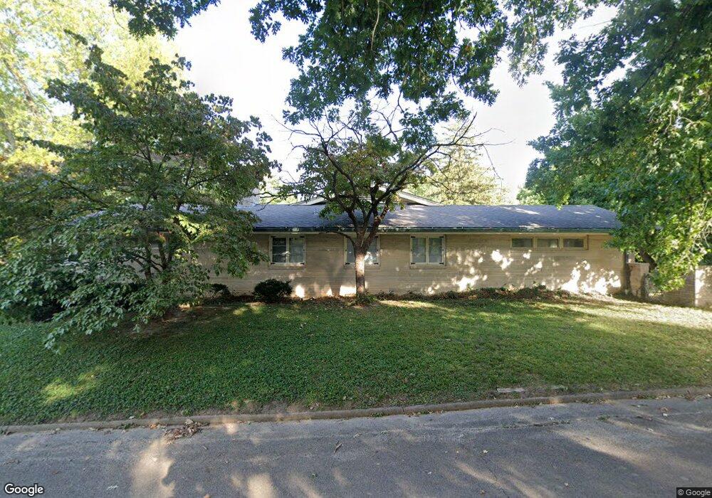
3 Powers Lane Place Decatur, IL 62522
Near West NeighborhoodEstimated Value: $154,000 - $257,000
3
Beds
3
Baths
3,654
Sq Ft
$57/Sq Ft
Est. Value
About This Home
This home is located at 3 Powers Lane Place, Decatur, IL 62522 and is currently estimated at $209,273, approximately $57 per square foot. 3 Powers Lane Place is a home located in Macon County with nearby schools including Dennis Lab School, St. Patrick School, and Teen Challenge-Home For Girls.
Ownership History
Date
Name
Owned For
Owner Type
Purchase Details
Closed on
Jan 11, 2010
Sold by
Scott Helen H
Bought by
Yepsen Matthew J and Yepsen Karen
Current Estimated Value
Home Financials for this Owner
Home Financials are based on the most recent Mortgage that was taken out on this home.
Original Mortgage
$126,000
Outstanding Balance
$82,390
Interest Rate
4.87%
Mortgage Type
New Conventional
Estimated Equity
$126,883
Create a Home Valuation Report for This Property
The Home Valuation Report is an in-depth analysis detailing your home's value as well as a comparison with similar homes in the area
Home Values in the Area
Average Home Value in this Area
Purchase History
| Date | Buyer | Sale Price | Title Company |
|---|---|---|---|
| Yepsen Matthew J | $157,500 | None Available |
Source: Public Records
Mortgage History
| Date | Status | Borrower | Loan Amount |
|---|---|---|---|
| Open | Yepsen Matthew J | $126,000 |
Source: Public Records
Tax History Compared to Growth
Tax History
| Year | Tax Paid | Tax Assessment Tax Assessment Total Assessment is a certain percentage of the fair market value that is determined by local assessors to be the total taxable value of land and additions on the property. | Land | Improvement |
|---|---|---|---|---|
| 2024 | $5,425 | $62,041 | $11,352 | $50,689 |
| 2023 | $5,359 | $59,845 | $10,950 | $48,895 |
| 2022 | $4,872 | $53,637 | $10,132 | $43,505 |
| 2021 | $4,537 | $50,092 | $9,463 | $40,629 |
| 2020 | $4,441 | $47,767 | $9,024 | $38,743 |
| 2019 | $4,441 | $47,767 | $9,024 | $38,743 |
| 2018 | $4,325 | $46,748 | $9,009 | $37,739 |
| 2017 | $4,399 | $47,995 | $9,249 | $38,746 |
| 2016 | $4,489 | $48,484 | $9,343 | $39,141 |
| 2015 | $4,255 | $47,627 | $9,178 | $38,449 |
| 2014 | $3,947 | $47,155 | $9,087 | $38,068 |
| 2013 | $4,098 | $48,926 | $9,428 | $39,498 |
Source: Public Records
Map
Nearby Homes
- 580 Powers Ln
- 650 S Crea St
- 530 Powers Ln
- 628 W Forest Ave
- 437 Powers Ln
- 617 W Decatur St
- 612 W Macon St
- 440 W Macon St
- 450 W Macon St
- 657 W Wood St
- 712 W Main St
- 899 W Main St
- 636 S Sycamore St
- 320 W Main St
- 1005 W Main St
- 281 W Prairie Ave
- 452 W Prairie Ave
- 442 W Prairie Ave
- 366 W Prairie Ave
- 233 N Edward St
- 729 S Monroe St
- 715 S Monroe St
- 5 Powers Lane Place
- 670 S Monroe St
- 8 Powers Lane Place
- 701 S Monroe St
- 1 Powers Lane Place
- 681 S Monroe St
- 10 Powers Lane Place
- 7 Powers Lane Place
- 669 S Monroe St
- 770 S Seigel St
- 2 Powers Lane Place
- 630 S Monroe St
- 777 S Monroe St
- 545 Bradley Ct
- 525 Bradley Ct
- 730 S Seigel St
- 9 Powers Lane Place
- 665 S Monroe St