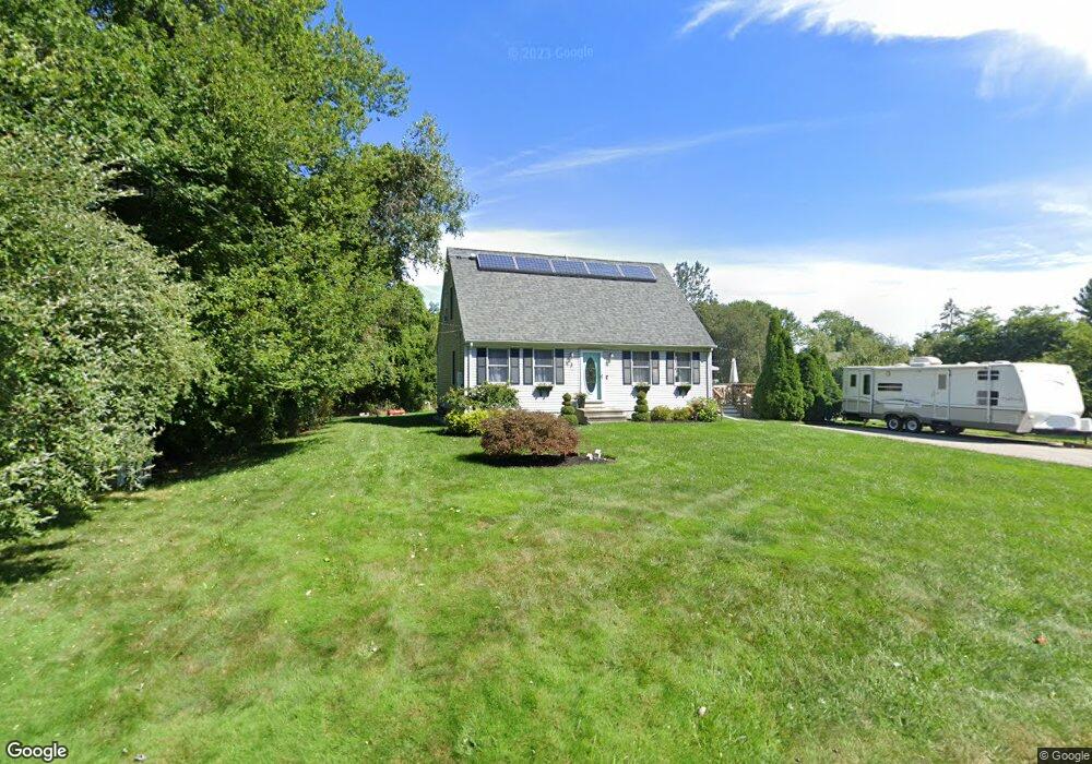
3 Pratt Ave Westport, MA 02790
Booth/Handy Four Corners NeighborhoodEstimated Value: $498,000 - $656,000
3
Beds
--
Bath
1,547
Sq Ft
$384/Sq Ft
Est. Value
About This Home
This home is located at 3 Pratt Ave, Westport, MA 02790 and is currently estimated at $593,468, approximately $383 per square foot. 3 Pratt Ave is a home located in Bristol County with nearby schools including Alice A. Macomber Primary School, Westport Elementary School, and Westport Middle-High School.
Ownership History
Date
Name
Owned For
Owner Type
Purchase Details
Closed on
Nov 4, 2013
Sold by
Raulet David M and Raulet Debra L
Bought by
Canwell Patrick and Conforti Kristen
Current Estimated Value
Home Financials for this Owner
Home Financials are based on the most recent Mortgage that was taken out on this home.
Original Mortgage
$243,621
Outstanding Balance
$181,824
Interest Rate
4.25%
Mortgage Type
FHA
Estimated Equity
$411,644
Purchase Details
Closed on
Feb 27, 1998
Sold by
Tavares Randall and Tavares Tina
Bought by
Raulet David M and Raulet Debra L
Purchase Details
Closed on
Dec 31, 1991
Sold by
Roberts Bob L and Roberts Joanne M
Bought by
Tavares Randall R and Tavares Tina M
Create a Home Valuation Report for This Property
The Home Valuation Report is an in-depth analysis detailing your home's value as well as a comparison with similar homes in the area
Home Values in the Area
Average Home Value in this Area
Purchase History
| Date | Buyer | Sale Price | Title Company |
|---|---|---|---|
| Canwell Patrick | $220,000 | -- | |
| Raulet David M | $126,500 | -- | |
| Tavares Randall R | $49,900 | -- |
Source: Public Records
Mortgage History
| Date | Status | Borrower | Loan Amount |
|---|---|---|---|
| Open | Canwell Patrick | $243,621 | |
| Previous Owner | Tavares Randall R | $75,000 | |
| Previous Owner | Tavares Randall R | $248,000 | |
| Previous Owner | Tavares Randall R | $203,000 |
Source: Public Records
Tax History Compared to Growth
Tax History
| Year | Tax Paid | Tax Assessment Tax Assessment Total Assessment is a certain percentage of the fair market value that is determined by local assessors to be the total taxable value of land and additions on the property. | Land | Improvement |
|---|---|---|---|---|
| 2025 | $3,400 | $456,400 | $193,600 | $262,800 |
| 2024 | $3,375 | $436,600 | $179,400 | $257,200 |
| 2023 | $3,197 | $391,800 | $151,100 | $240,700 |
| 2022 | $2,508 | $355,600 | $151,100 | $204,500 |
| 2021 | $2,508 | $290,900 | $137,400 | $153,500 |
| 2020 | $2,357 | $279,600 | $126,100 | $153,500 |
| 2019 | $2,173 | $262,700 | $114,700 | $148,000 |
| 2018 | $2,083 | $254,900 | $121,700 | $133,200 |
| 2017 | $2,008 | $251,900 | $121,700 | $130,200 |
| 2016 | $1,950 | $246,500 | $121,700 | $124,800 |
| 2015 | $1,886 | $237,800 | $121,700 | $116,100 |
Source: Public Records
Map
Nearby Homes
- 7 Village Way
- 15 Village Way
- 8 Village Way
- 837 Main Rd
- 8 Strawberry Ln
- 118 Charlotte White Rd Extension
- 0 Hidden Glen Ln
- 101 Adamsville Rd
- 920 Drift Rd
- 118 Charlotte White Rd
- 225 Hixbridge Rd
- 978 Sodom Rd
- Lot 0 Marcotte
- 47 Fallon Dr
- 73 White Oak Run
- 4 Main Rd
- 6 Angel Ct
- 1346 Main Rd Unit B
- 308 Robert St
- 17 Quail Trail