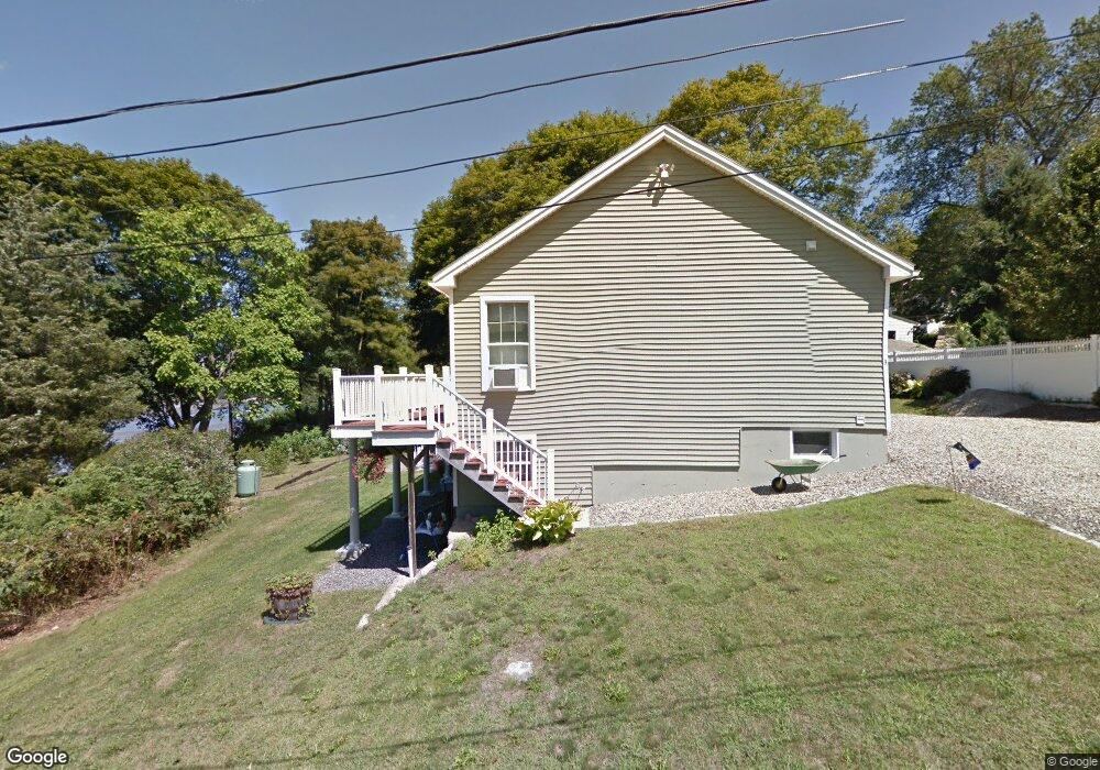
3 Reef Knot Way Gloucester, MA 01930
Estimated Value: $564,000 - $1,089,000
1
Bed
3
Baths
1,132
Sq Ft
$715/Sq Ft
Est. Value
About This Home
This home is located at 3 Reef Knot Way, Gloucester, MA 01930 and is currently estimated at $809,721, approximately $715 per square foot. 3 Reef Knot Way is a home located in Essex County with nearby schools including Beeman Memorial, Ralph B O'maley Middle School, and Faith Christian School.
Ownership History
Date
Name
Owned For
Owner Type
Purchase Details
Closed on
Jun 18, 2025
Sold by
Aptt Kenneth J and Aptt Roberta S
Bought by
Aptt Ft and Aptt
Current Estimated Value
Purchase Details
Closed on
Aug 3, 2022
Sold by
Aptt Roberta S
Bought by
Aptt Roberta S and Aptt Kenneth J
Purchase Details
Closed on
Aug 12, 2011
Sold by
Sartwell David A and Sartwell Mary G
Bought by
Sutherland Roberta A
Home Financials for this Owner
Home Financials are based on the most recent Mortgage that was taken out on this home.
Original Mortgage
$280,000
Interest Rate
4.51%
Mortgage Type
Purchase Money Mortgage
Create a Home Valuation Report for This Property
The Home Valuation Report is an in-depth analysis detailing your home's value as well as a comparison with similar homes in the area
Home Values in the Area
Average Home Value in this Area
Purchase History
| Date | Buyer | Sale Price | Title Company |
|---|---|---|---|
| Aptt Ft | -- | None Available | |
| Aptt Ft | -- | None Available | |
| Aptt Ft | -- | None Available | |
| Aptt Roberta S | -- | None Available | |
| Aptt Roberta S | -- | None Available | |
| Aptt Roberta S | -- | None Available | |
| Sutherland Roberta A | $351,500 | -- | |
| Sutherland Roberta A | $351,500 | -- |
Source: Public Records
Mortgage History
| Date | Status | Borrower | Loan Amount |
|---|---|---|---|
| Previous Owner | Sutherland Roberta A | $280,000 |
Source: Public Records
Tax History Compared to Growth
Tax History
| Year | Tax Paid | Tax Assessment Tax Assessment Total Assessment is a certain percentage of the fair market value that is determined by local assessors to be the total taxable value of land and additions on the property. | Land | Improvement |
|---|---|---|---|---|
| 2025 | $6,727 | $692,100 | $357,900 | $334,200 |
| 2024 | $6,519 | $670,000 | $341,000 | $329,000 |
| 2023 | $6,502 | $614,000 | $304,400 | $309,600 |
| 2022 | $6,175 | $526,400 | $264,600 | $261,800 |
| 2021 | $6,222 | $500,200 | $240,600 | $259,600 |
| 2020 | $5,685 | $461,100 | $226,800 | $234,300 |
| 2019 | $5,664 | $446,300 | $226,800 | $219,500 |
| 2018 | $5,609 | $433,800 | $226,800 | $207,000 |
| 2017 | $5,457 | $413,700 | $216,100 | $197,600 |
| 2016 | $5,090 | $374,000 | $204,900 | $169,100 |
| 2015 | $5,035 | $368,900 | $204,900 | $164,000 |
Source: Public Records
Map
Nearby Homes
- 49 Thurston Point Rd
- 18 Cherry St
- 109 Riverview Rd
- 672 Washington St
- 65 Poplar St
- 19 Mystic Ave
- 78 Grove St
- 6 Beauport Ave
- 196 Washington St
- 188 Atlantic St
- 40 Sargent St
- 3 Stone Ct
- 226 Atlantic St
- 15 Harvard St
- 119 Pleasant St
- 33 Maplewood Ave Unit 21
- 30 Atlantic St
- 8 Summer St Unit 103
- 145 Essex Ave Unit 610
- 4 Mount Vernon St
- 470 Washington St
- 5 Reef Knot Way
- 474 Washington St
- 4 Reef Knot Way
- 468 Washington St
- 476 Washington St
- 464 Washington St
- 480 Washington St
- 480A Washington St
- 462 Washington St
- 483 Washington St
- 485 Washington St
- 482 Washington St
- 489 Washington St
- 477 Washington St
- 491 Washington St
- 458 Washington St
- 475 Washington St
- 3 Piraino Ln
- 3 Piraino Ln Unit 3