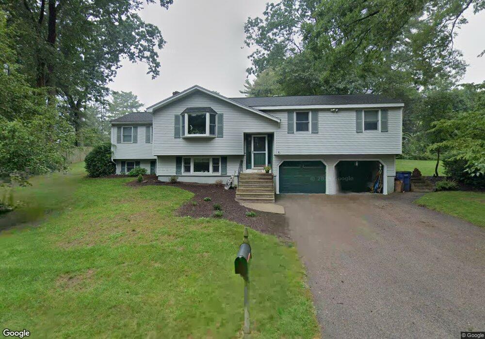
3 Riverview St Medway, MA 02053
Estimated Value: $599,000 - $748,000
4
Beds
3
Baths
1,504
Sq Ft
$440/Sq Ft
Est. Value
About This Home
This home is located at 3 Riverview St, Medway, MA 02053 and is currently estimated at $661,477, approximately $439 per square foot. 3 Riverview St is a home located in Norfolk County with nearby schools including John D. McGovern Elementary School, Burke-Memorial Elementary, and Medway Middle School.
Ownership History
Date
Name
Owned For
Owner Type
Purchase Details
Closed on
Nov 20, 2023
Sold by
Flannigan Michael P and Flannigan Megan T
Bought by
Mpte Ft and Flannigan
Current Estimated Value
Purchase Details
Closed on
Jun 14, 2022
Sold by
Thomson David P
Bought by
Flannigan Michael P and Thomson Megan J
Home Financials for this Owner
Home Financials are based on the most recent Mortgage that was taken out on this home.
Original Mortgage
$440,000
Interest Rate
5.1%
Mortgage Type
Purchase Money Mortgage
Purchase Details
Closed on
Mar 30, 1987
Sold by
Theroux Paul W
Bought by
Thomson David P
Home Financials for this Owner
Home Financials are based on the most recent Mortgage that was taken out on this home.
Original Mortgage
$83,900
Interest Rate
9.03%
Mortgage Type
Purchase Money Mortgage
Create a Home Valuation Report for This Property
The Home Valuation Report is an in-depth analysis detailing your home's value as well as a comparison with similar homes in the area
Home Values in the Area
Average Home Value in this Area
Purchase History
| Date | Buyer | Sale Price | Title Company |
|---|---|---|---|
| Mpte Ft | -- | None Available | |
| Flannigan Michael P | $550,000 | None Available | |
| Thomson David P | $147,000 | -- |
Source: Public Records
Mortgage History
| Date | Status | Borrower | Loan Amount |
|---|---|---|---|
| Previous Owner | Flannigan Michael P | $440,000 | |
| Previous Owner | Thomson David P | $115,000 | |
| Previous Owner | Thomson David P | $83,000 | |
| Previous Owner | Thomson David P | $83,900 |
Source: Public Records
Tax History Compared to Growth
Tax History
| Year | Tax Paid | Tax Assessment Tax Assessment Total Assessment is a certain percentage of the fair market value that is determined by local assessors to be the total taxable value of land and additions on the property. | Land | Improvement |
|---|---|---|---|---|
| 2025 | $7,855 | $551,200 | $288,800 | $262,400 |
| 2024 | $7,937 | $551,200 | $288,800 | $262,400 |
| 2023 | $7,721 | $484,400 | $239,300 | $245,100 |
| 2022 | $7,351 | $434,200 | $212,500 | $221,700 |
| 2021 | $7,220 | $413,500 | $196,000 | $217,500 |
| 2020 | $6,914 | $395,100 | $181,500 | $213,600 |
| 2019 | $6,571 | $387,200 | $181,500 | $205,700 |
| 2018 | $6,331 | $358,500 | $156,800 | $201,700 |
| 2017 | $6,037 | $336,900 | $156,800 | $180,100 |
| 2016 | $5,772 | $318,700 | $138,600 | $180,100 |
| 2015 | $5,574 | $305,600 | $123,800 | $181,800 |
| 2014 | $5,392 | $286,200 | $132,000 | $154,200 |
Source: Public Records
Map
Nearby Homes
- 0 Elm St
- 7 Gloucester Dr
- 841 Lincoln St
- 14 Sanford St Unit 15
- 280 Village St Unit D2
- 4 Shaw St
- 9 Sanford St
- 20 Broad St Unit 6
- 20 Broad St Unit A
- 20 Broad St Unit 4
- 2 Skyline Dr
- 732 Lincoln St
- 21 Riverside Rd
- 56 Fuller Place
- 24 Shayne Rd Unit 219
- 28 Wellington St
- 48 Leanne Way Unit 48
- 83 Oliver Pond Cir Unit 7
- 91 Oliver Pond Cir Unit 3
- 22 Sunset Dr
- 17 Charles River Rd
- 1 Riverview St
- 7 Riverview St
- 15 Charles River Rd
- 8 King Phillip St
- 16 Charles River Rd
- 18 Charles River Rd
- 5 Wamesit St
- 4 Riverview St
- 10 King Phillip St
- 21 Charles River Rd
- 6 Kings Ln
- 6 King Phillip St
- 3 Naumkeag St
- 4 Iroquois St
- 5 Iroquois St
- 4 King Phillip St
- 14 Charles River Rd
- 20 Charles River Rd
- 5 King Phillip St