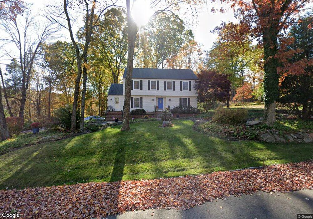
3 Robin Dr Randolph, NJ 07869
Estimated Value: $756,000 - $856,000
Studio
--
Bath
2,435
Sq Ft
$333/Sq Ft
Est. Value
About This Home
This home is located at 3 Robin Dr, Randolph, NJ 07869 and is currently estimated at $810,147, approximately $332 per square foot. 3 Robin Dr is a home located in Morris County with nearby schools including Randolph High School, Randolph Middle School, and Apple Montessori Schools and Camps - Randolph.
Ownership History
Date
Name
Owned For
Owner Type
Purchase Details
Closed on
Mar 13, 2008
Sold by
Schwarz Charles M
Bought by
Mclaughlin James M and Mclaughlin Elizabeth F
Current Estimated Value
Home Financials for this Owner
Home Financials are based on the most recent Mortgage that was taken out on this home.
Original Mortgage
$211,000
Interest Rate
4.83%
Mortgage Type
Purchase Money Mortgage
Purchase Details
Closed on
Dec 21, 2004
Sold by
Schwarz Charles
Bought by
Schwarz Charles
Purchase Details
Closed on
Aug 14, 2001
Sold by
Grembowitz Robert
Bought by
Schwarz Charles
Home Financials for this Owner
Home Financials are based on the most recent Mortgage that was taken out on this home.
Original Mortgage
$275,000
Interest Rate
7.16%
Purchase Details
Closed on
Jul 10, 1995
Sold by
Bree John M and Bree Margaret A
Bought by
Grembowitz Robert F and Grembowitz Doreen M
Create a Home Valuation Report for This Property
The Home Valuation Report is an in-depth analysis detailing your home's value as well as a comparison with similar homes in the area
Home Values in the Area
Average Home Value in this Area
Purchase History
| Date | Buyer | Sale Price | Title Company |
|---|---|---|---|
| Mclaughlin James M | $481,000 | Multiple | |
| Schwarz Charles | -- | -- | |
| Schwarz Charles | $457,500 | -- | |
| Schwarz Charles | $457,500 | -- | |
| Grembowitz Robert F | $280,000 | -- |
Source: Public Records
Mortgage History
| Date | Status | Borrower | Loan Amount |
|---|---|---|---|
| Previous Owner | Mclaughlin James M | $211,000 | |
| Previous Owner | Schwarz Charles | $275,000 |
Source: Public Records
Tax History
| Year | Tax Paid | Tax Assessment Tax Assessment Total Assessment is a certain percentage of the fair market value that is determined by local assessors to be the total taxable value of land and additions on the property. | Land | Improvement |
|---|---|---|---|---|
| 2025 | $13,600 | $480,400 | $208,800 | $271,600 |
| 2024 | $13,259 | $480,400 | $208,800 | $271,600 |
Source: Public Records
Map
Nearby Homes
- 384 Millbrook Ave
- 107 High St
- 181 Center Grove Rd
- 12 Birch St
- 3 Marble Ln
- 121 W Munson Ave
- 37 Kearney St
- 33 Shongum Rd
- 343 & 339 Quaker Church Rd
- 77B Highland Way
- 71 Washington Ave Unit 73
- 10 Bayberry Ln
- 44 Shongum Rd
- 14 Jessica Ln
- 5 A&B Dewey St
- 188 Casterline Rd
- 142 W Blackwell St
- 170 Park Heights Ave
- 14 Fieldstone Ct
- 8 Union Hill Rd
- 5 Robin Dr
- 1 Robin Dr
- 279 Millbrook Ave
- 6 Robin Dr
- 6 Starling Dr
- 4 Robin Dr
- 8 Starling Dr
- 6 Starling Rd
- 8 Robin Dr
- 277 Millbrook Ave Unit Basement
- 277 Millbrook Ave
- 10 Starling Dr
- 10 Starling Rd
- 301 Millbrook Ave
- 10 Robin Dr
- 275 Millbrook Ave
- 6 Woodcock Ln
- 302 Millbrook Ave
- 309 Millbrook Ave
- 4 Woodcock Ln
Your Personal Tour Guide
Ask me questions while you tour the home.