Estimated Value: $864,000 - $1,074,000
4
Beds
3
Baths
2,242
Sq Ft
$428/Sq Ft
Est. Value
About This Home
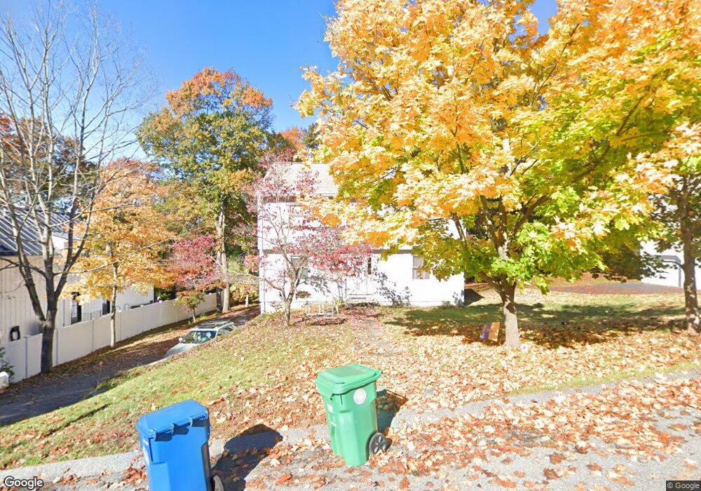
This home is located at 3 Robin Rd, Burlington, MA 01803 and is currently estimated at $959,124, approximately $427 per square foot. 3 Robin Rd is a home located in Middlesex County with nearby schools including Burlington High School, Memorial Elementary School, and Marshall Simonds Middle School.
Ownership History
Date
Name
Owned For
Owner Type
Purchase Details
Closed on
Dec 12, 2017
Sold by
Chludzinski Joseph W and Chludzinski Barbara J
Bought by
Three Robin Street Rt
Current Estimated Value
Purchase Details
Closed on
Nov 28, 2017
Sold by
3 Robin Street Rt
Bought by
Chuldzinski Barbara J and Chludzinski Joseph W
Purchase Details
Closed on
Mar 22, 2016
Sold by
Chludzinski Joseph W and Chludzinski Barbara J
Bought by
3 Robin Street Rt
Purchase Details
Closed on
May 13, 1994
Sold by
Adam Rt and Murray Daniel E
Bought by
Chludzinski Joseph W and Chludzinski Barbara J
Purchase Details
Closed on
Apr 11, 1994
Sold by
Connors Michael E
Bought by
Adam Rt and Murray Daniel E
Create a Home Valuation Report for This Property
The Home Valuation Report is an in-depth analysis detailing your home's value as well as a comparison with similar homes in the area
Home Values in the Area
Average Home Value in this Area
Purchase History
| Date | Buyer | Sale Price | Title Company |
|---|---|---|---|
| Three Robin Street Rt | -- | -- | |
| Chuldzinski Barbara J | -- | -- | |
| 3 Robin Street Rt | -- | -- | |
| Chludzinski Joseph W | $199,900 | -- | |
| Adam Rt | $80,000 | -- |
Source: Public Records
Mortgage History
| Date | Status | Borrower | Loan Amount |
|---|---|---|---|
| Previous Owner | Adam Rt | $220,000 | |
| Previous Owner | Adam Rt | $183,000 | |
| Previous Owner | Adam Rt | $38,000 |
Source: Public Records
Tax History
| Year | Tax Paid | Tax Assessment Tax Assessment Total Assessment is a certain percentage of the fair market value that is determined by local assessors to be the total taxable value of land and additions on the property. | Land | Improvement |
|---|---|---|---|---|
| 2025 | $7,014 | $809,900 | $397,700 | $412,200 |
| 2024 | $6,752 | $755,300 | $363,100 | $392,200 |
| 2023 | $6,582 | $700,200 | $314,700 | $385,500 |
| 2022 | $6,402 | $643,400 | $286,100 | $357,300 |
| 2021 | $7,300 | $625,500 | $268,000 | $357,500 |
| 2020 | $7,110 | $615,400 | $263,700 | $351,700 |
| 2019 | $5,861 | $559,300 | $246,400 | $312,900 |
| 2018 | $5,722 | $538,800 | $239,500 | $299,300 |
| 2017 | $5,589 | $538,800 | $239,500 | $299,300 |
| 2016 | $5,549 | $484,200 | $207,500 | $276,700 |
| 2015 | $5,496 | $484,200 | $207,500 | $276,700 |
| 2014 | $5,368 | $447,300 | $185,000 | $262,300 |
Source: Public Records
Map
Nearby Homes
- 4 Waite Ave
- 2 Rhuey Pass
- 9 Winter St
- 3 Arborwood Dr
- 7 Alan R Gerrish Dr Unit 7
- 13 Makechnie Rd
- 23 Ward St
- 23 Ward St Unit A
- 44 Pearl St
- 210 Winn St
- 13 West St
- 3 Georgia Dr
- 0 Johnson Rd
- 1 Briarwood Ln
- 30 Forbes Ave
- 3 Kearsarge Ave
- 1011 Main St Unit 5
- 22 Longwood Ave
- 11 Maple Ridge Dr Unit 11
- 9 Chester Ave
Your Personal Tour Guide
Ask me questions while you tour the home.