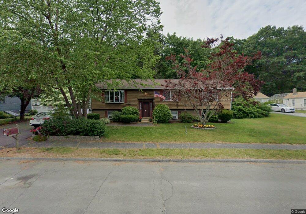
3 Robin Rd Shrewsbury, MA 01545
Estimated Value: $702,000 - $861,000
5
Beds
3
Baths
2,813
Sq Ft
$271/Sq Ft
Est. Value
About This Home
This home is located at 3 Robin Rd, Shrewsbury, MA 01545 and is currently estimated at $762,872, approximately $271 per square foot. 3 Robin Rd is a home located in Worcester County with nearby schools including Calvin Coolidge Elementary School, Sherwood Middle School, and Oak Middle School.
Ownership History
Date
Name
Owned For
Owner Type
Purchase Details
Closed on
Jun 18, 2004
Sold by
Wilkey Craig A and Wilkey Sonja A
Bought by
Connors Timothy D
Current Estimated Value
Home Financials for this Owner
Home Financials are based on the most recent Mortgage that was taken out on this home.
Original Mortgage
$278,400
Outstanding Balance
$137,186
Interest Rate
6.12%
Mortgage Type
Purchase Money Mortgage
Estimated Equity
$625,686
Purchase Details
Closed on
Jun 20, 2001
Sold by
Linda & Bev Rt
Bought by
Wilkey Craig A and Wilkey Sonja A
Purchase Details
Closed on
Aug 5, 1992
Sold by
Morse Jeffrey A and Morse Maureen
Bought by
Boyle Beverly P and Hitt Kenneth
Purchase Details
Closed on
May 18, 1990
Sold by
Caruso Mario P
Bought by
Morse Jeffrey A
Create a Home Valuation Report for This Property
The Home Valuation Report is an in-depth analysis detailing your home's value as well as a comparison with similar homes in the area
Home Values in the Area
Average Home Value in this Area
Purchase History
| Date | Buyer | Sale Price | Title Company |
|---|---|---|---|
| Connors Timothy D | $348,000 | -- | |
| Connors Timothy D | $348,000 | -- | |
| Connors Timothy D | $348,000 | -- | |
| Wilkey Craig A | $295,000 | -- | |
| Wilkey Craig A | $295,000 | -- | |
| Boyle Beverly P | $164,000 | -- | |
| Boyle Beverly P | $164,000 | -- | |
| Morse Jeffrey A | $50,000 | -- |
Source: Public Records
Mortgage History
| Date | Status | Borrower | Loan Amount |
|---|---|---|---|
| Open | Connors Timothy D | $278,400 | |
| Closed | Connors Timothy D | $278,400 |
Source: Public Records
Tax History Compared to Growth
Tax History
| Year | Tax Paid | Tax Assessment Tax Assessment Total Assessment is a certain percentage of the fair market value that is determined by local assessors to be the total taxable value of land and additions on the property. | Land | Improvement |
|---|---|---|---|---|
| 2025 | $79 | $652,000 | $259,500 | $392,500 |
| 2024 | $7,281 | $588,100 | $247,100 | $341,000 |
| 2023 | $6,725 | $512,600 | $247,100 | $265,500 |
| 2022 | $6,657 | $471,800 | $247,100 | $224,700 |
| 2021 | $5,531 | $419,300 | $197,700 | $221,600 |
| 2020 | $4,942 | $396,300 | $197,700 | $198,600 |
| 2019 | $4,712 | $374,900 | $181,300 | $193,600 |
| 2018 | $4,859 | $383,800 | $173,500 | $210,300 |
| 2017 | $4,537 | $353,600 | $157,100 | $196,500 |
| 2016 | $4,464 | $343,400 | $147,100 | $196,300 |
| 2015 | $4,377 | $331,600 | $142,100 | $189,500 |
Source: Public Records
Map
Nearby Homes
- 190 S Quinsigamond Ave Unit 102
- 259 S Quinsigamond Ave
- 105 S Quinsigamond Ave
- 73 S Quinsigamond Ave
- 241 Lake Ave
- 40 Shrewsbury Green Dr Unit A
- 42 Shrewsbury Green Dr Unit I
- 44 Ayrshire Rd
- 26 Browne Rd
- 22 Shrewsbury Green Dr Unit C
- 342 Lake Ave
- 10 Gleason Rd
- 135 Lake Ave
- 24 Sherbrook Ave
- 22 Sherbrook Ave
- 334 Bridle Path
- 16 Nelson Point Rd
- 276 Coburn Ave
- 96 Lake Ave
- 76 Hillside Dr