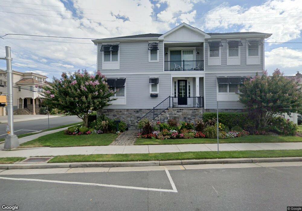
3 S 29th Ave Longport, NJ 08403
Estimated Value: $2,487,000 - $2,928,000
5
Beds
4
Baths
2,852
Sq Ft
$926/Sq Ft
Est. Value
About This Home
This home is located at 3 S 29th Ave, Longport, NJ 08403 and is currently estimated at $2,639,534, approximately $925 per square foot. 3 S 29th Ave is a home located in Atlantic County with nearby schools including Blessed Sacrament Regional School, St. James Elementary School, and Saint Joseph Regional School.
Ownership History
Date
Name
Owned For
Owner Type
Purchase Details
Closed on
Sep 17, 2019
Sold by
Mendelsohn Jules and Mendelsohn Patricia
Bought by
Pasternack Alla
Current Estimated Value
Home Financials for this Owner
Home Financials are based on the most recent Mortgage that was taken out on this home.
Original Mortgage
$950,000
Interest Rate
3.5%
Mortgage Type
Purchase Money Mortgage
Purchase Details
Closed on
Jan 5, 2016
Sold by
Jakubowski John R and Gaul Regina L
Bought by
Mendelsohn Jules and Mendelsohn Patricia
Create a Home Valuation Report for This Property
The Home Valuation Report is an in-depth analysis detailing your home's value as well as a comparison with similar homes in the area
Home Values in the Area
Average Home Value in this Area
Purchase History
| Date | Buyer | Sale Price | Title Company |
|---|---|---|---|
| Pasternack Alla | $1,450,000 | City Abstract | |
| Mendelsohn Jules | $700,000 | Attorney |
Source: Public Records
Mortgage History
| Date | Status | Borrower | Loan Amount |
|---|---|---|---|
| Previous Owner | Pasternack Alla | $950,000 |
Source: Public Records
Tax History Compared to Growth
Tax History
| Year | Tax Paid | Tax Assessment Tax Assessment Total Assessment is a certain percentage of the fair market value that is determined by local assessors to be the total taxable value of land and additions on the property. | Land | Improvement |
|---|---|---|---|---|
| 2025 | $12,568 | $1,120,100 | $584,500 | $535,600 |
| 2024 | $12,568 | $1,120,100 | $584,500 | $535,600 |
| 2023 | $11,347 | $1,120,100 | $584,500 | $535,600 |
| 2022 | $11,347 | $1,120,100 | $584,500 | $535,600 |
| 2021 | $10,899 | $1,120,100 | $584,500 | $535,600 |
| 2020 | $11,044 | $1,120,100 | $584,500 | $535,600 |
| 2019 | $5,751 | $584,500 | $584,500 | $0 |
| 2018 | $11,022 | $1,120,100 | $584,500 | $535,600 |
| 2017 | $6,355 | $659,200 | $584,500 | $74,700 |
| 2016 | $6,104 | $659,200 | $584,500 | $74,700 |
| 2015 | $5,979 | $659,200 | $584,500 | $74,700 |
| 2014 | $5,920 | $659,200 | $584,500 | $74,700 |
Source: Public Records
Map
Nearby Homes
- 5 S 27th Ave
- 2700 Atlantic Ave Unit 701
- 2700 Atlantic Ave Unit 515
- 2700 Atlantic Ave Unit 212
- 2700 Atlantic Ave Unit 419
- 2700 Atlantic Ave Unit AVE601
- 2931 Pacific Ave
- 2404 Atlantic Ave
- 2407 Atlantic Ave
- 32 N Pelham Ave
- 3008 Ventnor Ave
- 32 N Manor Ave
- 3014 Ventnor Ave
- 3105 Pacific Ave
- 3301 Atlantic Ave
- 3404 Ventnor Ave
- 212 N 33rd Ave
- 121 S 17th Ave
- 9600 Atlantic Ave Unit 1713
- 9600 Atlantic Ave Unit 1711
- 2904 Pacific Ave
- 5 S 29th Ave
- 2808 Pacific Ave
- 2901 Atlantic Ave Unit E203
- 8 S Pelham Ave
- 2903 Atlantic Ave
- 6 S 29th Ave
- 4 S Pelham Ave
- 2905 Pacific Ave
- 2806 Pacific Ave
- 2809 Atlantic Ave
- 2909 Atlantic Ave
- 2805 Atlantic Ave
- 2804 Pacific Ave
- 1 S 28th Ave
- 7 S 28th Ave
- 1 N 29th Ave
- 2803 Atlantic Ave
- 7 S Pelham Ave