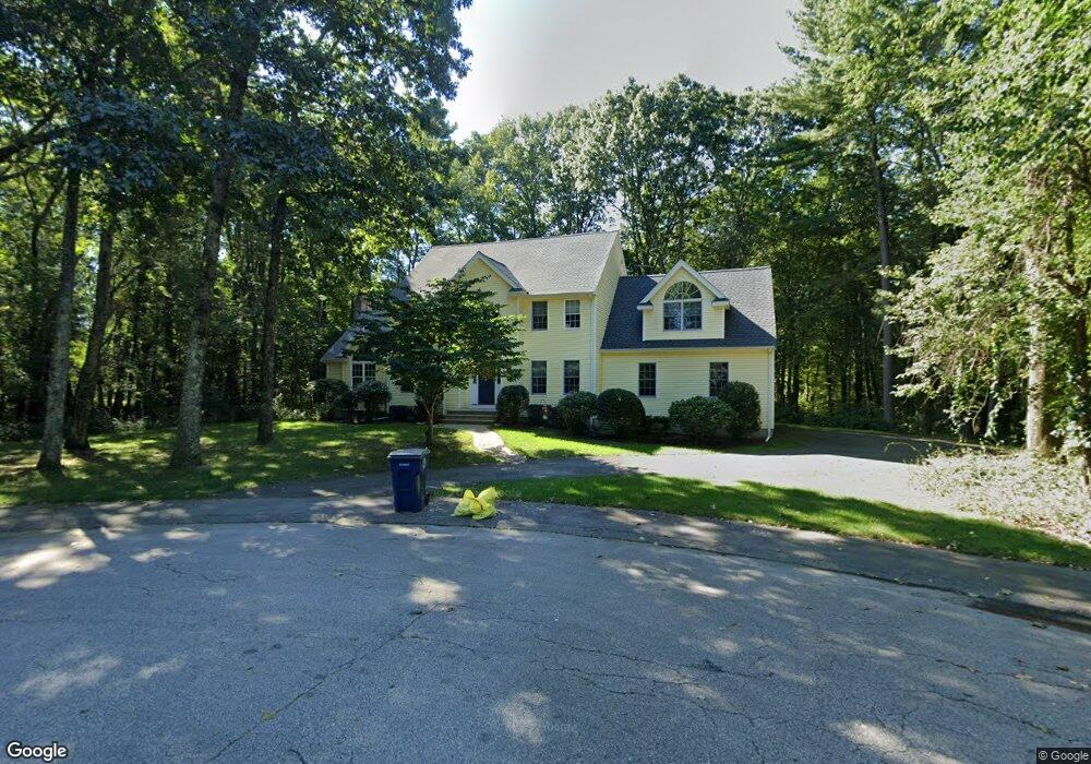
3 Shamrock Ln Medway, MA 02053
Estimated Value: $905,499 - $1,176,000
4
Beds
3
Baths
2,800
Sq Ft
$377/Sq Ft
Est. Value
About This Home
This home is located at 3 Shamrock Ln, Medway, MA 02053 and is currently estimated at $1,056,125, approximately $377 per square foot. 3 Shamrock Ln is a home located in Norfolk County with nearby schools including John D. McGovern Elementary School, Burke-Memorial Elementary, and Medway Middle School.
Ownership History
Date
Name
Owned For
Owner Type
Purchase Details
Closed on
Aug 12, 1999
Sold by
S&W Dev Corp
Bought by
Reilly Edward B and Reilly Judy A
Current Estimated Value
Home Financials for this Owner
Home Financials are based on the most recent Mortgage that was taken out on this home.
Original Mortgage
$270,000
Interest Rate
7.65%
Mortgage Type
Purchase Money Mortgage
Create a Home Valuation Report for This Property
The Home Valuation Report is an in-depth analysis detailing your home's value as well as a comparison with similar homes in the area
Home Values in the Area
Average Home Value in this Area
Purchase History
| Date | Buyer | Sale Price | Title Company |
|---|---|---|---|
| Reilly Edward B | $350,000 | -- |
Source: Public Records
Mortgage History
| Date | Status | Borrower | Loan Amount |
|---|---|---|---|
| Open | Reilly Edward B | $244,692 | |
| Closed | Reilly Edward B | $270,000 |
Source: Public Records
Tax History Compared to Growth
Tax History
| Year | Tax Paid | Tax Assessment Tax Assessment Total Assessment is a certain percentage of the fair market value that is determined by local assessors to be the total taxable value of land and additions on the property. | Land | Improvement |
|---|---|---|---|---|
| 2025 | $11,618 | $815,300 | $340,600 | $474,700 |
| 2024 | $11,740 | $815,300 | $340,600 | $474,700 |
| 2023 | $11,206 | $703,000 | $310,100 | $392,900 |
| 2022 | $10,373 | $612,700 | $229,500 | $383,200 |
| 2021 | $10,396 | $595,400 | $214,200 | $381,200 |
| 2020 | $10,271 | $586,900 | $214,200 | $372,700 |
| 2019 | $9,761 | $575,200 | $205,500 | $369,700 |
| 2018 | $10,040 | $568,500 | $205,500 | $363,000 |
| 2017 | $9,713 | $542,000 | $196,800 | $345,200 |
| 2016 | $9,618 | $531,100 | $185,900 | $345,200 |
| 2015 | $9,580 | $525,200 | $185,900 | $339,300 |
| 2014 | $8,776 | $465,800 | $186,700 | $279,100 |
Source: Public Records
Map
Nearby Homes
- 12 Lovering St
- 36 Lovering St
- 106 Holliston St
- 3 Meryl St
- 14 Heritage Dr
- 1 Walnut Ln
- 22 Sunset Dr
- 30 Broken Tree Rd
- 19 Sycamore Way Unit L40
- 50 Main St
- 116 Winthrop St
- 0 Hill St
- 7 Hill St
- 176 Main St Unit 3
- 12 Longmeadow Ln
- 625 Norfolk St
- 280 Village St Unit D2
- 28 Wellington St
- 140 Goulding St
- 20 Broad St Unit 6