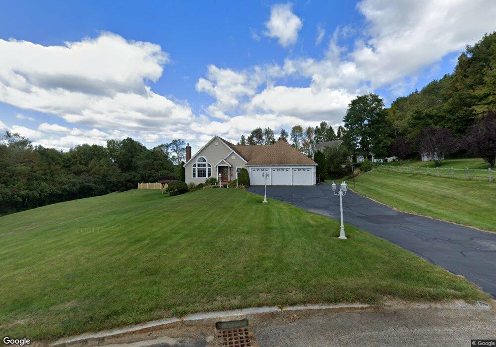
3 Sidoti Ln Rutland, MA 01543
Estimated Value: $653,000 - $969,000
4
Beds
3
Baths
4,922
Sq Ft
$153/Sq Ft
Est. Value
About This Home
This home is located at 3 Sidoti Ln, Rutland, MA 01543 and is currently estimated at $755,499, approximately $153 per square foot. 3 Sidoti Ln is a home located in Worcester County with nearby schools including Wachusett Regional High School.
Ownership History
Date
Name
Owned For
Owner Type
Purchase Details
Closed on
Oct 8, 2004
Sold by
Ekstrom Nadine G and Ekstrom Rodger S
Bought by
Qutab Abbas S
Current Estimated Value
Home Financials for this Owner
Home Financials are based on the most recent Mortgage that was taken out on this home.
Original Mortgage
$386,150
Outstanding Balance
$192,137
Interest Rate
5.84%
Mortgage Type
Purchase Money Mortgage
Estimated Equity
$563,362
Create a Home Valuation Report for This Property
The Home Valuation Report is an in-depth analysis detailing your home's value as well as a comparison with similar homes in the area
Home Values in the Area
Average Home Value in this Area
Purchase History
| Date | Buyer | Sale Price | Title Company |
|---|---|---|---|
| Qutab Abbas S | $514,900 | -- |
Source: Public Records
Mortgage History
| Date | Status | Borrower | Loan Amount |
|---|---|---|---|
| Open | Qutab Abbas S | $386,150 |
Source: Public Records
Tax History
| Year | Tax Paid | Tax Assessment Tax Assessment Total Assessment is a certain percentage of the fair market value that is determined by local assessors to be the total taxable value of land and additions on the property. | Land | Improvement |
|---|---|---|---|---|
| 2025 | $9,057 | $636,000 | $98,100 | $537,900 |
| 2024 | $9,147 | $616,800 | $94,200 | $522,600 |
| 2023 | $8,361 | $609,400 | $88,900 | $520,500 |
| 2022 | $7,606 | $481,700 | $75,200 | $406,500 |
| 2021 | $8,058 | $482,500 | $75,200 | $407,300 |
| 2020 | $8,627 | $489,900 | $71,400 | $418,500 |
| 2019 | $8,603 | $480,900 | $68,000 | $412,900 |
| 2018 | $8,719 | $480,900 | $68,000 | $412,900 |
| 2017 | $8,812 | $481,000 | $68,000 | $413,000 |
| 2016 | $8,127 | $467,900 | $64,700 | $403,200 |
| 2015 | $7,434 | $421,200 | $64,700 | $356,500 |
| 2014 | $7,207 | $421,200 | $64,700 | $356,500 |
Source: Public Records
Map
Nearby Homes
- 311 Pleasantdale Rd
- 21 Wildbrook Dr
- 122 Integrity Dr Unit 61
- Lot 11 Pleasantdale Rd
- Lot 6 Irish Ln
- 236 Turkey Hill Rd
- 7 Emerald Rd
- LOT 8 Pierre Cir
- 14A Welch Ave Unit A
- 11 Brigham Rd
- Lot 0 N Brookfield Rd
- 7 Victoria Ave
- 2 Kosta Ave
- 0 Barrack Hill Rd Unit 73395148
- 4 Fidelity Dr Unit 2
- Lot 29 Quail Run
- Lot 27A Quail Run
- 20 Integrity Dr Unit 10
- 18 Integrity Dr Unit 9
- 13 Woodside Ave
- 2 Sidoti Ln
- 2 Sidoti Ln Unit 1
- 1 Sidoti Ln
- 1 Sidoti Ln Unit 1
- 278 Pleasantdale Rd
- 274 Pleasantdale Rd
- 282 Pleasantdale Rd
- 292 Pleasantdale Rd
- 268 Pleasantdale Rd
- 285 Pleasantdale Rd
- 304 Pleasantdale Rd
- 255 Pleasantdale Rd
- 0 E Hill Rd Unit 30158097
- 31 E Hill Rd
- 253 Pleasantdale Rd
- 246 Pleasantdale Rd
- 248 Pleasantdale Rd
- 251 Pleasantdale Rd
- 249 Pleasantdale Rd
- 245 Pleasantdale Rd
Your Personal Tour Guide
Ask me questions while you tour the home.