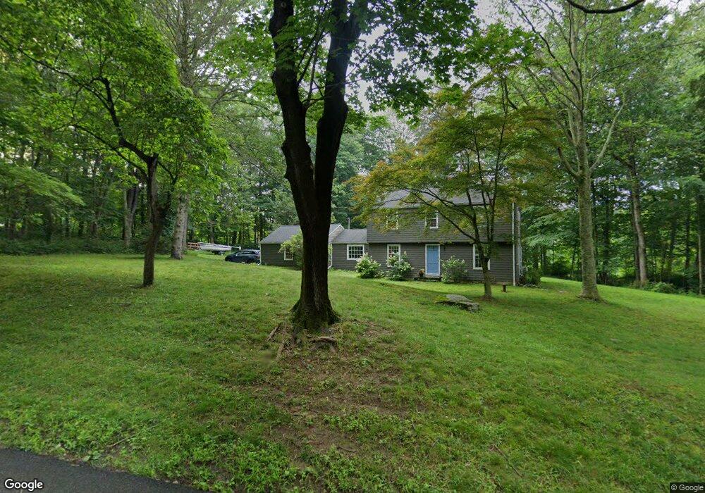
3 Silversmith Ln Redding, CT 06896
Estimated Value: $667,866 - $1,027,000
3
Beds
2
Baths
1,922
Sq Ft
$398/Sq Ft
Est. Value
About This Home
This home is located at 3 Silversmith Ln, Redding, CT 06896 and is currently estimated at $764,967, approximately $398 per square foot. 3 Silversmith Ln is a home located in Fairfield County with nearby schools including Redding Elementary School, John Read Middle School, and Joel Barlow High School.
Ownership History
Date
Name
Owned For
Owner Type
Purchase Details
Closed on
Aug 9, 2010
Sold by
Cabot Eliot B and Miller Amy D
Bought by
Cowherd Joseph E and Cowherd Cheryl M
Current Estimated Value
Home Financials for this Owner
Home Financials are based on the most recent Mortgage that was taken out on this home.
Original Mortgage
$359,200
Outstanding Balance
$239,737
Interest Rate
4.73%
Estimated Equity
$525,230
Purchase Details
Closed on
Dec 7, 2004
Sold by
Est Fox Gilbert and Morency Donna
Bought by
Miller Amy and Cabot Eliot
Home Financials for this Owner
Home Financials are based on the most recent Mortgage that was taken out on this home.
Original Mortgage
$237,000
Interest Rate
5.69%
Create a Home Valuation Report for This Property
The Home Valuation Report is an in-depth analysis detailing your home's value as well as a comparison with similar homes in the area
Home Values in the Area
Average Home Value in this Area
Purchase History
| Date | Buyer | Sale Price | Title Company |
|---|---|---|---|
| Cowherd Joseph E | $449,000 | -- | |
| Cabot Eliot B | -- | -- | |
| Miller Amy | $475,000 | -- |
Source: Public Records
Mortgage History
| Date | Status | Borrower | Loan Amount |
|---|---|---|---|
| Open | Miller Amy | $359,200 | |
| Previous Owner | Miller Amy | $150,000 | |
| Previous Owner | Miller Amy | $237,000 |
Source: Public Records
Tax History Compared to Growth
Tax History
| Year | Tax Paid | Tax Assessment Tax Assessment Total Assessment is a certain percentage of the fair market value that is determined by local assessors to be the total taxable value of land and additions on the property. | Land | Improvement |
|---|---|---|---|---|
| 2025 | $10,832 | $366,700 | $154,000 | $212,700 |
| 2024 | $10,532 | $366,700 | $154,000 | $212,700 |
| 2023 | $9,874 | $356,600 | $154,000 | $202,600 |
| 2022 | $9,639 | $289,100 | $158,800 | $130,300 |
| 2021 | $9,494 | $289,100 | $158,800 | $130,300 |
| 2020 | $9,494 | $289,100 | $158,800 | $130,300 |
| 2019 | $9,314 | $289,100 | $158,800 | $130,300 |
| 2018 | $9,170 | $289,100 | $158,800 | $130,300 |
| 2017 | $8,234 | $278,000 | $159,100 | $118,900 |
| 2016 | $8,129 | $278,000 | $159,100 | $118,900 |
| 2015 | $8,037 | $278,000 | $159,100 | $118,900 |
| 2014 | $8,037 | $278,000 | $159,100 | $118,900 |
Source: Public Records
Map
Nearby Homes
- 41 Sullivan Dr
- 241 Black Rock Turnpike
- 63 Turney Rd
- 15 Tunxis Trail
- 56 Cross Hwy
- 280 Newtown Turnpike
- 22 Lonetown Rd
- 28 Sunnyview Dr
- 41 Deer Hill Rd
- 10 Shady Ln
- 54 Rock House Rd
- 294 Maple Rd
- 235 Rock House Rd
- 45 Great Pasture Rd
- 9 Nicolina Way
- 9 Vona Way
- 18 Sebastian Tr
- lot5B Nicolina Way
- 5 Vona Way
- lot22 Vona Way
- 6 Silversmith Ln
- 10 Silversmith Ln
- 7 Silversmith Ln
- 174 Black Rock Turnpike
- 9 Silversmith Ln
- 170 Black Rock Turnpike
- 172 Black Rock Turnpike
- 15 Silversmith Ln
- 205 Black Rock Turnpike
- 11 Silversmith Ln
- 168 Black Rock Turnpike
- 164 Black Rock Turnpike
- 211 Black Rock Turnpike
- 16 Silversmith Ln
- 210 Black Rock Turnpike
- 161 Black Rock Turnpike
- 5 South Ln
- 21 Sullivan Dr
- 23 Sullivan Dr
- 214 Black Rock Turnpike