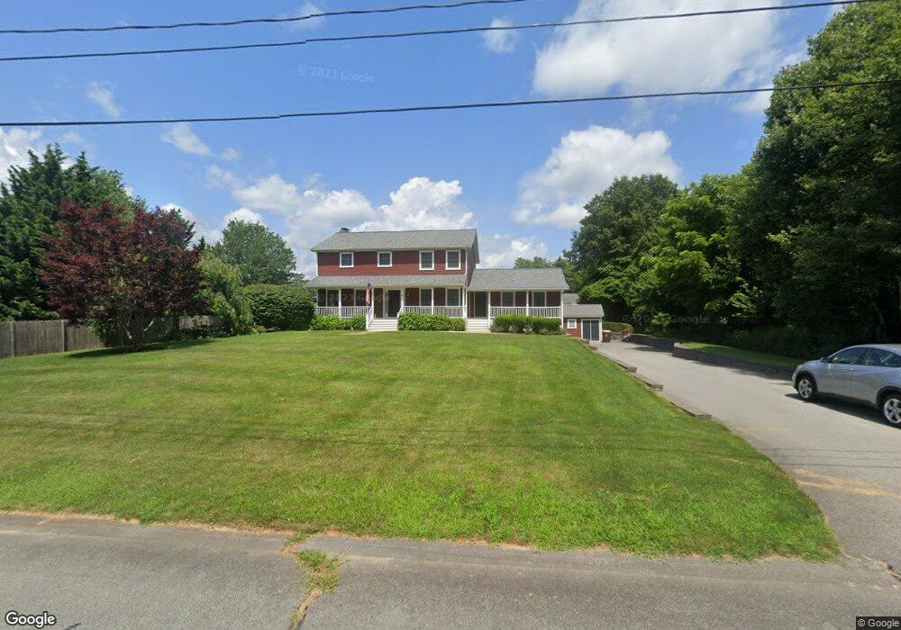
3 Snap Weed Ln Acushnet, MA 02743
Upper Acushnet NeighborhoodEstimated Value: $665,821 - $820,000
5
Beds
3
Baths
3,136
Sq Ft
$239/Sq Ft
Est. Value
About This Home
This home is located at 3 Snap Weed Ln, Acushnet, MA 02743 and is currently estimated at $750,955, approximately $239 per square foot. 3 Snap Weed Ln is a home located in Bristol County with nearby schools including Acushnet Elementary School, Albert F Ford Middle School, and Alma Del Mar Charter School.
Ownership History
Date
Name
Owned For
Owner Type
Purchase Details
Closed on
Nov 25, 2019
Sold by
Clementino Sally and Clementino Simeao B
Bought by
Clementino-Pacheco Ft and Clementino
Current Estimated Value
Purchase Details
Closed on
Sep 19, 2008
Sold by
Moran Julie M and Moran Paul B
Bought by
Clementino Sally and Clementino Simeao B
Home Financials for this Owner
Home Financials are based on the most recent Mortgage that was taken out on this home.
Original Mortgage
$235,000
Interest Rate
6.54%
Mortgage Type
Purchase Money Mortgage
Purchase Details
Closed on
Apr 15, 2005
Sold by
Sirva Relocation Llc
Bought by
Moran Julie M and Moran Paul B
Create a Home Valuation Report for This Property
The Home Valuation Report is an in-depth analysis detailing your home's value as well as a comparison with similar homes in the area
Home Values in the Area
Average Home Value in this Area
Purchase History
| Date | Buyer | Sale Price | Title Company |
|---|---|---|---|
| Clementino-Pacheco Ft | -- | -- | |
| Clementino Sally | $335,000 | -- | |
| Moran Julie M | $425,000 | -- | |
| Sirva Relocation Llc | $425,000 | -- |
Source: Public Records
Mortgage History
| Date | Status | Borrower | Loan Amount |
|---|---|---|---|
| Previous Owner | Sirva Relocation Llc | $205,000 | |
| Previous Owner | Sirva Relocation Llc | $235,000 | |
| Previous Owner | Sirva Relocation Llc | $235,000 |
Source: Public Records
Tax History
| Year | Tax Paid | Tax Assessment Tax Assessment Total Assessment is a certain percentage of the fair market value that is determined by local assessors to be the total taxable value of land and additions on the property. | Land | Improvement |
|---|---|---|---|---|
| 2025 | $63 | $583,100 | $159,700 | $423,400 |
| 2024 | $5,941 | $520,700 | $139,700 | $381,000 |
| 2023 | $5,903 | $491,900 | $127,300 | $364,600 |
| 2022 | $5,402 | $407,100 | $119,800 | $287,300 |
| 2021 | $5,312 | $384,100 | $119,800 | $264,300 |
| 2020 | $5,170 | $370,900 | $119,800 | $251,100 |
| 2019 | $5,164 | $364,200 | $119,800 | $244,400 |
| 2018 | $5,005 | $347,100 | $119,800 | $227,300 |
| 2017 | $4,888 | $338,500 | $119,800 | $218,700 |
| 2016 | $4,677 | $321,900 | $119,800 | $202,100 |
| 2015 | $4,597 | $321,900 | $119,800 | $202,100 |
Source: Public Records
Map
Nearby Homes
- 363 Main St
- 25 Pershing Ave
- 23 Oliveira Ave
- 489 Main St
- 329 Middle Rd
- 7 Hamlin St
- 12 White St
- 0 Hathaway Rd Unit 73469544
- 23 Coury Dr
- 11 Boylston St
- 134 Nyes Ln
- 27 Meadow Ln
- 14 Hayes St Unit 1
- 12 Hayes St Unit 1
- 15 Ball St
- 191 Hathaway Rd
- 65 Armsby St
- 1027 Kenmore St
- 279 Adelaide St
- 2800 Acushnet Ave
- 4 Rock Cress Ln
- 4 Snap Weed Ln
- 2 Snap Weed Ln
- 12 Balsam Brook Ln
- 14 Balsam Brook Ln
- 5 Rock Cress Ln
- 7 Rock Cress Ln
- 3 Rock Cress Ln
- 6 Snap Weed Ln
- 7 Snap Weed Ln
- 11 Balsam Brook Ln
- 1 Rock Cress Ln
- 8 Rock Cress Ln
- 9 Rock Cress Ln
- 11 Snap Weed Ln
- 11 Rock Cress Ln
- 8 Snap Weed Ln
- 7 Balsam Brook Ln
- 10 Snap Weed Ln
- 8 Balsam Brook Ln
Your Personal Tour Guide
Ask me questions while you tour the home.