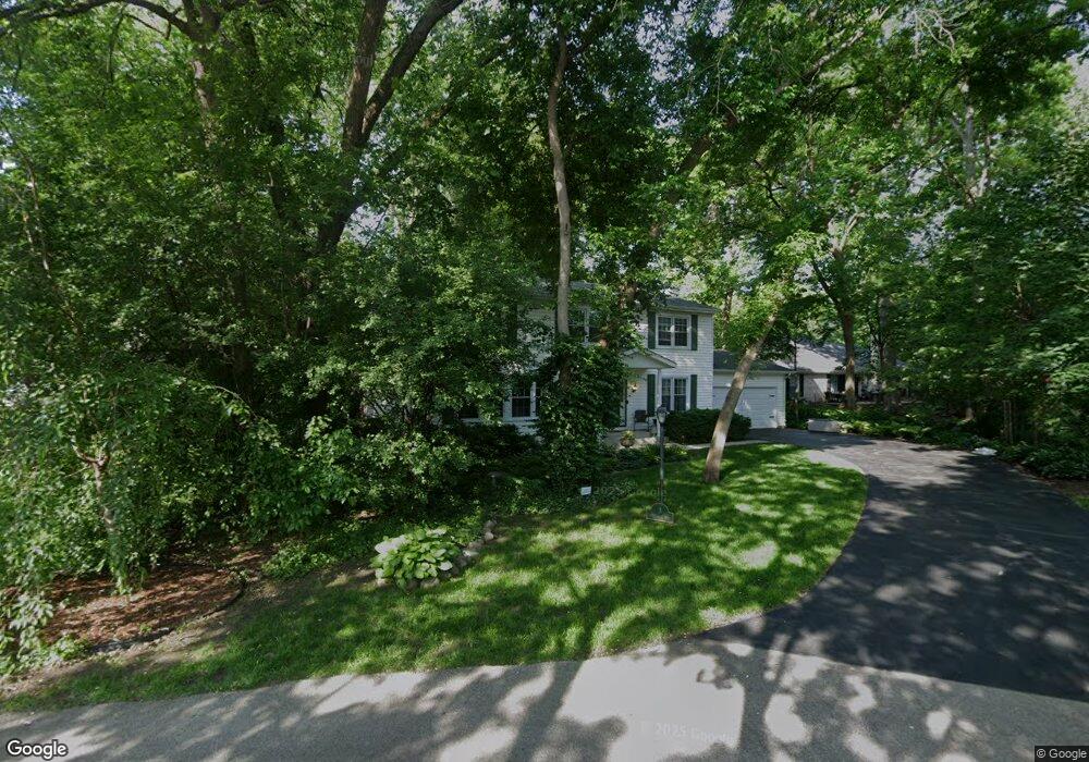
3 Stoneridge Rd Rolling Meadows, IL 60008
Creekside NeighborhoodEstimated Value: $676,000 - $794,000
5
Beds
3
Baths
2,850
Sq Ft
$255/Sq Ft
Est. Value
About This Home
This home is located at 3 Stoneridge Rd, Rolling Meadows, IL 60008 and is currently estimated at $725,586, approximately $254 per square foot. 3 Stoneridge Rd is a home located in Cook County with nearby schools including Central Road Elementary School, Plum Grove Jr High School, and William Fremd High School.
Ownership History
Date
Name
Owned For
Owner Type
Purchase Details
Closed on
Apr 12, 1999
Sold by
American National Bk & Tr Co Of Chicago
Bought by
Charlesworth Mark and Charlesworth May
Current Estimated Value
Home Financials for this Owner
Home Financials are based on the most recent Mortgage that was taken out on this home.
Original Mortgage
$165,000
Outstanding Balance
$39,195
Interest Rate
7.04%
Estimated Equity
$686,391
Purchase Details
Closed on
May 23, 1996
Sold by
Montagno Larry and Montagno Connie
Bought by
Peoples Wendy A
Home Financials for this Owner
Home Financials are based on the most recent Mortgage that was taken out on this home.
Original Mortgage
$193,500
Interest Rate
7.99%
Mortgage Type
Balloon
Create a Home Valuation Report for This Property
The Home Valuation Report is an in-depth analysis detailing your home's value as well as a comparison with similar homes in the area
Home Values in the Area
Average Home Value in this Area
Purchase History
| Date | Buyer | Sale Price | Title Company |
|---|---|---|---|
| Charlesworth Mark | $335,000 | -- | |
| Peoples Wendy A | $96,500 | Ati Title Company |
Source: Public Records
Mortgage History
| Date | Status | Borrower | Loan Amount |
|---|---|---|---|
| Open | Charlesworth Mark | $165,000 | |
| Previous Owner | Peoples Wendy A | $193,500 |
Source: Public Records
Tax History Compared to Growth
Tax History
| Year | Tax Paid | Tax Assessment Tax Assessment Total Assessment is a certain percentage of the fair market value that is determined by local assessors to be the total taxable value of land and additions on the property. | Land | Improvement |
|---|---|---|---|---|
| 2025 | $13,126 | $63,000 | $10,141 | $52,859 |
| 2024 | $13,126 | $47,543 | $8,581 | $38,962 |
| 2023 | $12,580 | $47,543 | $8,581 | $38,962 |
| 2022 | $12,580 | $47,543 | $8,581 | $38,962 |
| 2021 | $12,002 | $41,103 | $5,460 | $35,643 |
| 2020 | $11,949 | $41,103 | $5,460 | $35,643 |
| 2019 | $12,851 | $45,926 | $5,460 | $40,466 |
| 2018 | $12,618 | $41,123 | $5,070 | $36,053 |
| 2017 | $13,289 | $43,898 | $5,070 | $38,828 |
| 2016 | $12,637 | $43,898 | $5,070 | $38,828 |
| 2015 | $12,700 | $41,548 | $4,680 | $36,868 |
| 2014 | $12,444 | $41,548 | $4,680 | $36,868 |
| 2013 | $12,119 | $41,548 | $4,680 | $36,868 |
Source: Public Records
Map
Nearby Homes
- 2650 Brookwood Way Dr Unit 108
- 2600 Brookwood Way Dr Unit 316
- 2600 Brookwood Way Dr Unit 305
- 2600 Brookwood Unit 314
- 208 Brookdale Ln
- 4795 Woodcliff Ln
- 2401 Rohlwing Rd
- 1 Harrogate on Oxford
- 4301 Euclid Ave
- 108 Croftwood Ct
- 3200 Thrush Ln
- 1620 Waxwing Ct
- 112 Ironwood Ct
- 4101 Owl Dr
- 1294 Catalina Ct
- 1609 Waxwing Ct
- 1931 Prairie Square Unit 1931
- 1926 Prairie Square Unit 302
- 1926 Prairie Square Unit 103
- 1926 Prairie Square Unit 210
- 1 Stoneridge Rd
- 1 Applejack Rd
- 5 Stoneridge Rd
- 3 Applejack Rd
- 1 Wildwood Rd
- 2 Stoneridge Rd
- 2 Rosewood Rd
- 4 Stoneridge Rd
- 12 Rumford on Asbury
- 3008 Oaksbury Ct
- 3 Rumford on Asbury
- 2 Applejack Rd
- 10 Rumford on Asbury
- 3009 Oaksbury Ct
- 1 Rosewood Rd Unit 4
- 2 Wildwood Rd
- 1 Rumford on Asbury
- 3 Wildwood Rd
- 3000 Oaksbury Ct
- 4 Wildwood Rd