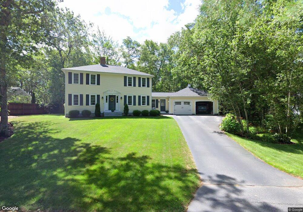
3 Tamarack Ln Amherst, NH 03031
Estimated Value: $591,000 - $729,000
3
Beds
3
Baths
2,042
Sq Ft
$325/Sq Ft
Est. Value
About This Home
This home is located at 3 Tamarack Ln, Amherst, NH 03031 and is currently estimated at $663,931, approximately $325 per square foot. 3 Tamarack Ln is a home with nearby schools including Wilkins Elementary School, Amherst Middle School, and Souhegan Cooperative High School.
Ownership History
Date
Name
Owned For
Owner Type
Purchase Details
Closed on
Jan 7, 2004
Sold by
In Landamerica Onestop
Bought by
Hayes Robert P and Hayes Tricia L
Current Estimated Value
Purchase Details
Closed on
Aug 26, 2003
Sold by
Nri Relocation Inc
Bought by
Griffiths Lori and Griffiths Darrell
Purchase Details
Closed on
Jun 16, 1997
Sold by
Mitchell Glenn T and Mitchell Virginia L
Bought by
Trapnell James G and Trapnell Annette C
Create a Home Valuation Report for This Property
The Home Valuation Report is an in-depth analysis detailing your home's value as well as a comparison with similar homes in the area
Home Values in the Area
Average Home Value in this Area
Purchase History
| Date | Buyer | Sale Price | Title Company |
|---|---|---|---|
| Hayes Robert P | $328,000 | -- | |
| In Landamerica Onestop | $328,000 | -- | |
| Griffiths Lori | $316,000 | -- | |
| Nri Relocation Inc | $316,000 | -- | |
| Trapnell James G | $180,000 | -- |
Source: Public Records
Mortgage History
| Date | Status | Borrower | Loan Amount |
|---|---|---|---|
| Open | Trapnell James G | $15,000 | |
| Open | Trapnell James G | $200,000 | |
| Closed | Trapnell James G | $10,000 |
Source: Public Records
Tax History
| Year | Tax Paid | Tax Assessment Tax Assessment Total Assessment is a certain percentage of the fair market value that is determined by local assessors to be the total taxable value of land and additions on the property. | Land | Improvement |
|---|---|---|---|---|
| 2025 | $10,779 | $449,500 | $141,300 | $308,200 |
| 2024 | $10,307 | $449,500 | $141,300 | $308,200 |
| 2023 | $9,835 | $449,500 | $141,300 | $308,200 |
| 2022 | $9,375 | $443,700 | $141,300 | $302,400 |
| 2021 | $9,455 | $443,700 | $141,300 | $302,400 |
| 2020 | $9,230 | $324,100 | $113,000 | $211,100 |
| 2019 | $8,773 | $325,400 | $113,000 | $212,400 |
| 2018 | $8,861 | $325,400 | $113,000 | $212,400 |
| 2017 | $8,464 | $325,400 | $113,000 | $212,400 |
| 2016 | $8,168 | $325,400 | $113,000 | $212,400 |
| 2015 | $7,968 | $300,900 | $122,000 | $178,900 |
| 2014 | $8,022 | $300,900 | $122,000 | $178,900 |
| 2013 | $7,959 | $300,900 | $122,000 | $178,900 |
Source: Public Records
Map
Nearby Homes
- 464 Boston Post Rd Unit 5
- 6 Patricia Ln
- 53 Seaverns Bridge Rd
- 449 Silver Lake Rd
- 447 Silver Lake Rd Unit A
- 447 Silver Lake Rd Unit B
- 197 Stable Rd
- 101-2 Seaverns Bridge Rd
- 101 Seaverns Bridge Rd
- 2 Barrington Way
- 103 Seaverns Bridge Rd
- 105 Seaverns Bridge Rd
- 1 County Rd
- 148 County Rd
- 150 County Rd Unit 4-142-8
- 150 County Rd
- 7 Jennifer Ln
- 43 Alsun Dr
- 1 Whitetail Way
- 15 Martingale Rd
Your Personal Tour Guide
Ask me questions while you tour the home.