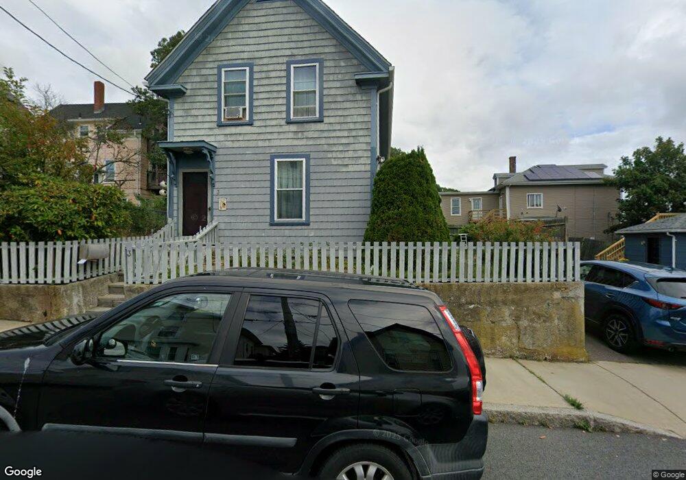
3 Trask St Gloucester, MA 01930
Central Gloucester NeighborhoodEstimated Value: $532,000 - $546,000
3
Beds
2
Baths
1,089
Sq Ft
$494/Sq Ft
Est. Value
About This Home
This home is located at 3 Trask St, Gloucester, MA 01930 and is currently estimated at $538,203, approximately $494 per square foot. 3 Trask St is a home located in Essex County with nearby schools including East Veterans Memorial Elementary, Ralph B O'maley Middle School, and Gloucester High School.
Ownership History
Date
Name
Owned For
Owner Type
Purchase Details
Closed on
May 29, 2025
Sold by
Heassler Martha L and Heassler Steven A
Bought by
Heassler Rt and Heassler
Current Estimated Value
Purchase Details
Closed on
Nov 22, 2000
Sold by
Lucido John S and Lucido Nikki R
Bought by
Heassler Steven A and Heassler Martha L
Purchase Details
Closed on
Sep 30, 1996
Sold by
Silva Brian K and Silva Linda M
Bought by
Lucido John S and Lucido Nikki R
Create a Home Valuation Report for This Property
The Home Valuation Report is an in-depth analysis detailing your home's value as well as a comparison with similar homes in the area
Home Values in the Area
Average Home Value in this Area
Purchase History
| Date | Buyer | Sale Price | Title Company |
|---|---|---|---|
| Heassler Rt | -- | -- | |
| Heassler Rt | -- | -- | |
| Heassler Rt | -- | -- | |
| Heassler Steven A | $190,000 | -- | |
| Heassler Steven A | $190,000 | -- | |
| Lucido John S | $117,000 | -- | |
| Lucido John S | $117,000 | -- |
Source: Public Records
Mortgage History
| Date | Status | Borrower | Loan Amount |
|---|---|---|---|
| Previous Owner | Lucido John S | $286,000 | |
| Previous Owner | Lucido John S | $284,000 |
Source: Public Records
Tax History
| Year | Tax Paid | Tax Assessment Tax Assessment Total Assessment is a certain percentage of the fair market value that is determined by local assessors to be the total taxable value of land and additions on the property. | Land | Improvement |
|---|---|---|---|---|
| 2025 | $4,553 | $468,400 | $126,900 | $341,500 |
| 2024 | $4,499 | $462,400 | $120,900 | $341,500 |
| 2023 | $4,300 | $406,000 | $107,900 | $298,100 |
| 2022 | $4,159 | $354,600 | $93,800 | $260,800 |
| 2021 | $4,012 | $322,500 | $85,300 | $237,200 |
| 2020 | $3,888 | $315,300 | $85,300 | $230,000 |
| 2019 | $3,634 | $286,400 | $85,300 | $201,100 |
| 2018 | $3,428 | $265,100 | $85,300 | $179,800 |
| 2017 | $3,261 | $247,200 | $76,800 | $170,400 |
| 2016 | $3,069 | $225,500 | $76,800 | $148,700 |
| 2015 | $2,921 | $214,000 | $76,800 | $137,200 |
Source: Public Records
Map
Nearby Homes
- 50 Warner St
- 19 Trask St Unit 2
- 40 Sargent St
- 113 Pleasant St
- 33 Maplewood Ave Unit 310
- 12 Arthur St
- 9 Cleveland Place
- 139A Prospect St
- 98 Maplewood Ave
- 191 Main St Unit 3
- 191 Main St Unit 2A
- 8 Mystic Ave
- 13 Mystic Ave
- 120 Washington St
- 35 Middle St Unit 4
- 33 Middle St
- 36 Eastern Ave
- 6 Monroe Ct
- 20 Beacon St
- 20 Beacon St Unit 2
Your Personal Tour Guide
Ask me questions while you tour the home.