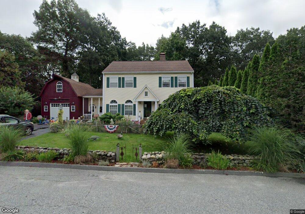
3 Trevor Ln Worcester, MA 01605
Forest Grove NeighborhoodEstimated Value: $583,437 - $637,000
3
Beds
3
Baths
1,944
Sq Ft
$318/Sq Ft
Est. Value
About This Home
This home is located at 3 Trevor Ln, Worcester, MA 01605 and is currently estimated at $617,359, approximately $317 per square foot. 3 Trevor Ln is a home located in Worcester County with nearby schools including Nelson Place Elementary School, Jacob Hiatt Magnet School, and Chandler Magnet.
Ownership History
Date
Name
Owned For
Owner Type
Purchase Details
Closed on
Mar 8, 1993
Sold by
Patriot Developers Inc
Bought by
Kusy Alan R
Current Estimated Value
Home Financials for this Owner
Home Financials are based on the most recent Mortgage that was taken out on this home.
Original Mortgage
$130,550
Interest Rate
7.96%
Mortgage Type
Purchase Money Mortgage
Purchase Details
Closed on
Jan 4, 1993
Sold by
Limestone Dev Rt and Browning Keith N
Bought by
Patriot Dev Inc
Create a Home Valuation Report for This Property
The Home Valuation Report is an in-depth analysis detailing your home's value as well as a comparison with similar homes in the area
Home Values in the Area
Average Home Value in this Area
Purchase History
| Date | Buyer | Sale Price | Title Company |
|---|---|---|---|
| Kusy Alan R | $145,101 | -- | |
| Patriot Dev Inc | $40,000 | -- |
Source: Public Records
Mortgage History
| Date | Status | Borrower | Loan Amount |
|---|---|---|---|
| Open | Patriot Dev Inc | $220,000 | |
| Closed | Patriot Dev Inc | $180,000 | |
| Closed | Patriot Dev Inc | $13,000 | |
| Closed | Patriot Dev Inc | $130,550 |
Source: Public Records
Tax History
| Year | Tax Paid | Tax Assessment Tax Assessment Total Assessment is a certain percentage of the fair market value that is determined by local assessors to be the total taxable value of land and additions on the property. | Land | Improvement |
|---|---|---|---|---|
| 2025 | $6,815 | $516,700 | $119,000 | $397,700 |
| 2024 | $6,648 | $483,500 | $119,000 | $364,500 |
| 2023 | $6,472 | $451,300 | $103,500 | $347,800 |
| 2022 | $6,006 | $394,900 | $82,800 | $312,100 |
| 2021 | $5,928 | $364,100 | $66,200 | $297,900 |
| 2020 | $5,721 | $336,500 | $66,200 | $270,300 |
| 2019 | $5,731 | $318,400 | $59,700 | $258,700 |
| 2018 | $5,671 | $299,900 | $59,700 | $240,200 |
| 2017 | $5,420 | $282,000 | $59,700 | $222,300 |
| 2016 | $5,488 | $266,300 | $44,500 | $221,800 |
| 2015 | $5,351 | $266,600 | $44,500 | $222,100 |
| 2014 | $4,822 | $246,800 | $44,500 | $202,300 |
Source: Public Records
Map
Nearby Homes
- 158 Chester St
- 12 Tattan Farm Rd
- 90 Bjorklund Ave
- 61 Barry Rd
- 46 Barry Rd
- 4004 Brompton Cir
- 97 Parkton Ave
- 770 Salisbury St Unit 333
- 25 Chester St
- 28 Lynnwood Ln
- 42 N Worcester Ave
- 667 Grove St
- 82 Holden St
- 16 Baiting Brook Ln Unit 64
- 14 Baiting Brook Ln Unit 65
- 10 Salisbury Hill Blvd Unit 75
- 11 Holden St
- 3 Old English Rd
- 10 Baiting Brook Ln Unit 67
- 37 Mohave Rd
- 1 Trevor Ln
- 5 Trevor Ln
- 7 Trevor Ln
- 6 Trevor Ln
- 4 Trevor Ln
- 131 Chester St
- 129 Chester St
- 8 Trevor Ln
- 12 Laurelwood Dr
- 10 Laurelwood Dr
- 2 Trevor Ln
- 127 Chester St
- 9 Trevor Ln
- 5 Russell Calvin Dr
- 3 Russell Calvin Dr
- 16 Laurelwood Dr
- 16 Laurelwood Dr Unit SF
- 16 Laurelwood Dr Unit 1
- 16 Laurelwood Dr Unit 16
- 8 Laurelwood Dr
Your Personal Tour Guide
Ask me questions while you tour the home.