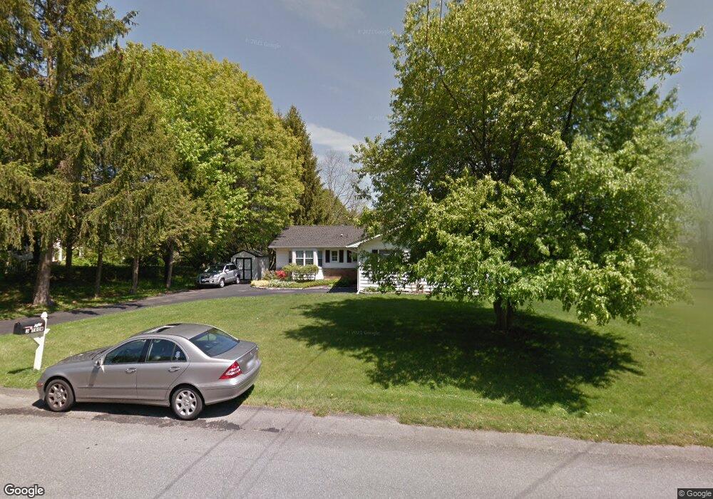
3 Trow Blvd Red Hook, NY 12571
Estimated Value: $449,000 - $499,000
3
Beds
2
Baths
1
Sq Ft
$469,133/Sq Ft
Est. Value
About This Home
This home is located at 3 Trow Blvd, Red Hook, NY 12571 and is currently estimated at $469,133, approximately $469,133 per square foot. 3 Trow Blvd is a home located in Dutchess County with nearby schools including Mill Road Primary School, Mill Road Intermediate School, and Linden Avenue Middle School.
Ownership History
Date
Name
Owned For
Owner Type
Purchase Details
Closed on
Apr 12, 2000
Sold by
Minerley Kevin G
Bought by
Oconnor Thomas and Hadley Oconnor
Current Estimated Value
Purchase Details
Closed on
Jul 17, 1996
Sold by
P & S Construction Corp
Bought by
Seymour Timothy J and Seymour Melissa A
Create a Home Valuation Report for This Property
The Home Valuation Report is an in-depth analysis detailing your home's value as well as a comparison with similar homes in the area
Home Values in the Area
Average Home Value in this Area
Purchase History
| Date | Buyer | Sale Price | Title Company |
|---|---|---|---|
| Oconnor Thomas | $128,000 | Jeffrey C Martin | |
| Seymour Timothy J | $121,500 | -- |
Source: Public Records
Tax History
| Year | Tax Paid | Tax Assessment Tax Assessment Total Assessment is a certain percentage of the fair market value that is determined by local assessors to be the total taxable value of land and additions on the property. | Land | Improvement |
|---|---|---|---|---|
| 2024 | $6,709 | $349,800 | $82,200 | $267,600 |
| 2023 | $7,123 | $330,000 | $77,500 | $252,500 |
| 2019 | $6,059 | $240,000 | $69,800 | $170,200 |
Source: Public Records
Map
Nearby Homes
- 0 Old Route 199 Unit KEY951706
- 234 W Market St
- 7 Smith St
- 10 Phillips St
- 1 Maizeland Rd
- 11 Cambridge Dr
- 15 Amherst Rd
- 7441 S Broadway
- 201 Linden Ave
- 7432 S Broadway
- 14 Princeton St
- 82 Rokeby Rd
- 33 Thompson St
- 26 Birchwood Dr
- 0 Beckrick Dr Unit KEY959947
- 84 Rockefeller Ln
- 155 Metzger Rd
- 74 Lemon Ln
- 10 Rathbun Rd
- 0 Feller Newmark Rd
Your Personal Tour Guide
Ask me questions while you tour the home.