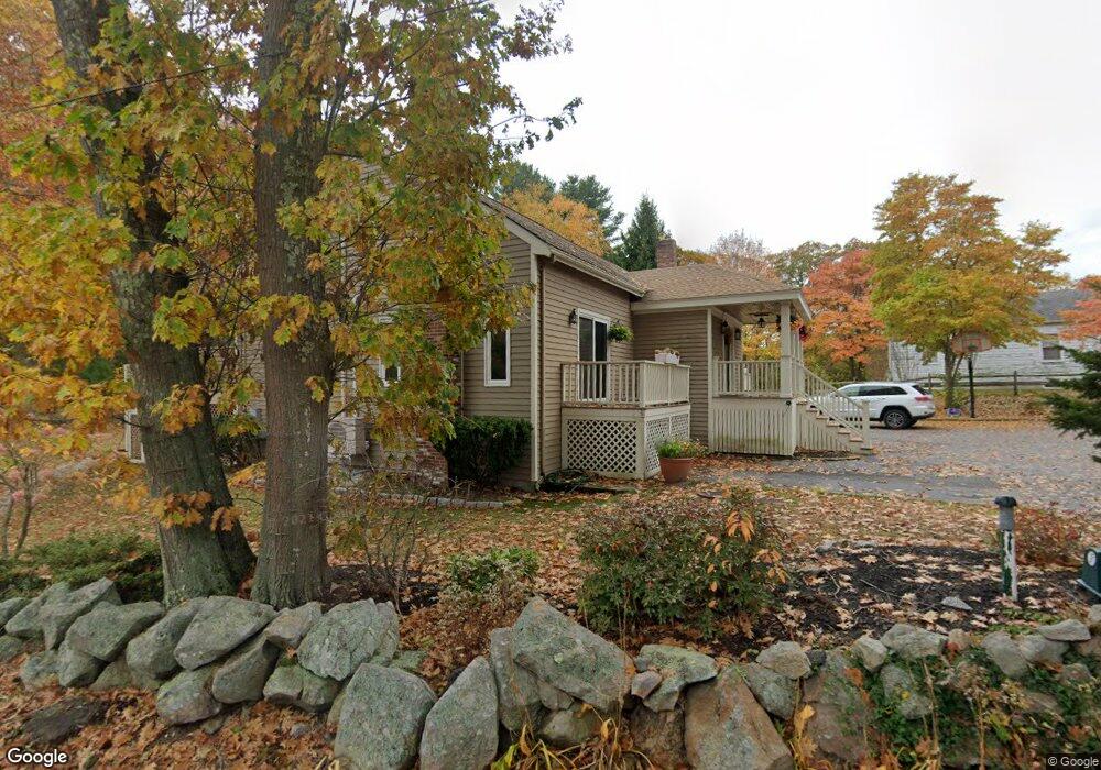
3 Waterside Ln Unit B Gloucester, MA 01930
West Gloucester NeighborhoodEstimated Value: $667,173 - $796,000
3
Beds
2
Baths
1,835
Sq Ft
$401/Sq Ft
Est. Value
About This Home
This home is located at 3 Waterside Ln Unit B, Gloucester, MA 01930 and is currently estimated at $735,043, approximately $400 per square foot. 3 Waterside Ln Unit B is a home located in Essex County with nearby schools including West Parish, Ralph B O'maley Middle School, and Gloucester High School.
Ownership History
Date
Name
Owned For
Owner Type
Purchase Details
Closed on
May 9, 2025
Sold by
Mitchell Stephen M and Mitchell Karen L
Bought by
S M & Karen L Mitchell Lt and Mitchell
Current Estimated Value
Create a Home Valuation Report for This Property
The Home Valuation Report is an in-depth analysis detailing your home's value as well as a comparison with similar homes in the area
Home Values in the Area
Average Home Value in this Area
Purchase History
| Date | Buyer | Sale Price | Title Company |
|---|---|---|---|
| S M & Karen L Mitchell Lt | -- | None Available |
Source: Public Records
Tax History
| Year | Tax Paid | Tax Assessment Tax Assessment Total Assessment is a certain percentage of the fair market value that is determined by local assessors to be the total taxable value of land and additions on the property. | Land | Improvement |
|---|---|---|---|---|
| 2025 | $5,495 | $565,300 | $0 | $565,300 |
| 2024 | $5,156 | $529,900 | $0 | $529,900 |
| 2023 | $4,774 | $450,800 | $0 | $450,800 |
| 2022 | $4,794 | $408,700 | $0 | $408,700 |
| 2021 | $4,784 | $384,600 | $0 | $384,600 |
| 2020 | $4,742 | $384,600 | $0 | $384,600 |
| 2019 | $4,966 | $391,300 | $0 | $391,300 |
| 2018 | $4,744 | $366,900 | $0 | $366,900 |
| 2017 | $4,485 | $340,000 | $0 | $340,000 |
| 2016 | $4,264 | $313,300 | $0 | $313,300 |
| 2015 | $4,185 | $306,600 | $0 | $306,600 |
Source: Public Records
Map
Nearby Homes
- 5 Marshfield St
- 13 Leslie o Johnson Rd
- 100 Eastern Point Blvd
- 5 Lepage Ln
- 24 Cobblestone Ln Unit 603
- 145 Essex Ave Unit 512
- 145 Essex Ave Unit 402
- 18 Hampden St
- 45 & 43 Englewood Rd
- 18 Lyndale Ave
- 20 Beacon St
- 20 Beacon St Unit 2
- 20 Beacon St Unit 1
- 33 Middle St
- 15 Harvard St
- 15 Raven Ln Unit 15
- 35 Middle St Unit 4
- 5 Samoset Rd Unit B
- 1 Wonson St
- 120 Washington St
- 3 Waterside Ln Unit A
- 258 Western Ave
- 250 Western Ave
- 250 Western Ave Unit 2
- 349 Western Ave
- 351 Western Ave Unit 1
- 248 Western Ave
- 353 Western Ave
- 355 Western Ave
- 347 Western Ave
- 268 Western Ave
- 357 Western Ave
- 6 Waterside Ln
- 246 Western Ave
- 11 Waterside Ln
- 272 Western Ave
- 339 Western Ave
- 5 Stillington Dr
- 262 Western Ave
- 365 Western Ave
Your Personal Tour Guide
Ask me questions while you tour the home.