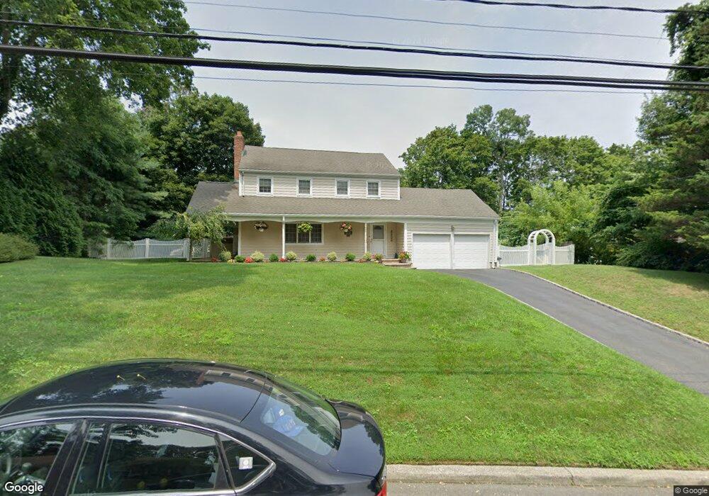
3 West Rd East Setauket, NY 11733
Estimated Value: $760,109 - $932,000
4
Beds
2
Baths
2,172
Sq Ft
$388/Sq Ft
Est. Value
About This Home
This home is located at 3 West Rd, East Setauket, NY 11733 and is currently estimated at $842,277, approximately $387 per square foot. 3 West Rd is a home located in Suffolk County with nearby schools including Minnesauke Elementary School, Paul J Gelinas Junior High School, and Ward Melville Senior High School.
Ownership History
Date
Name
Owned For
Owner Type
Purchase Details
Closed on
Jan 11, 1999
Sold by
Keary Kevin
Bought by
Keary Kevin and Keary Eileen
Current Estimated Value
Home Financials for this Owner
Home Financials are based on the most recent Mortgage that was taken out on this home.
Original Mortgage
$200,000
Outstanding Balance
$46,029
Interest Rate
6.67%
Estimated Equity
$796,248
Purchase Details
Closed on
Jun 6, 1996
Sold by
Levine Richard A and Levine Felice R
Bought by
Keary Kevin
Create a Home Valuation Report for This Property
The Home Valuation Report is an in-depth analysis detailing your home's value as well as a comparison with similar homes in the area
Home Values in the Area
Average Home Value in this Area
Purchase History
| Date | Buyer | Sale Price | Title Company |
|---|---|---|---|
| Keary Kevin | -- | -- | |
| Keary Kevin | $222,000 | -- |
Source: Public Records
Mortgage History
| Date | Status | Borrower | Loan Amount |
|---|---|---|---|
| Open | Keary Kevin | $200,000 |
Source: Public Records
Tax History Compared to Growth
Tax History
| Year | Tax Paid | Tax Assessment Tax Assessment Total Assessment is a certain percentage of the fair market value that is determined by local assessors to be the total taxable value of land and additions on the property. | Land | Improvement |
|---|---|---|---|---|
| 2024 | $15,481 | $3,675 | $300 | $3,375 |
| 2023 | $15,481 | $3,675 | $300 | $3,375 |
| 2022 | $12,942 | $3,675 | $300 | $3,375 |
| 2021 | $12,942 | $3,675 | $300 | $3,375 |
| 2020 | $14,570 | $3,675 | $300 | $3,375 |
| 2019 | $14,570 | $0 | $0 | $0 |
| 2018 | $12,680 | $3,675 | $300 | $3,375 |
| 2017 | $12,680 | $3,675 | $300 | $3,375 |
| 2016 | $12,500 | $3,675 | $300 | $3,375 |
| 2015 | -- | $3,675 | $300 | $3,375 |
| 2014 | -- | $3,675 | $300 | $3,375 |
Source: Public Records
Map
Nearby Homes
- 16 Abbey Ln Unit 116
- 5 Satterly Rd
- 2 Little Hill Rd
- 28 Buckingham Meadow Rd
- 63-LOT1 N Country Rd
- 3 Driftwood Ln
- 5 Stony Wood Rd
- 2 Shore Rd
- 45 Shore Rd
- 10 Spyglass Ln
- 19 Fox Rd
- 155 Lower Sheep Pasture Rd
- 783 Route 25A
- 121 Lower Sheep Pasture Rd
- 19 Pheasant Ln
- 19 Partridge Ln
- 63 Ridgeway Ave
- 27 Upper Sheep Pasture Rd
- 26 View Rd
- 26 Brewster Hill Rd
- 5 West Rd
- 1 West Rd
- 15 Kenwood St
- 70 Gnarled Hollow Rd
- 7 West Rd
- 6 West Rd
- 8 Kenwood St
- 9 Kenwood St
- 9 West Rd
- 73 Gnarled Hollow Rd
- 77 Gnarled Hollow Rd
- 66 Gnarled Hollow Rd
- 66 Gnarled Hollow Rd
- 7 Kenwood St
- 64 Gnarled Hollow Rd
- 64 Gnarled Hollow Rd
- 13 West Rd
- 85 Gnarled Hollow Rd
- 6 Kenwood St
- 81 Gnarled Hollow Rd