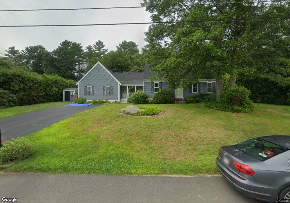
3 Wildrose Ln Acushnet, MA 02743
Sherwood Forest NeighborhoodEstimated Value: $559,132 - $591,000
--
Bed
1
Bath
2,203
Sq Ft
$260/Sq Ft
Est. Value
About This Home
This home is located at 3 Wildrose Ln, Acushnet, MA 02743 and is currently estimated at $572,283, approximately $259 per square foot. 3 Wildrose Ln is a home located in Bristol County with nearby schools including Acushnet Elementary School, Albert F Ford Middle School, and Alma del Mar Charter School.
Ownership History
Date
Name
Owned For
Owner Type
Purchase Details
Closed on
May 26, 2006
Sold by
Pringle James L and Pringle Kathleen P
Bought by
Pringle James L and Pringle Kathleen P
Current Estimated Value
Home Financials for this Owner
Home Financials are based on the most recent Mortgage that was taken out on this home.
Original Mortgage
$280,000
Outstanding Balance
$164,248
Interest Rate
6.53%
Mortgage Type
Purchase Money Mortgage
Estimated Equity
$408,035
Purchase Details
Closed on
Apr 4, 1997
Sold by
Lacasse Gary S and Lacasse Valerie J
Bought by
Pringle James L and Pringle Kathleen P
Home Financials for this Owner
Home Financials are based on the most recent Mortgage that was taken out on this home.
Original Mortgage
$99,500
Interest Rate
7.5%
Mortgage Type
Purchase Money Mortgage
Purchase Details
Closed on
Mar 6, 1987
Sold by
Koska John T
Bought by
Lacasse Gary S
Create a Home Valuation Report for This Property
The Home Valuation Report is an in-depth analysis detailing your home's value as well as a comparison with similar homes in the area
Home Values in the Area
Average Home Value in this Area
Purchase History
| Date | Buyer | Sale Price | Title Company |
|---|---|---|---|
| Pringle James L | -- | -- | |
| Pringle James L | $134,500 | -- | |
| Lacasse Gary S | $110,000 | -- |
Source: Public Records
Mortgage History
| Date | Status | Borrower | Loan Amount |
|---|---|---|---|
| Open | Lacasse Gary S | $280,000 | |
| Previous Owner | Lacasse Gary S | $99,500 | |
| Previous Owner | Lacasse Gary S | $95,000 | |
| Previous Owner | Lacasse Gary S | $8,000 |
Source: Public Records
Tax History Compared to Growth
Tax History
| Year | Tax Paid | Tax Assessment Tax Assessment Total Assessment is a certain percentage of the fair market value that is determined by local assessors to be the total taxable value of land and additions on the property. | Land | Improvement |
|---|---|---|---|---|
| 2025 | $48 | $447,400 | $129,300 | $318,100 |
| 2024 | $4,691 | $411,100 | $122,200 | $288,900 |
| 2023 | $4,655 | $387,900 | $105,800 | $282,100 |
| 2022 | $4,473 | $337,100 | $101,100 | $236,000 |
| 2021 | $4,121 | $298,000 | $101,100 | $196,900 |
| 2020 | $4,154 | $298,000 | $101,100 | $196,900 |
| 2019 | $4,068 | $286,900 | $103,400 | $183,500 |
| 2018 | $3,922 | $272,000 | $103,400 | $168,600 |
| 2017 | $3,803 | $263,400 | $103,400 | $160,000 |
| 2016 | $3,768 | $259,300 | $96,400 | $162,900 |
| 2015 | $3,430 | $240,200 | $96,400 | $143,800 |
Source: Public Records
Map
Nearby Homes
- 67 Morses Ln
- 13 Fairway Dr
- 16 Morses Ln
- 5 Fairway Dr
- SS Charbonneau Ln
- 1269 Bartlett St
- 1045 Forbes St
- 649 Middle Rd
- 1063 Westgate St
- 26 Rounseville St
- ES Acushnet Ave
- 62 Longview Rd
- 2 Woodland Rd
- 145 Heritage Dr
- 26 Blueberry Dr
- 34 Poplar Rd
- 700 Pine Hill Dr
- 868 Phillips Rd
- 210 Heritage Dr
- 2992 Acushnet Ave