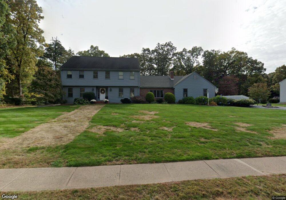
3 Windmill Rd Ellington, CT 06029
Estimated Value: $581,000 - $761,000
4
Beds
3
Baths
2,844
Sq Ft
$233/Sq Ft
Est. Value
About This Home
This home is located at 3 Windmill Rd, Ellington, CT 06029 and is currently estimated at $661,272, approximately $232 per square foot. 3 Windmill Rd is a home located in Tolland County with nearby schools including Ellington High School.
Ownership History
Date
Name
Owned For
Owner Type
Purchase Details
Closed on
Dec 23, 2013
Sold by
Julianne B Staples Lt and Staples
Bought by
Gaetani Joseph A and Gaetani Rachel E
Current Estimated Value
Home Financials for this Owner
Home Financials are based on the most recent Mortgage that was taken out on this home.
Original Mortgage
$348,000
Outstanding Balance
$259,489
Interest Rate
4.15%
Estimated Equity
$401,783
Purchase Details
Closed on
Sep 28, 1988
Sold by
Lacava Constr Co
Bought by
Alaimo Charles
Create a Home Valuation Report for This Property
The Home Valuation Report is an in-depth analysis detailing your home's value as well as a comparison with similar homes in the area
Home Values in the Area
Average Home Value in this Area
Purchase History
| Date | Buyer | Sale Price | Title Company |
|---|---|---|---|
| Gaetani Joseph A | $420,000 | -- | |
| Fieldhouse 3Rd Frederick | $412,000 | -- | |
| Gaetani Joseph A | $420,000 | -- | |
| Alaimo Charles | $305,000 | -- |
Source: Public Records
Mortgage History
| Date | Status | Borrower | Loan Amount |
|---|---|---|---|
| Open | Gaetani Joseph A | $348,000 | |
| Closed | Alaimo Charles | $348,000 | |
| Previous Owner | Alaimo Charles | $250,000 | |
| Closed | Alaimo Charles | $0 |
Source: Public Records
Tax History
| Year | Tax Paid | Tax Assessment Tax Assessment Total Assessment is a certain percentage of the fair market value that is determined by local assessors to be the total taxable value of land and additions on the property. | Land | Improvement |
|---|---|---|---|---|
| 2025 | $9,323 | $251,300 | $62,720 | $188,580 |
| 2024 | $9,047 | $251,300 | $62,720 | $188,580 |
| 2023 | $8,620 | $251,300 | $62,720 | $188,580 |
| 2022 | $8,167 | $251,300 | $62,720 | $188,580 |
| 2021 | $7,941 | $251,300 | $62,720 | $188,580 |
| 2020 | $8,249 | $253,030 | $62,640 | $190,390 |
| 2019 | $8,249 | $253,030 | $62,640 | $190,390 |
| 2016 | $7,717 | $253,030 | $62,640 | $190,390 |
| 2015 | $7,853 | $257,480 | $62,640 | $194,840 |
| 2014 | $7,390 | $257,480 | $62,640 | $194,840 |
Source: Public Records
Map
Nearby Homes
- 9 Brockway Rd
- 96 Muddy Brook Rd
- 196 Jobs Hill Rd
- 22 Sadds Mill Rd
- 33 Lanz Ln
- 58 Maple St
- 3 Meagan Cir
- 160 East Rd
- 164 East Rd
- 183 Chamberlain Rd
- 0 Porter Rd
- 164 Pinney St
- 56 Highland Ave
- 26 Hillside Farms Dr
- 77 Thrall Rd
- 30 Broadbrook Rd
- 298 Broadbrook Rd
- 222 Mountain Rd
- 13 Reservoir Ave
- 35 Highland Ave
Your Personal Tour Guide
Ask me questions while you tour the home.