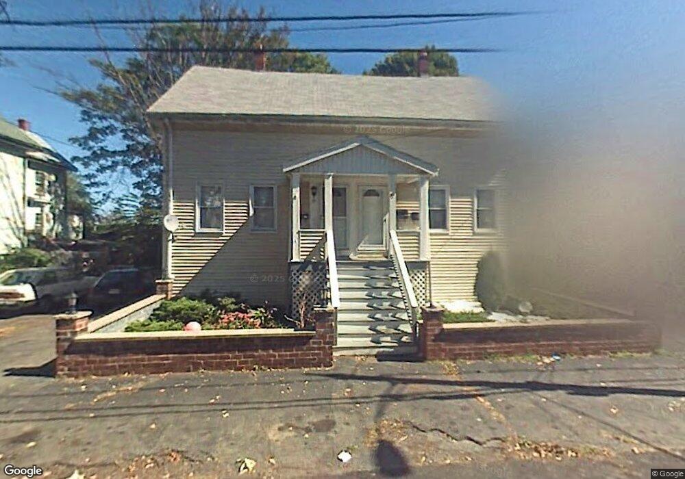
30 1/2 Newhall St Saugus, MA 01906
Cliftondale NeighborhoodEstimated Value: $829,000 - $1,049,000
6
Beds
4
Baths
2,557
Sq Ft
$360/Sq Ft
Est. Value
About This Home
This home is located at 30 1/2 Newhall St, Saugus, MA 01906 and is currently estimated at $921,553, approximately $360 per square foot. 30 1/2 Newhall St is a home located in Essex County with nearby schools including Saugus High School and Sacred Heart School.
Ownership History
Date
Name
Owned For
Owner Type
Purchase Details
Closed on
Jan 11, 2021
Sold by
30 Newhall Street Llc
Bought by
Devaldivieso Joamy B and Valdivieso Alex J
Current Estimated Value
Home Financials for this Owner
Home Financials are based on the most recent Mortgage that was taken out on this home.
Original Mortgage
$760,962
Outstanding Balance
$672,786
Interest Rate
2.7%
Mortgage Type
FHA
Estimated Equity
$248,767
Purchase Details
Closed on
Jul 26, 2020
Sold by
Ciaramaglia Steven and Verone Peter
Bought by
30 Newhall Street Llc
Home Financials for this Owner
Home Financials are based on the most recent Mortgage that was taken out on this home.
Original Mortgage
$590,000
Interest Rate
3.1%
Mortgage Type
New Conventional
Purchase Details
Closed on
Jun 18, 2020
Sold by
Zepaj Marenglen
Bought by
Ciaramaglia Steven and Varone Peter
Home Financials for this Owner
Home Financials are based on the most recent Mortgage that was taken out on this home.
Original Mortgage
$590,000
Interest Rate
3.1%
Mortgage Type
New Conventional
Purchase Details
Closed on
Jun 1, 2020
Sold by
Bank New York Mellon Tr
Bought by
Zepaj Marenglen
Home Financials for this Owner
Home Financials are based on the most recent Mortgage that was taken out on this home.
Original Mortgage
$590,000
Interest Rate
3.1%
Mortgage Type
New Conventional
Purchase Details
Closed on
Jun 19, 2019
Sold by
Koutroubis Konstadinos V and Bank Of New York Mellon
Bought by
Bank New York Mellon Tr
Purchase Details
Closed on
Aug 12, 2004
Sold by
30-30 Newhall Street R and 30-30 Koutroubis
Bought by
Koutroubis Konstandinos
Home Financials for this Owner
Home Financials are based on the most recent Mortgage that was taken out on this home.
Original Mortgage
$100,000
Interest Rate
6.16%
Mortgage Type
Purchase Money Mortgage
Purchase Details
Closed on
Jul 23, 2003
Sold by
Koutroubis Konstadinos and Koutroubis Maria
Bought by
30-30 Newhall St Rt
Purchase Details
Closed on
Jan 12, 1996
Sold by
Briggs Elaine and Maclaren William
Bought by
Poulopoulos K K and Poulopoulos Effie
Create a Home Valuation Report for This Property
The Home Valuation Report is an in-depth analysis detailing your home's value as well as a comparison with similar homes in the area
Home Values in the Area
Average Home Value in this Area
Purchase History
| Date | Buyer | Sale Price | Title Company |
|---|---|---|---|
| Devaldivieso Joamy B | $775,000 | None Available | |
| 30 Newhall Street Llc | $560,000 | None Available | |
| Ciaramaglia Steven | $477,750 | None Available | |
| Zepaj Marenglen | $477,750 | None Available | |
| Bank New York Mellon Tr | $448,000 | -- | |
| Koutroubis Konstandinos | -- | -- | |
| 30-30 Newhall St Rt | -- | -- | |
| Poulopoulos K K | $107,000 | -- |
Source: Public Records
Mortgage History
| Date | Status | Borrower | Loan Amount |
|---|---|---|---|
| Open | Devaldivieso Joamy B | $760,962 | |
| Previous Owner | 30 Newhall Street Llc | $590,000 | |
| Previous Owner | Poulopoulos K K | $77,400 | |
| Previous Owner | Poulopoulos K K | $361,200 | |
| Previous Owner | Poulopoulos K K | $100,000 |
Source: Public Records
Tax History Compared to Growth
Tax History
| Year | Tax Paid | Tax Assessment Tax Assessment Total Assessment is a certain percentage of the fair market value that is determined by local assessors to be the total taxable value of land and additions on the property. | Land | Improvement |
|---|---|---|---|---|
| 2025 | $9,426 | $882,600 | $301,000 | $581,600 |
| 2024 | $9,108 | $855,200 | $283,800 | $571,400 |
| 2023 | $8,540 | $758,400 | $249,400 | $509,000 |
| 2022 | $7,858 | $654,300 | $228,800 | $425,500 |
| 2021 | $6,597 | $534,600 | $198,700 | $335,900 |
| 2020 | $6,099 | $511,700 | $189,200 | $322,500 |
| 2019 | $5,549 | $455,600 | $172,000 | $283,600 |
| 2018 | $4,810 | $415,400 | $166,800 | $248,600 |
| 2017 | $4,422 | $367,000 | $155,700 | $211,300 |
| 2016 | $4,210 | $345,100 | $155,400 | $189,700 |
| 2015 | $3,951 | $328,700 | $148,000 | $180,700 |
| 2014 | $3,845 | $331,200 | $148,000 | $183,200 |
Source: Public Records
Map
Nearby Homes
- 62 Chestnut St Unit 2
- 11 Richard St
- 9 Spencer Ave
- 44 Ballard St
- 21 Fenton Ave
- 9 Douglas Rd
- 11 Margin St Unit 6
- 12 Atlantic Ave
- 66 Springdale Ave
- 12 Seagirt Ave
- 22 Seagirt Ave
- 79 Laurel St
- 100 Ashland St
- 25 Piedmont Ave
- 4 Oneil Way
- 41-43 Seagirt Ave
- 28 Naples Ave
- 70 Farrell Rd
- 16 River St Unit 6
- 110 Holyoke St