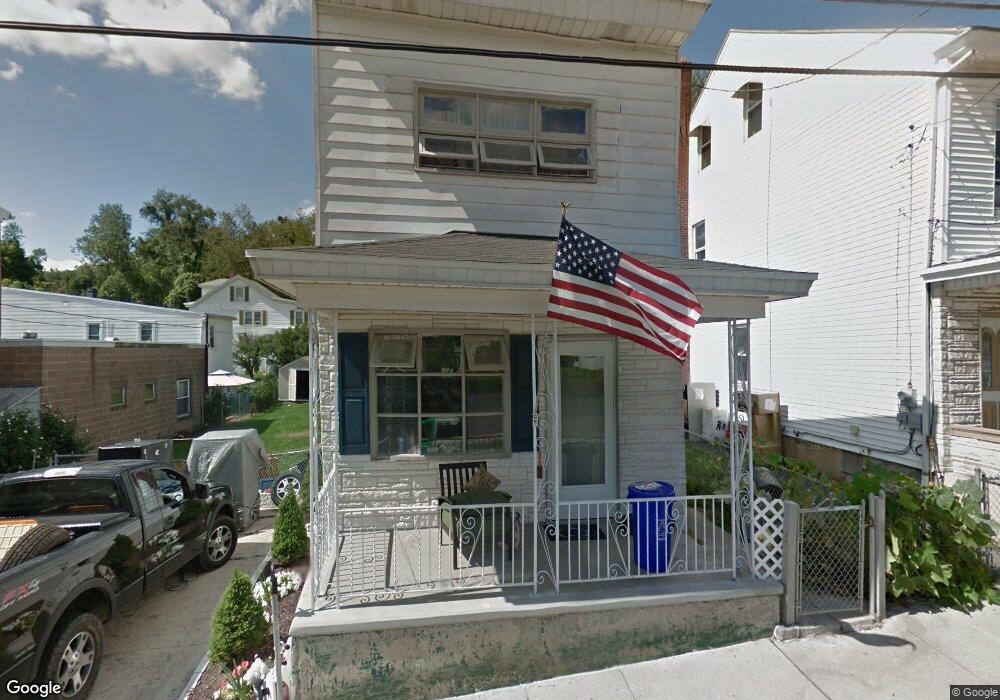
30 Ann St Pottsville, PA 17901
Estimated Value: $64,000 - $101,000
3
Beds
1
Bath
1,290
Sq Ft
$64/Sq Ft
Est. Value
About This Home
This home is located at 30 Ann St, Pottsville, PA 17901 and is currently estimated at $82,926, approximately $64 per square foot. 30 Ann St is a home located in Schuylkill County with nearby schools including Saint Clair Area Elementary/Middle School, Gillingham Charter School, and ASSUMPTION BVM SCHOOL.
Ownership History
Date
Name
Owned For
Owner Type
Purchase Details
Closed on
Oct 17, 2024
Sold by
Platts Steven Joseph and Holley Jacquelyn Makayla
Bought by
Platts Steven Joseph
Current Estimated Value
Purchase Details
Closed on
Apr 7, 2020
Sold by
Platts Steve
Bought by
Flatts Steven Joseph and Holley Jacquelyn Makayla
Purchase Details
Closed on
Aug 14, 2013
Sold by
Umbenhen Richard T and Umbenhen Cornelia M
Bought by
Platts Steve
Purchase Details
Closed on
Apr 22, 2005
Sold by
Heiser Suzanne and Kerns Kevin
Bought by
Umbenhen Richard T and Umbenhen Cornelia M
Create a Home Valuation Report for This Property
The Home Valuation Report is an in-depth analysis detailing your home's value as well as a comparison with similar homes in the area
Home Values in the Area
Average Home Value in this Area
Purchase History
| Date | Buyer | Sale Price | Title Company |
|---|---|---|---|
| Platts Steven Joseph | -- | None Listed On Document | |
| Platts Steven Joseph | -- | None Listed On Document | |
| Flatts Steven Joseph | -- | None Available | |
| Platts Steve | $25,000 | None Available | |
| Umbenhen Richard T | $30,000 | None Available |
Source: Public Records
Tax History Compared to Growth
Tax History
| Year | Tax Paid | Tax Assessment Tax Assessment Total Assessment is a certain percentage of the fair market value that is determined by local assessors to be the total taxable value of land and additions on the property. | Land | Improvement |
|---|---|---|---|---|
| 2025 | $857 | $13,030 | $3,000 | $10,030 |
| 2024 | $802 | $13,030 | $3,000 | $10,030 |
| 2023 | $762 | $13,030 | $3,000 | $10,030 |
| 2022 | $762 | $13,030 | $3,000 | $10,030 |
| 2021 | $770 | $13,030 | $3,000 | $10,030 |
| 2020 | $770 | $13,030 | $3,000 | $10,030 |
| 2018 | $754 | $13,030 | $3,000 | $10,030 |
| 2017 | $725 | $13,030 | $3,000 | $10,030 |
| 2015 | -- | $13,030 | $3,000 | $10,030 |
| 2011 | -- | $13,030 | $0 | $0 |
Source: Public Records
Map
Nearby Homes
- 438 S Front St
- 219 S 3rd St
- 122 S 3rd St
- 320 S Mill St
- 101 S 2nd St
- 108 Cherry St
- 20 S 2nd St
- 32 S Front St
- 225 Cherry St
- 145 Chamberlaine Ave
- 212 Broad St
- 48 N 2nd St
- 702 & 698 Port Carbon St Clair Hwy
- 665 Port Carbon Saint Clair Hwy
- 311 Broad St
- 309 Chestnut St
- 0 Caroline Ave Unit PASK2022658
- 144 N Mill St
- 350 North St
- Lot 30 Elmwood Ct