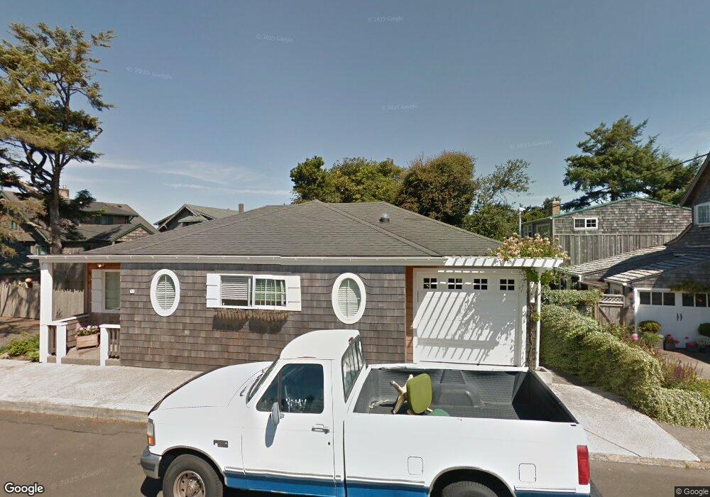
30 Avenue N Seaside, OR 97138
Estimated Value: $481,000 - $639,000
2
Beds
2
Baths
995
Sq Ft
$558/Sq Ft
Est. Value
About This Home
This home is located at 30 Avenue N, Seaside, OR 97138 and is currently estimated at $555,547, approximately $558 per square foot. 30 Avenue N is a home located in Clatsop County with nearby schools including Seaside High School.
Ownership History
Date
Name
Owned For
Owner Type
Purchase Details
Closed on
Apr 12, 2018
Sold by
Anderosn Marjorie E and Anderosn Richard T
Bought by
Anderson Marjorie E
Current Estimated Value
Purchase Details
Closed on
Mar 2, 2010
Sold by
Griggs Gary and Griggs Dana
Bought by
Anderson Marjorie E and Anderson Richard T
Home Financials for this Owner
Home Financials are based on the most recent Mortgage that was taken out on this home.
Original Mortgage
$176,250
Outstanding Balance
$116,756
Interest Rate
4.97%
Mortgage Type
New Conventional
Estimated Equity
$438,791
Create a Home Valuation Report for This Property
The Home Valuation Report is an in-depth analysis detailing your home's value as well as a comparison with similar homes in the area
Home Values in the Area
Average Home Value in this Area
Purchase History
| Date | Buyer | Sale Price | Title Company |
|---|---|---|---|
| Anderson Marjorie E | -- | None Available | |
| Anderson Marjorie E | $235,000 | Multiple |
Source: Public Records
Mortgage History
| Date | Status | Borrower | Loan Amount |
|---|---|---|---|
| Open | Anderson Marjorie E | $176,250 |
Source: Public Records
Tax History Compared to Growth
Tax History
| Year | Tax Paid | Tax Assessment Tax Assessment Total Assessment is a certain percentage of the fair market value that is determined by local assessors to be the total taxable value of land and additions on the property. | Land | Improvement |
|---|---|---|---|---|
| 2024 | $3,415 | $237,714 | -- | -- |
| 2023 | $3,314 | $230,791 | $0 | $0 |
| 2022 | $3,224 | $224,070 | $0 | $0 |
| 2021 | $3,155 | $217,545 | $0 | $0 |
| 2020 | $3,082 | $211,210 | $0 | $0 |
| 2019 | $2,997 | $205,059 | $0 | $0 |
| 2018 | $2,878 | $199,088 | $0 | $0 |
| 2017 | $2,747 | $193,290 | $0 | $0 |
| 2016 | $2,416 | $187,661 | $98,907 | $88,754 |
| 2015 | $2,353 | $182,196 | $96,027 | $86,169 |
| 2014 | $2,346 | $176,891 | $0 | $0 |
| 2013 | -- | $171,740 | $0 | $0 |
Source: Public Records
Map
Nearby Homes
- 1265 Beach Dr
- TL 8700 S Promenade Unit 8700 & 8400
- 8700 S Promenade Unit 6 &11
- 1560 S Downing St
- 1164 Beach Dr
- 1281 S Downing St
- 0 Vacant Lot Avenue L
- 0
- 1210 S Downing St
- 1560 S Edgewood St
- 1616 S Edgewood St
- 1081 S Prom
- 121 Avenue S
- 1041 S Beach Dr SW
- TL 8700 Prom St
- 1041 Beach Dr
- 425 Avenue P
- 1021 S Prom
- 1061 S Columbia St
- 335 Avenue K