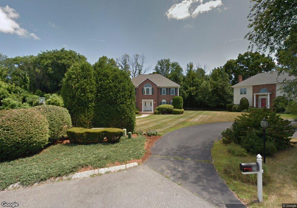
30 Battle Green Rd Lexington, MA 02421
North Lexington NeighborhoodEstimated Value: $1,867,000 - $2,425,000
4
Beds
3
Baths
3,324
Sq Ft
$665/Sq Ft
Est. Value
About This Home
This home is located at 30 Battle Green Rd, Lexington, MA 02421 and is currently estimated at $2,211,928, approximately $665 per square foot. 30 Battle Green Rd is a home located in Middlesex County with nearby schools including Maria Hastings Elementary School, William Diamond Middle School, and Lexington High School.
Ownership History
Date
Name
Owned For
Owner Type
Purchase Details
Closed on
Mar 14, 2024
Sold by
Dadgar Anowshirvan and Dadgar Helen P
Bought by
Anowshirvan Dadgar T and Anowshirvan Dadgar
Current Estimated Value
Purchase Details
Closed on
Nov 15, 1993
Sold by
Diamond West Dev Corp
Bought by
Dadgar Anowshirvan and Dadgar Helen
Create a Home Valuation Report for This Property
The Home Valuation Report is an in-depth analysis detailing your home's value as well as a comparison with similar homes in the area
Home Values in the Area
Average Home Value in this Area
Purchase History
| Date | Buyer | Sale Price | Title Company |
|---|---|---|---|
| Anowshirvan Dadgar T | -- | None Available | |
| Anowshirvan Dadgar T | -- | None Available | |
| Dadgar Anowshirvan | $615,325 | -- | |
| Dadgar Anowshirvan | $615,325 | -- |
Source: Public Records
Mortgage History
| Date | Status | Borrower | Loan Amount |
|---|---|---|---|
| Previous Owner | Dadgar Anowshirvan | $1,850,000 | |
| Previous Owner | Dadgar Anowshirvan | $353,000 |
Source: Public Records
Tax History Compared to Growth
Tax History
| Year | Tax Paid | Tax Assessment Tax Assessment Total Assessment is a certain percentage of the fair market value that is determined by local assessors to be the total taxable value of land and additions on the property. | Land | Improvement |
|---|---|---|---|---|
| 2025 | $23,800 | $1,946,000 | $859,000 | $1,087,000 |
| 2024 | $23,018 | $1,879,000 | $818,000 | $1,061,000 |
| 2023 | $20,995 | $1,615,000 | $744,000 | $871,000 |
| 2022 | $20,272 | $1,469,000 | $676,000 | $793,000 |
| 2021 | $20,477 | $1,423,000 | $644,000 | $779,000 |
| 2020 | $19,052 | $1,356,000 | $644,000 | $712,000 |
| 2019 | $18,568 | $1,315,000 | $613,000 | $702,000 |
| 2018 | $17,832 | $1,247,000 | $584,000 | $663,000 |
| 2017 | $17,460 | $1,205,000 | $566,000 | $639,000 |
| 2016 | $16,805 | $1,151,000 | $520,000 | $631,000 |
| 2015 | $16,257 | $1,094,000 | $481,000 | $613,000 |
| 2014 | $15,743 | $1,015,000 | $426,000 | $589,000 |
Source: Public Records
Map
Nearby Homes
- 2380 Massachusetts Ave
- 2520 Massachusetts Ave
- 18 Greenwood St
- 21 Balfour St
- 7 Carmel Cir
- 30 Harbell St
- 46 Asbury St
- 24 Deering Ave
- 6 Revolutionary Rd
- 2663 Massachusetts Ave
- 50 School St
- 19 Deering Ave
- 5 Leroy Rd
- 671 Marrett Rd
- 32 Forest St
- 24 Vaille Ave
- 1900 Massachusetts Ave
- 1894 Massachusetts Ave
- 93 Bedford St Unit 201
- 93 Bedford St Unit 308
- 29 Battle Green Rd
- 27 Battle Green Rd
- 26 Battle Green Rd
- 2361 Massachusetts Ave
- 2361 Massachusetts Ave
- 23 Battle Green Rd
- 6 Powers Ct
- 2405 Massachusetts Ave
- 2407 Massachusetts Ave
- 2377 Massachusetts Ave
- 4 Powers Ct
- 33 Columbus St
- 65 Paul Revere Rd
- 5 Minute Man Ln
- 3 Minute Man Ln
- 2317 Massachusetts Ave
- 63 Paul Revere Rd
- 5 Powers Ct
- 1 Minute Man Ln
- 2295 Massachusetts Ave