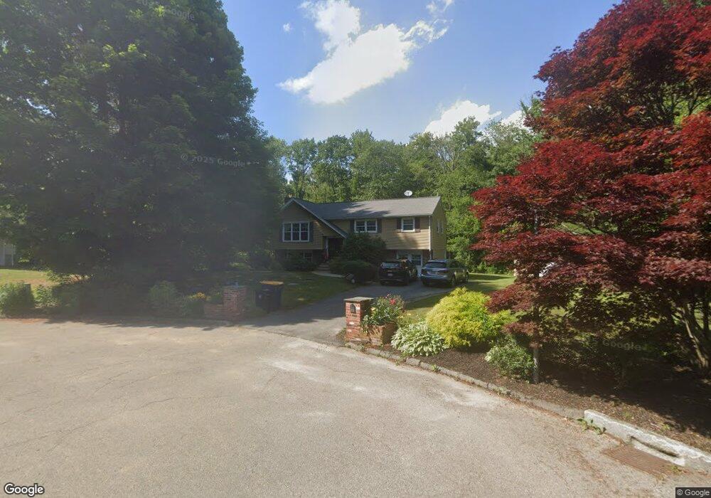
30 Beaver Brook Rd Sharon, MA 02067
Estimated Value: $728,271 - $874,000
3
Beds
3
Baths
1,332
Sq Ft
$588/Sq Ft
Est. Value
About This Home
This home is located at 30 Beaver Brook Rd, Sharon, MA 02067 and is currently estimated at $783,068, approximately $587 per square foot. 30 Beaver Brook Rd is a home located in Norfolk County with nearby schools including Cottage Street Elementary School, Sharon Middle School, and Sharon High School.
Ownership History
Date
Name
Owned For
Owner Type
Purchase Details
Closed on
Jun 24, 2005
Sold by
30 Beaver Brook Road R
Bought by
Dhathathreya Bhuvaneswari and Ramadurai Raghavn
Current Estimated Value
Purchase Details
Closed on
Dec 24, 1999
Sold by
Minichiello Charles and Minichiello Virginia M
Bought by
Beaver Brook Rd Rt
Create a Home Valuation Report for This Property
The Home Valuation Report is an in-depth analysis detailing your home's value as well as a comparison with similar homes in the area
Home Values in the Area
Average Home Value in this Area
Purchase History
| Date | Buyer | Sale Price | Title Company |
|---|---|---|---|
| Dhathathreya Bhuvaneswari | $455,000 | -- | |
| Beaver Brook Rd Rt | $260,000 | -- |
Source: Public Records
Mortgage History
| Date | Status | Borrower | Loan Amount |
|---|---|---|---|
| Open | Beaver Brook Rd Rt | $272,000 | |
| Closed | Beaver Brook Rd Rt | $277,500 | |
| Closed | Beaver Brook Rd Rt | $289,000 |
Source: Public Records
Tax History
| Year | Tax Paid | Tax Assessment Tax Assessment Total Assessment is a certain percentage of the fair market value that is determined by local assessors to be the total taxable value of land and additions on the property. | Land | Improvement |
|---|---|---|---|---|
| 2025 | $11,675 | $667,900 | $417,700 | $250,200 |
| 2024 | $11,249 | $639,900 | $383,200 | $256,700 |
| 2023 | $10,989 | $591,100 | $358,200 | $232,900 |
| 2022 | $10,647 | $539,100 | $298,500 | $240,600 |
| 2021 | $10,577 | $517,700 | $281,700 | $236,000 |
| 2020 | $10,080 | $530,500 | $294,500 | $236,000 |
| 2019 | $9,420 | $485,300 | $249,300 | $236,000 |
| 2018 | $8,873 | $458,100 | $222,100 | $236,000 |
| 2017 | $8,658 | $441,300 | $207,500 | $233,800 |
| 2016 | $8,881 | $441,600 | $228,300 | $213,300 |
| 2015 | $8,309 | $409,300 | $207,500 | $201,800 |
| 2014 | $7,690 | $374,200 | $188,700 | $185,500 |
Source: Public Records
Map
Nearby Homes
- 7 Cape Club Dr Unit 9
- 38 Cape Club Dr Unit 38
- 40 Cape Club Dr Unit 40
- 51-U:37 Cape Club Dr
- Unit 11 Powder House Ln Unit 11
- 8 Powder House Ln Unit 2
- Unit 12 Powder House Ln Unit 12
- Unit 3 Powder House Ln Unit 3
- 277 Everett St
- 272 Union St Unit 272
- 1 Providence Hwy
- 1 Palace Ct
- 0 Charlotte Rd
- 136 N Main St
- 363 - 367 Washington St
- 486 Washington St
- 29 Station St
- 3 Trowel Shop Pond Rd Unit 3
- 20 Trowel Shop Pond Rd Unit 24
- 16 Trowel Shop Pond Rd Unit 16
- 26 Beaver Brook Rd
- 22 Beaver Brook Rd
- 18 Beaver Brook Rd
- 19 Beaver Brook Rd
- 14 Beaver Brook Rd
- 37 Edge Hill Rd
- 31 Edge Hill Rd
- 30 Blueberry Ln
- 2 Pheasant Wood Rd
- 2 Pheasant Wood Rd
- 43 Edge Hill Rd
- 6 Pheasant Wood Rd
- 25 Edge Hill Rd
- 10 Pheasant Wood Rd
- 31 Blueberry Ln
- 10 Beaver Brook Rd
- 49 Edge Hill Rd
- 26 Blueberry Ln
- 19 Edge Hill Rd
- 28 Edge Hill Rd
Your Personal Tour Guide
Ask me questions while you tour the home.