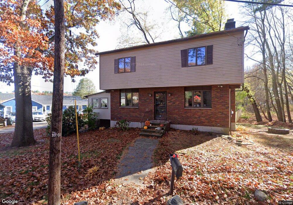
30 Birchmeadow Rd Merrimac, MA 01860
Estimated Value: $744,000 - $1,140,000
3
Beds
2
Baths
2,216
Sq Ft
$416/Sq Ft
Est. Value
About This Home
This home is located at 30 Birchmeadow Rd, Merrimac, MA 01860 and is currently estimated at $922,550, approximately $416 per square foot. 30 Birchmeadow Rd is a home located in Essex County with nearby schools including Pentucket Regional High School.
Ownership History
Date
Name
Owned For
Owner Type
Purchase Details
Closed on
May 11, 2020
Sold by
Patti Anthony C and Patti Michele L
Bought by
Shared Living Collaboratv
Current Estimated Value
Home Financials for this Owner
Home Financials are based on the most recent Mortgage that was taken out on this home.
Original Mortgage
$925,000
Interest Rate
3%
Mortgage Type
Purchase Money Mortgage
Purchase Details
Closed on
Jan 16, 2009
Sold by
Lynch Peter M
Bought by
Patti Anthony C and Patti Michele L
Home Financials for this Owner
Home Financials are based on the most recent Mortgage that was taken out on this home.
Original Mortgage
$350,000
Interest Rate
5.52%
Mortgage Type
Purchase Money Mortgage
Purchase Details
Closed on
Jun 30, 1998
Sold by
Pennacchio Ft
Bought by
Lynch Peter M
Purchase Details
Closed on
Jun 30, 1992
Sold by
Jordan Ronald R and Jordan Dianne C
Bought by
Pennacchio Joseph
Create a Home Valuation Report for This Property
The Home Valuation Report is an in-depth analysis detailing your home's value as well as a comparison with similar homes in the area
Home Values in the Area
Average Home Value in this Area
Purchase History
| Date | Buyer | Sale Price | Title Company |
|---|---|---|---|
| Shared Living Collaboratv | $665,000 | None Available | |
| Patti Anthony C | $680,000 | -- | |
| Lynch Peter M | $280,000 | -- | |
| Pennacchio Joseph | $180,000 | -- |
Source: Public Records
Mortgage History
| Date | Status | Borrower | Loan Amount |
|---|---|---|---|
| Previous Owner | Shared Living Collaboratv | $925,000 | |
| Previous Owner | Pennacchio Joseph | $350,000 | |
| Previous Owner | Pennacchio Joseph | $210,000 |
Source: Public Records
Tax History Compared to Growth
Tax History
| Year | Tax Paid | Tax Assessment Tax Assessment Total Assessment is a certain percentage of the fair market value that is determined by local assessors to be the total taxable value of land and additions on the property. | Land | Improvement |
|---|---|---|---|---|
| 2025 | $9,252 | $698,300 | $418,900 | $279,400 |
| 2024 | $8,887 | $658,300 | $371,500 | $286,800 |
| 2023 | $8,920 | $603,900 | $336,700 | $267,200 |
| 2022 | $8,677 | $531,000 | $297,400 | $233,600 |
| 2021 | $8,104 | $497,200 | $253,900 | $243,300 |
| 2020 | $7,398 | $497,200 | $253,900 | $243,300 |
| 2019 | $6,977 | $441,300 | $219,000 | $222,300 |
| 2018 | $6,278 | $398,368 | $176,068 | $222,300 |
| 2017 | $6,080 | $372,081 | $149,781 | $222,300 |
| 2016 | $6,710 | $415,200 | $192,900 | $222,300 |
| 2015 | $5,907 | $363,481 | $145,381 | $218,100 |
| 2014 | $5,776 | $363,481 | $145,381 | $218,100 |
Source: Public Records
Map
Nearby Homes
- 3 W Parish Ln
- 3 Noyes Ln
- 80 Brandy Brow Rd
- 0 Mountain View Ave
- 4 Vendome St Unit 2
- 0 W Main St
- 21 Green St
- 11 Central St
- 49 Church St
- 42 School St
- 14 Corliss Hill Rd
- 21-23 E Main St
- 46 Locust St
- 18 Harriman Rd
- 5 Wentworth Dr
- 71 Old Amesbury Line Rd
- 2 River Rd
- 61 E Main St
- 531 Amesbury Rd
- 7 Ashley Ln
- 30 Birch Meadow Rd
- 5 W Parish Ln
- 7 W Parish Ln
- 6 W Parish Ln
- 1 W Parish Ln
- 8 W Parish Ln
- 10 W Parish Ln
- 1 Clement Place
- 12 W Parish Ln
- 9 W Parish Ln
- 3 Clement Place
- 4 W Parish Ln
- 5 Clement Place
- 4 Stevens Terrace
- 6 Stevens Terrace
- 14 W Parish Ln
- 32 Birchmeadow Rd
- 2 Clement Place
- 6 Clement Place
- 3 Stevens Terrace