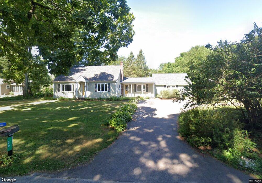
30 Blanding Rd Rehoboth, MA 02769
Estimated Value: $545,092 - $620,000
3
Beds
2
Baths
1,789
Sq Ft
$324/Sq Ft
Est. Value
About This Home
This home is located at 30 Blanding Rd, Rehoboth, MA 02769 and is currently estimated at $580,364, approximately $324 per square foot. 30 Blanding Rd is a home located in Bristol County with nearby schools including Dighton-Rehoboth Regional High School, St Margaret School, and Cedar Brook School.
Ownership History
Date
Name
Owned For
Owner Type
Purchase Details
Closed on
May 13, 2014
Sold by
Figueira Harold A and Figueira Joan C
Bought by
30 Blading Road Irt and Figueira Jared M
Current Estimated Value
Create a Home Valuation Report for This Property
The Home Valuation Report is an in-depth analysis detailing your home's value as well as a comparison with similar homes in the area
Home Values in the Area
Average Home Value in this Area
Purchase History
| Date | Buyer | Sale Price | Title Company |
|---|---|---|---|
| 30 Blading Road Irt | -- | -- |
Source: Public Records
Tax History Compared to Growth
Tax History
| Year | Tax Paid | Tax Assessment Tax Assessment Total Assessment is a certain percentage of the fair market value that is determined by local assessors to be the total taxable value of land and additions on the property. | Land | Improvement |
|---|---|---|---|---|
| 2025 | $51 | $458,400 | $198,000 | $260,400 |
| 2024 | $4,846 | $426,600 | $198,000 | $228,600 |
| 2023 | $4,886 | $421,900 | $194,000 | $227,900 |
| 2022 | $4,597 | $362,800 | $185,600 | $177,200 |
| 2021 | $4,619 | $348,900 | $169,300 | $179,600 |
| 2020 | $4,530 | $345,300 | $169,300 | $176,000 |
| 2018 | $3,755 | $313,700 | $161,500 | $152,200 |
| 2017 | $3,706 | $295,100 | $161,500 | $133,600 |
| 2016 | $3,491 | $287,300 | $161,500 | $125,800 |
| 2015 | $3,681 | $299,000 | $154,300 | $144,700 |
| 2014 | $3,504 | $281,700 | $147,100 | $134,600 |
Source: Public Records
Map
Nearby Homes
- 9 Hidden Hills Dr
- 25 Lincoln St
- 23 Colonial Way
- 37 Colonial Way
- 824 Taunton Ave
- 16 Salisbury St
- 67 Wheeler St
- 181 Hope St
- 420 Chestnut St
- 0 Patterson St Unit 73348933
- 15 Hickory Ridge Rd
- 6 Running Stream Rd
- 181 Sherman Ave
- 0 Winter St
- 42 Tee Jay Dr
- 25 Pimental Dr
- 57 Redwood Ln
- 111 Summer St
- 20 School St
- 224 Arcade Ave
- 34 Blanding Rd
- 27 Blanding Rd
- 36 Blanding Rd
- 26 Blanding Rd
- 37 Blanding Rd Unit 39
- 23 Blanding Rd
- 20 Blanding Rd
- 570 Winthrop St
- 19 Blanding Rd
- 44 Blanding Rd
- 576 Winthrop St
- 16 Blanding Rd
- 578 Winthrop St
- 15 Blanding Rd
- 569 Winthrop St Unit 2
- 569 Winthrop St Unit 3
- 569 Winthrop St Unit 1
- 12 Blanding Rd
- 582 Winthrop St
- 584 Winthrop St