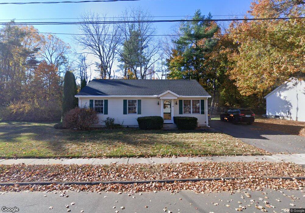
30 Burnham St Plainville, CT 06062
Estimated Value: $298,000 - $324,000
3
Beds
2
Baths
1,120
Sq Ft
$281/Sq Ft
Est. Value
About This Home
This home is located at 30 Burnham St, Plainville, CT 06062 and is currently estimated at $315,116, approximately $281 per square foot. 30 Burnham St is a home located in Hartford County with nearby schools including Middle School Of Plainville, Plainville High School, and Great Beginnings.
Ownership History
Date
Name
Owned For
Owner Type
Purchase Details
Closed on
Nov 9, 1998
Sold by
Plainville Afford Hsg
Bought by
Bullawa Diane M
Current Estimated Value
Home Financials for this Owner
Home Financials are based on the most recent Mortgage that was taken out on this home.
Original Mortgage
$83,600
Interest Rate
6.64%
Create a Home Valuation Report for This Property
The Home Valuation Report is an in-depth analysis detailing your home's value as well as a comparison with similar homes in the area
Home Values in the Area
Average Home Value in this Area
Purchase History
| Date | Buyer | Sale Price | Title Company |
|---|---|---|---|
| Bullawa Diane M | $90,900 | -- | |
| Bullawa Diane M | $90,900 | -- |
Source: Public Records
Mortgage History
| Date | Status | Borrower | Loan Amount |
|---|---|---|---|
| Closed | Bullawa Diane M | $86,000 | |
| Closed | Bullawa Diane M | $83,600 |
Source: Public Records
Tax History Compared to Growth
Tax History
| Year | Tax Paid | Tax Assessment Tax Assessment Total Assessment is a certain percentage of the fair market value that is determined by local assessors to be the total taxable value of land and additions on the property. | Land | Improvement |
|---|---|---|---|---|
| 2025 | $4,940 | $143,780 | $47,950 | $95,830 |
| 2024 | $4,693 | $143,780 | $47,950 | $95,830 |
| 2023 | $4,518 | $143,780 | $47,950 | $95,830 |
| 2022 | $4,405 | $143,780 | $47,950 | $95,830 |
| 2021 | $4,195 | $121,380 | $45,290 | $76,090 |
| 2020 | $4,202 | $121,380 | $45,290 | $76,090 |
| 2019 | $4,202 | $121,380 | $45,290 | $76,090 |
| 2018 | $4,107 | $121,380 | $45,290 | $76,090 |
| 2017 | $3,967 | $121,380 | $45,290 | $76,090 |
| 2016 | $4,011 | $125,370 | $42,420 | $82,950 |
| 2015 | $3,991 | $125,370 | $42,420 | $82,950 |
| 2014 | $4,204 | $133,980 | $39,270 | $94,710 |
Source: Public Records
Map
Nearby Homes
- 97 Trumbull Ave
- 98 Rockwell Ave
- 42 Cleveland St
- 16 1/2 E Maple St
- 15 W Pine Way Unit 31
- 20 Macarthur Rd
- 48 Plum Tree Rd
- 18 Ivy Rd
- 50 Pierce St Unit 46
- 0 Lot 36 Unit 24121321
- 47 Orrin Ave
- 6 Bruce Ave
- 47 Julie Rd
- 16 View St
- 170 Westwood Ave
- 135 Woodford Avenue Extension
- 36 View St
- 99 Pinnacle Rd
- 18 Homestead Ave
- 25 Lincoln St
- 26 Burnham St
- 23 Burnham St
- 36 Burnham St
- 30 Trumbull Ave
- 57 Burnham St
- 38 Trumbull Ave
- 22 Burnham St
- 41 Trumbull Ave
- 53 Burnham St
- 43 Trumbull Ave
- 42 Trumbull Ave
- 46 Trumbull Ave
- 49 Trumbull Ave
- 36 Farmington Ave
- 51 Trumbull Ave
- 59 Burnham St
- 59 Burnham St Unit 2
- 53 Trumbull Ave
- 40 Farmington Ave
- 55 Trumbull Ave