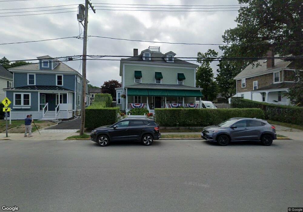
30 Carroll Ave Newport, RI 02840
Fifth Ward NeighborhoodEstimated Value: $1,072,000 - $1,844,000
4
Beds
3
Baths
2,935
Sq Ft
$548/Sq Ft
Est. Value
About This Home
This home is located at 30 Carroll Ave, Newport, RI 02840 and is currently estimated at $1,607,144, approximately $547 per square foot. 30 Carroll Ave is a home located in Newport County with nearby schools including Rogers High School, St Michael's Country Day School, and All Saints STEAM Academy.
Ownership History
Date
Name
Owned For
Owner Type
Purchase Details
Closed on
Aug 22, 2014
Sold by
Roberts Eileen and Chase Catherine
Bought by
Kirwin James T and Kirwin Eugenia
Current Estimated Value
Home Financials for this Owner
Home Financials are based on the most recent Mortgage that was taken out on this home.
Original Mortgage
$277,700
Outstanding Balance
$89,612
Interest Rate
4.09%
Estimated Equity
$1,517,532
Purchase Details
Closed on
Aug 29, 1995
Sold by
Mcdougal Thayer
Bought by
Kirwin James T
Create a Home Valuation Report for This Property
The Home Valuation Report is an in-depth analysis detailing your home's value as well as a comparison with similar homes in the area
Home Values in the Area
Average Home Value in this Area
Purchase History
| Date | Buyer | Sale Price | Title Company |
|---|---|---|---|
| Kirwin James T | $161,000 | -- | |
| Kirwin James T | $155,000 | -- |
Source: Public Records
Mortgage History
| Date | Status | Borrower | Loan Amount |
|---|---|---|---|
| Open | Kirwin James T | $277,700 | |
| Closed | Kirwin James T | $142,000 |
Source: Public Records
Tax History
| Year | Tax Paid | Tax Assessment Tax Assessment Total Assessment is a certain percentage of the fair market value that is determined by local assessors to be the total taxable value of land and additions on the property. | Land | Improvement |
|---|---|---|---|---|
| 2025 | $9,972 | $1,147,700 | $543,000 | $604,700 |
| 2024 | $7,999 | $1,147,700 | $543,000 | $604,700 |
| 2023 | $7,329 | $738,800 | $355,000 | $383,800 |
| 2022 | $7,100 | $738,800 | $355,000 | $383,800 |
| 2021 | $6,893 | $738,800 | $355,000 | $383,800 |
| 2020 | $5,979 | $581,600 | $261,700 | $319,900 |
| 2019 | $5,979 | $581,600 | $261,700 | $319,900 |
| 2018 | $5,810 | $581,600 | $261,700 | $319,900 |
| 2017 | $5,355 | $477,700 | $187,300 | $290,400 |
| 2016 | $5,221 | $477,700 | $187,300 | $290,400 |
| 2015 | $5,097 | $477,700 | $187,300 | $290,400 |
| 2014 | $5,082 | $421,400 | $159,200 | $262,200 |
Source: Public Records
Map
Nearby Homes
- 6 Price's Cove Ave
- 39 Connection St
- 5 Meikle Ave
- 73 Old Fort Rd Unit 75
- 57 Clinton St Unit 57C
- 75 Roseneath Ave
- 128 Ruggles Ave
- 15 Narragansett Ave Unit 2
- 629 Thames St
- 59 Houston Ave
- 6 Sullivan St
- 32 Houston Ave
- 46 Chastellux Ave Unit M6
- 6 Sharon Ct
- 2 Harbor View Dr
- 421 Bellevue Ave Unit 3B
- 14 Leroy Ave
- 401 Bellevue Ave Unit 112
- 8 Key Ct
- 553 Bellevue Ave Unit 6
- 32 Carroll Ave
- 26 Carroll Ave
- 29 Vaughan Ave
- 27 Vaughan Ave
- 27 Vaughan Ave
- 27 Vaughan Ave Unit 2
- 36 Carroll Ave
- 31 Vaughan Ave
- 25 Vaughan Ave
- 22 Carroll Ave Unit 24
- 22 Carroll Ave
- 8 Bateman Ave
- 0 Bateman Ave
- 24 Carroll Ave
- 23 Vaughan Ave
- 38 Carroll Ave
- 21 Carroll Ave
- 20 Carroll Ave
- 10 Bateman Ave
- 21 Vaughan Ave
Your Personal Tour Guide
Ask me questions while you tour the home.