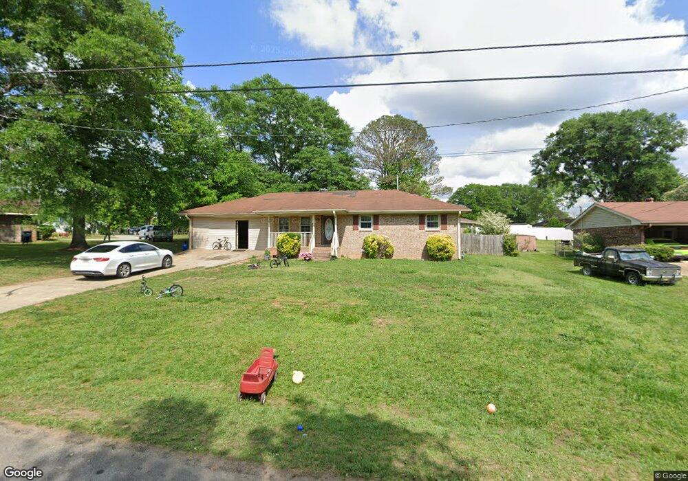
30 Castlegate Cir Carrollton, GA 30116
Abilene NeighborhoodEstimated Value: $210,043 - $253,000
3
Beds
2
Baths
1,674
Sq Ft
$141/Sq Ft
Est. Value
About This Home
This home is located at 30 Castlegate Cir, Carrollton, GA 30116 and is currently estimated at $235,261, approximately $140 per square foot. 30 Castlegate Cir is a home located in Carroll County with nearby schools including Sharp Creek Elementary School, Bay Springs Middle School, and Villa Rica High School.
Ownership History
Date
Name
Owned For
Owner Type
Purchase Details
Closed on
Jan 25, 2011
Sold by
Federal National Mortgage Association
Bought by
Carroll County Properties Llc
Current Estimated Value
Purchase Details
Closed on
Mar 2, 2010
Sold by
Nunn Tiffany M
Bought by
Bank Of America
Purchase Details
Closed on
Aug 28, 2007
Sold by
Us Bank National Associati
Bought by
Nunn Tiffany M
Purchase Details
Closed on
Jul 3, 2007
Sold by
Kendrix Donald
Bought by
Us Bank National Association
Purchase Details
Closed on
Oct 14, 2005
Sold by
Kelly Bonita
Bought by
Kendrix Donald
Home Financials for this Owner
Home Financials are based on the most recent Mortgage that was taken out on this home.
Original Mortgage
$91,800
Interest Rate
7.15%
Mortgage Type
New Conventional
Purchase Details
Closed on
Apr 24, 2003
Sold by
Kelley Bonita and Kelley Marquess
Bought by
Kelley Bonita
Purchase Details
Closed on
Jul 3, 2002
Sold by
Kelley Bonita and Kelley Kendrix A
Bought by
Kelley Bonita and Kelley Marquess
Purchase Details
Closed on
Sep 10, 2001
Sold by
Horton Frank
Bought by
Kelley Bonita
Purchase Details
Closed on
Jun 21, 2000
Sold by
Phillips Winford P
Bought by
Horton Frank
Purchase Details
Closed on
Jul 6, 1999
Sold by
Redford
Bought by
Phillips Winford P
Purchase Details
Closed on
Apr 1, 1981
Bought by
Redford
Create a Home Valuation Report for This Property
The Home Valuation Report is an in-depth analysis detailing your home's value as well as a comparison with similar homes in the area
Home Values in the Area
Average Home Value in this Area
Purchase History
| Date | Buyer | Sale Price | Title Company |
|---|---|---|---|
| Carroll County Properties Llc | $25,000 | -- | |
| Bank Of America | $83,200 | -- | |
| Nunn Tiffany M | $68,000 | -- | |
| Us Bank National Association | $97,577 | -- | |
| Kendrix Donald | $108,000 | -- | |
| Kelley Bonita | -- | -- | |
| Kelley Bonita | -- | -- | |
| Kelley Bonita | -- | -- | |
| Horton Frank | $72,900 | -- | |
| Phillips Winford P | $37,500 | -- | |
| Redford | -- | -- |
Source: Public Records
Mortgage History
| Date | Status | Borrower | Loan Amount |
|---|---|---|---|
| Previous Owner | Kendrix Donald | $91,800 | |
| Previous Owner | Kendrix Donald | $16,200 |
Source: Public Records
Tax History Compared to Growth
Tax History
| Year | Tax Paid | Tax Assessment Tax Assessment Total Assessment is a certain percentage of the fair market value that is determined by local assessors to be the total taxable value of land and additions on the property. | Land | Improvement |
|---|---|---|---|---|
| 2024 | $1,279 | $56,552 | $3,390 | $53,162 |
| 2023 | $1,279 | $66,732 | $4,000 | $62,732 |
| 2022 | $1,361 | $54,275 | $4,000 | $50,275 |
| 2021 | $1,209 | $47,157 | $4,000 | $43,157 |
| 2020 | $869 | $42,622 | $4,000 | $38,622 |
| 2019 | $813 | $39,218 | $4,000 | $35,218 |
| 2018 | $596 | $26,709 | $4,000 | $22,709 |
| 2017 | $598 | $26,709 | $4,000 | $22,709 |
| 2016 | $493 | $26,709 | $4,000 | $22,709 |
| 2015 | $651 | $23,292 | $4,000 | $19,293 |
| 2014 | $654 | $23,293 | $4,000 | $19,293 |
Source: Public Records
Map
Nearby Homes
- 0 Old Airport Rd Unit 10599783
- 0 Old Airport Rd Unit 7642336
- 0 Old Airport Rd Unit 10599779
- 0 Knight Dr W
- The McGinnis Plan at Morgan Landing
- 00 Old Airport Rd
- 211 Greystone Dr
- 255 Morgan Rd
- 0 Shady Grove Rd Unit 10601173
- 0 Shady Grove Rd Unit 10601172
- 1890 Shady Grove Rd
- 221 Turtle Cove
- 105 Providence Ct
- 131 Hunter Way
- 255 Emerald Pointe Dr
- 45 Sassafrass Way Unit 202
- 912 Folds Rd
- 0 Frashier Rd Unit 7549781
- 0 Frashier Rd Unit 10488685
- 1711B Bankhead Hwy
- 40 Castlegate Cir
- 395 Old Airport Rd
- 417 Old Airport Rd
- 0 Old Airport Rd Unit 10599776
- 0 Old Airport Rd Unit 7324726
- 0 Old Airport Rd Unit 7018405
- 0 Old Airport Rd Unit 9028377
- 0 Old Airport Rd Unit 9043687
- 0 Old Airport Rd Unit 8742119
- 0 Old Airport Rd Unit 8273475
- 0 Old Airport Rd Unit 8897231
- 0 Old Airport Rd Unit 8849897
- 0 Old Airport Rd Unit 7337783
- 0 Old Airport Rd Unit 7399513
- 0 Old Airport Rd Unit 7535543
- 0 Old Airport Rd Unit 8376947
- 50 Castlegate Cir
- 45 Castlegate Cir
- 25 Castlegate Cir
- 290 Castlegate Cir