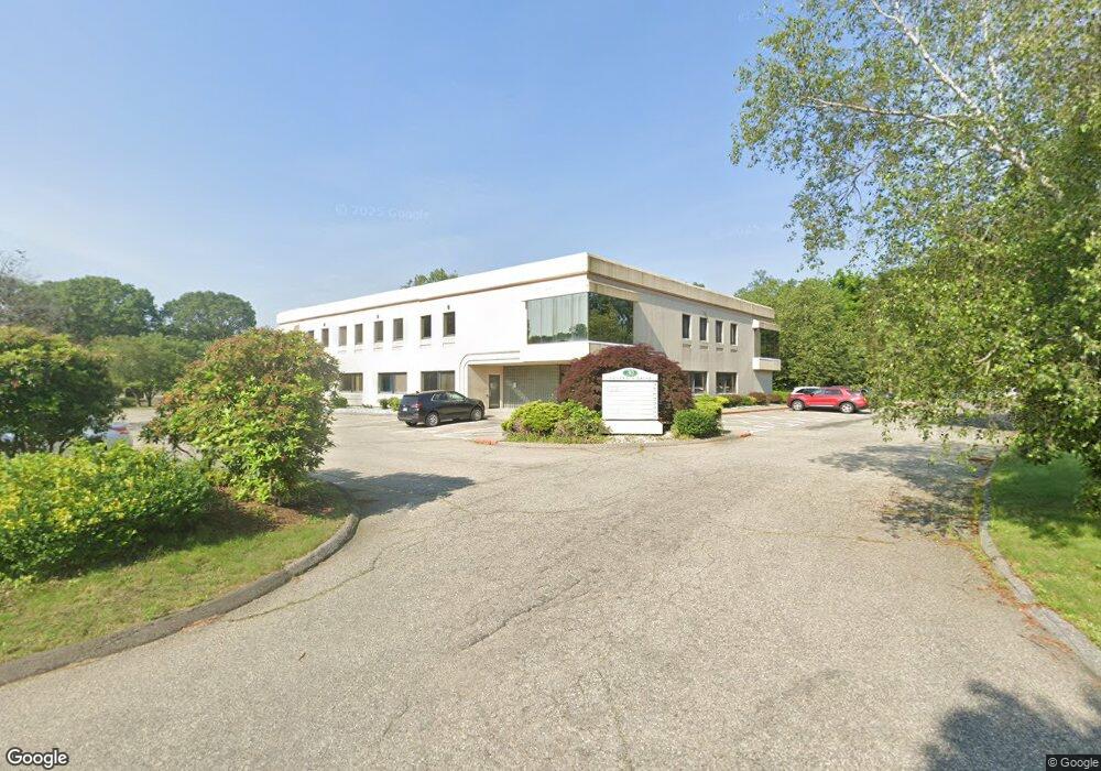
30 Controls Dr Shelton, CT 06484
Estimated Value: $2,271,298
Studio
--
Bath
24,212
Sq Ft
$94/Sq Ft
Est. Value
About This Home
This home is located at 30 Controls Dr, Shelton, CT 06484 and is currently estimated at $2,271,298, approximately $93 per square foot. 30 Controls Dr is a home located in Fairfield County with nearby schools including Perry Hill School, Shelton Intermediate School, and Shelton High School.
Ownership History
Date
Name
Owned For
Owner Type
Purchase Details
Closed on
Jun 7, 2021
Sold by
Seaside Enterprises Llc
Bought by
Posca Antonio and Posca Concetta
Current Estimated Value
Purchase Details
Closed on
Oct 8, 2013
Sold by
Communications Control
Bought by
Seaside Enterprises Ll
Home Financials for this Owner
Home Financials are based on the most recent Mortgage that was taken out on this home.
Original Mortgage
$1,100,000
Interest Rate
4.61%
Mortgage Type
Commercial
Create a Home Valuation Report for This Property
The Home Valuation Report is an in-depth analysis detailing your home's value as well as a comparison with similar homes in the area
Home Values in the Area
Average Home Value in this Area
Purchase History
| Date | Buyer | Sale Price | Title Company |
|---|---|---|---|
| Posca Antonio | $1,675,000 | None Available | |
| Posca Antonio | $1,675,000 | None Available | |
| Seaside Enterprises Ll | $1,375,000 | -- | |
| Seaside Enterprises Ll | $1,375,000 | -- |
Source: Public Records
Mortgage History
| Date | Status | Borrower | Loan Amount |
|---|---|---|---|
| Previous Owner | Seaside Enterprises Ll | $1,100,000 | |
| Previous Owner | Seaside Enterprises Ll | $1,400,000 |
Source: Public Records
Tax History
| Year | Tax Paid | Tax Assessment Tax Assessment Total Assessment is a certain percentage of the fair market value that is determined by local assessors to be the total taxable value of land and additions on the property. | Land | Improvement |
|---|---|---|---|---|
| 2025 | $23,223 | $1,233,960 | $267,120 | $966,840 |
| 2024 | $23,667 | $1,233,960 | $267,120 | $966,840 |
| 2023 | $21,557 | $1,233,960 | $267,120 | $966,840 |
| 2022 | $21,557 | $1,233,960 | $267,120 | $966,840 |
| 2021 | $27,172 | $1,233,400 | $215,180 | $1,018,220 |
| 2020 | $27,653 | $1,233,400 | $215,180 | $1,018,220 |
| 2019 | $27,653 | $1,233,400 | $215,180 | $1,018,220 |
| 2017 | $27,394 | $1,233,400 | $215,180 | $1,018,220 |
| 2015 | $32,669 | $1,464,330 | $207,760 | $1,256,570 |
| 2014 | $32,669 | $1,464,330 | $207,760 | $1,256,570 |
Source: Public Records
Map
Nearby Homes
- 2 Trout Creek Rd Unit 2
- 444 Asbury Ridge
- 469 Asbury Ridge
- 3 Rushbrooke Ln
- 133 Rocky Rest Rd
- 82 Country Walk
- 26 Bunker Hill Cir
- 136 Turtle Run Dr Unit A
- 88 Rocky Rest Rd
- 2 Brookview Heights Ct
- 76 River Bend Rd Unit C
- 82 River Bend Rd Unit A
- 106 Smoke Valley Dr Unit B
- 72 River Bend Rd Unit B
- 16 Scotch Pine Dr
- 182 Remy Ct Unit 182
- 47 Oronoque Trail
- 44 Hemlock Dr
- 65 River Bend Rd Unit C
- 12 Horseshoe Dr
- 134 Long Hill Cross Rd
- 127 Long Hill Cross Rd
- 115 Long Hill Cross Rd
- 120 Long Hill Cross Rd
- LOT B Long Hill Cross Rd
- 157 Long Hill Cross Rd
- 152 Long Hill Cross Rd
- 96 Long Hill Cross Rd
- 96 Long Hill Cross Rd Unit 20
- 96 Long Hill Cross Rd Unit 10
- 96 Long Hill Cross Rd Unit 1
- 96 Long Hill Cross Rd Unit 2
- 96 Long Hill Cross Rd Unit 9
- 96 Long Hill Cross Rd Unit 12
- 96 Long Hill Cross Rd Unit 11
- 96 Long Hill Cross Rd Unit 8
- 96 Long Hill Cross Rd Unit 7
- 96 Long Hill Cross Rd Unit 3
- 158 Long Hill Cross Rd
- 109 Old Mill Rd
Your Personal Tour Guide
Ask me questions while you tour the home.