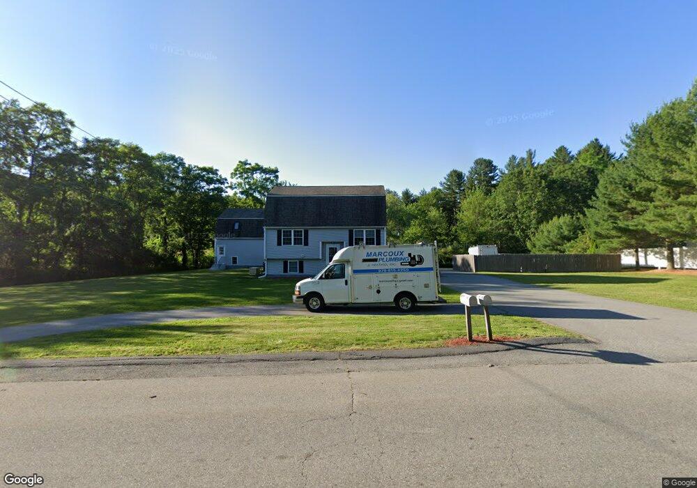
30 Cross Rd Dracut, MA 01826
Estimated Value: $666,000 - $745,000
3
Beds
2
Baths
1,562
Sq Ft
$452/Sq Ft
Est. Value
About This Home
This home is located at 30 Cross Rd, Dracut, MA 01826 and is currently estimated at $706,115, approximately $452 per square foot. 30 Cross Rd is a home located in Middlesex County with nearby schools including George H. Englesby Elementary School, Richardson Middle School, and Dracut Senior High School.
Ownership History
Date
Name
Owned For
Owner Type
Purchase Details
Closed on
Dec 22, 2011
Sold by
Jakon Dev Corp
Bought by
30 Cross Road Llc
Current Estimated Value
Home Financials for this Owner
Home Financials are based on the most recent Mortgage that was taken out on this home.
Original Mortgage
$240,000
Outstanding Balance
$164,019
Interest Rate
3.99%
Mortgage Type
Purchase Money Mortgage
Estimated Equity
$542,096
Create a Home Valuation Report for This Property
The Home Valuation Report is an in-depth analysis detailing your home's value as well as a comparison with similar homes in the area
Home Values in the Area
Average Home Value in this Area
Purchase History
| Date | Buyer | Sale Price | Title Company |
|---|---|---|---|
| 30 Cross Road Llc | $300,000 | -- |
Source: Public Records
Mortgage History
| Date | Status | Borrower | Loan Amount |
|---|---|---|---|
| Open | 30 Cross Road Llc | $240,000 |
Source: Public Records
Tax History
| Year | Tax Paid | Tax Assessment Tax Assessment Total Assessment is a certain percentage of the fair market value that is determined by local assessors to be the total taxable value of land and additions on the property. | Land | Improvement |
|---|---|---|---|---|
| 2025 | $5,798 | $572,900 | $234,800 | $338,100 |
| 2024 | $5,493 | $525,600 | $223,800 | $301,800 |
| 2023 | $5,355 | $462,400 | $194,700 | $267,700 |
| 2022 | $5,222 | $424,900 | $177,300 | $247,600 |
| 2021 | $5,067 | $389,500 | $161,200 | $228,300 |
| 2020 | $5,033 | $377,000 | $156,400 | $220,600 |
| 2019 | $4,716 | $343,000 | $149,000 | $194,000 |
| 2018 | $4,741 | $335,300 | $149,000 | $186,300 |
| 2017 | $4,727 | $335,300 | $149,000 | $186,300 |
| 2016 | $4,615 | $311,000 | $143,300 | $167,700 |
| 2015 | $4,558 | $305,300 | $143,300 | $162,000 |
| 2014 | $4,285 | $295,700 | $143,300 | $152,400 |
Source: Public Records
Map
Nearby Homes
- 19 Esther Way Unit Lot 10
- 29 Saddle Rd
- 23 Frank St Unit 2
- 28 Bridal Path Rd
- 26 Frank St
- 1573 Bridge St
- 1563 Bridge St
- 154 New Boston Rd
- 287 Fox Ave
- 315 Broadway Rd Unit 1
- 315 Broadway Rd Unit 7
- 5 Lori Ln
- 54 Montaup Ave
- 83 Turgeon Ave
- 1391 Bridge St
- 551 Hildreth St Unit 10
- 69 Arlington St
- 170 E Richardson Rd
- 19 Louis Farm Rd Unit 19
- 13 Louis Farm Rd Unit 13
- 50 Cross Rd
- 60 Cross Rd
- 53 Cross Rd
- Lot 4D Marsh Hill
- 78 Cross Rd
- 81 Cross Rd
- 1948 Bridge St
- 2041 Bridge St
- 45 Marsh Hill Rd
- 91 Cross Rd
- 39 Marsh Hill Rd
- 46 Marsh Hill Rd
- 97 Cross Rd
- 28 Old Pasture Rd Unit Lot 4
- 28 Old Pasture Rd
- 20 Old Pasture Rd
- 13 Chuck Dr Unit 3
- 13 Chuck Dr Unit 2
- 13 Chuck Dr
- 36 Old Pasture Rd Unit Lot 5
Your Personal Tour Guide
Ask me questions while you tour the home.