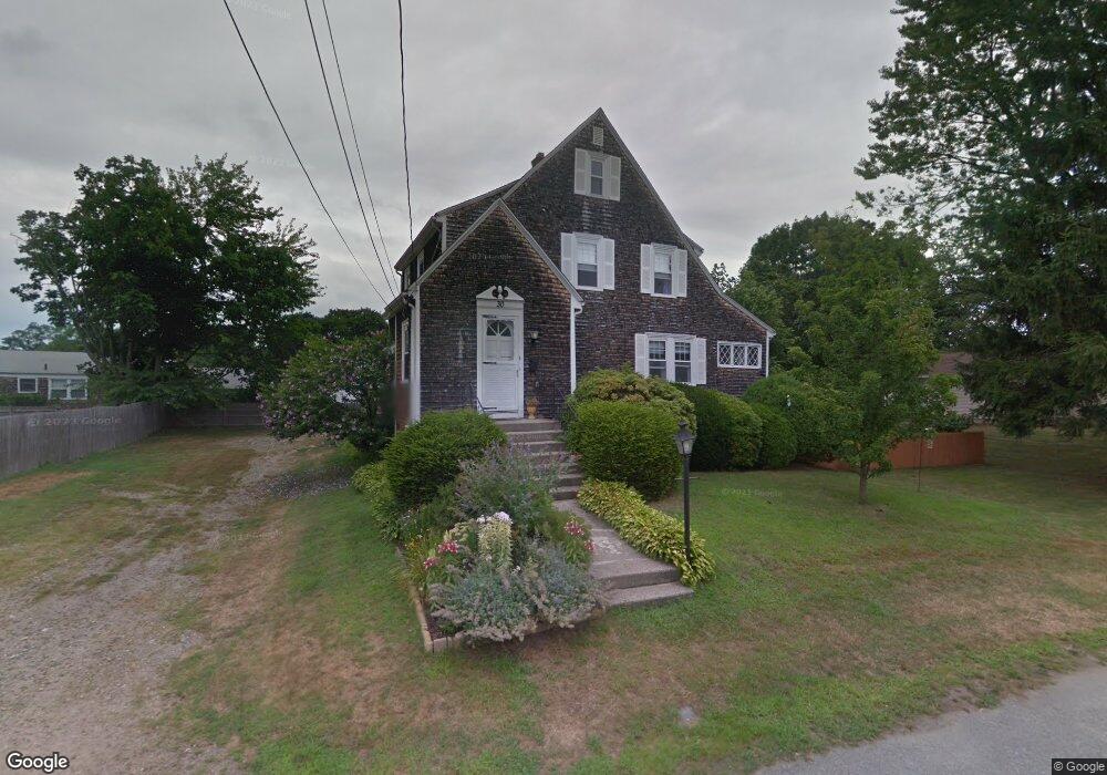
30 Deer St Rumford, RI 02916
Rumford NeighborhoodEstimated Value: $454,826 - $678,000
3
Beds
2
Baths
1,788
Sq Ft
$293/Sq Ft
Est. Value
About This Home
This home is located at 30 Deer St, Rumford, RI 02916 and is currently estimated at $523,457, approximately $292 per square foot. 30 Deer St is a home located in Providence County with nearby schools including East Providence High School, St Margaret School, and Saint Teresa Catholic Elementary School.
Ownership History
Date
Name
Owned For
Owner Type
Purchase Details
Closed on
Mar 11, 2008
Sold by
Nowakowski Rita
Bought by
Cameron Michael and Cameron Melanie
Current Estimated Value
Home Financials for this Owner
Home Financials are based on the most recent Mortgage that was taken out on this home.
Original Mortgage
$202,000
Interest Rate
5.57%
Mortgage Type
Purchase Money Mortgage
Create a Home Valuation Report for This Property
The Home Valuation Report is an in-depth analysis detailing your home's value as well as a comparison with similar homes in the area
Home Values in the Area
Average Home Value in this Area
Purchase History
| Date | Buyer | Sale Price | Title Company |
|---|---|---|---|
| Cameron Michael | $275,000 | -- | |
| Cameron Michael | $275,000 | -- |
Source: Public Records
Mortgage History
| Date | Status | Borrower | Loan Amount |
|---|---|---|---|
| Open | Cameron Michael | $201,267 | |
| Closed | Cameron Michael | $202,000 | |
| Previous Owner | Cameron Michael | $100,000 |
Source: Public Records
Tax History Compared to Growth
Tax History
| Year | Tax Paid | Tax Assessment Tax Assessment Total Assessment is a certain percentage of the fair market value that is determined by local assessors to be the total taxable value of land and additions on the property. | Land | Improvement |
|---|---|---|---|---|
| 2025 | $5,556 | $425,100 | $104,900 | $320,200 |
| 2024 | $4,993 | $325,700 | $87,400 | $238,300 |
| 2023 | $4,807 | $325,700 | $87,400 | $238,300 |
| 2022 | $5,286 | $241,800 | $62,400 | $179,400 |
| 2021 | $5,199 | $241,800 | $59,000 | $182,800 |
| 2020 | $4,608 | $223,800 | $59,000 | $164,800 |
| 2019 | $4,472 | $223,400 | $59,000 | $164,400 |
| 2018 | $4,475 | $195,600 | $56,200 | $139,400 |
| 2017 | $4,376 | $195,600 | $56,200 | $139,400 |
| 2016 | $4,354 | $195,600 | $56,200 | $139,400 |
| 2015 | $4,280 | $186,500 | $52,100 | $134,400 |
| 2014 | $4,280 | $186,500 | $52,100 | $134,400 |
Source: Public Records
Map
Nearby Homes
- 25 Orange St
- 8 Pine Grove St
- 27 Orange St
- 39 Webster Ave Unit 201
- 60 West Dr
- 63 East Dr
- 99 Ruth Ave Unit 101
- 241 Wilson Ave
- 70 Glen Meadows Dr
- 261 263 Roger Williams Ave
- 496 Beverage Hill Ave
- 339 Beverage Hill Ave
- 23 Frederick St
- 46 Lowell Ave
- 38 Lowell Ave
- 77 Manistee St
- 77 Manistee St
- 17 Maplewood Dr
- 0 Rosella Ave
- 200 Roger Williams Ave Unit 109