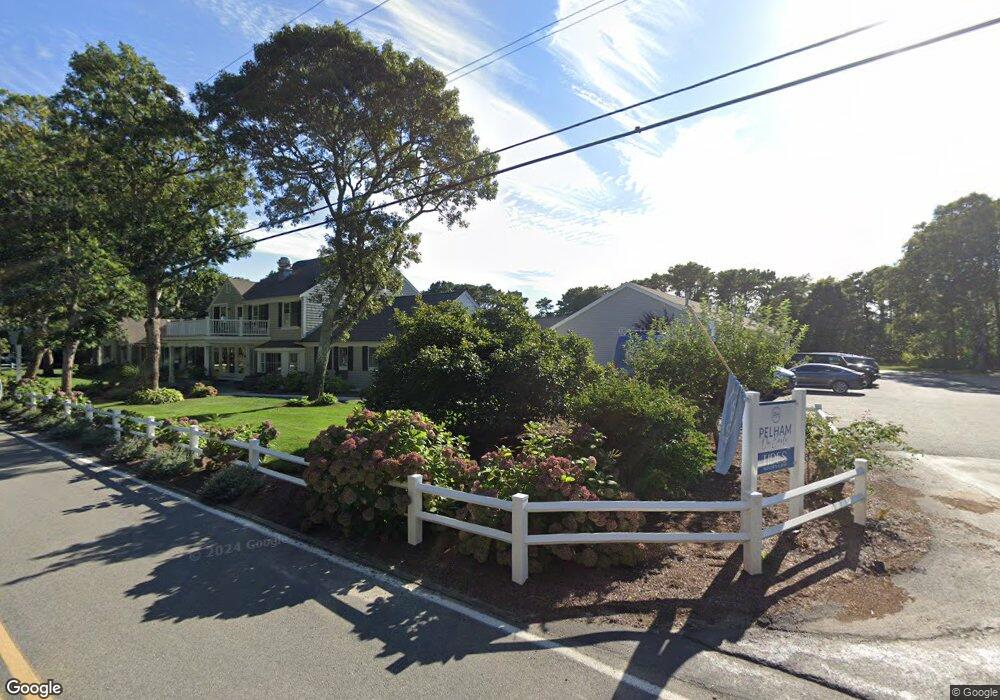
30 Earle Rd West Harwich, MA 02671
Northwest Harwich NeighborhoodEstimated Value: $4,027,683
--
Bed
--
Bath
5,940
Sq Ft
$678/Sq Ft
Est. Value
About This Home
This home is located at 30 Earle Rd, West Harwich, MA 02671 and is currently estimated at $4,027,683, approximately $678 per square foot. 30 Earle Rd is a home located in Barnstable County with nearby schools including Harwich Elementary School, Chatham Elementary School, and Monomoy Regional Middle School.
Ownership History
Date
Name
Owned For
Owner Type
Purchase Details
Closed on
Dec 2, 2021
Sold by
30 Earle Road Llc
Bought by
Pelham On Earle Llc
Current Estimated Value
Purchase Details
Closed on
Jun 23, 2017
Sold by
Commodore Inn Ltd
Bought by
30 Earle Road Llc
Home Financials for this Owner
Home Financials are based on the most recent Mortgage that was taken out on this home.
Original Mortgage
$2,100,000
Interest Rate
4.05%
Mortgage Type
Commercial
Purchase Details
Closed on
Jun 30, 2004
Sold by
Jones Flora M and Jones Richard A
Bought by
Commodore Inn Ltd
Purchase Details
Closed on
Sep 3, 1991
Sold by
Commodore Motel & Rlty
Bought by
Cape Cod Five Sb
Create a Home Valuation Report for This Property
The Home Valuation Report is an in-depth analysis detailing your home's value as well as a comparison with similar homes in the area
Home Values in the Area
Average Home Value in this Area
Purchase History
| Date | Buyer | Sale Price | Title Company |
|---|---|---|---|
| Pelham On Earle Llc | $3,150,000 | None Available | |
| 30 Earle Road Llc | $2,835,000 | -- | |
| Commodore Inn Ltd | -- | -- | |
| Cape Cod Five Sb | $260,000 | -- |
Source: Public Records
Mortgage History
| Date | Status | Borrower | Loan Amount |
|---|---|---|---|
| Previous Owner | 30 Earle Road Llc | $2,100,000 | |
| Previous Owner | Cape Cod Five Sb | $1,668,202 | |
| Previous Owner | Cape Cod Five Sb | $100,000 | |
| Previous Owner | Cape Cod Five Sb | $1,200,000 |
Source: Public Records
Tax History Compared to Growth
Tax History
| Year | Tax Paid | Tax Assessment Tax Assessment Total Assessment is a certain percentage of the fair market value that is determined by local assessors to be the total taxable value of land and additions on the property. | Land | Improvement |
|---|---|---|---|---|
| 2025 | $22,506 | $3,808,100 | $2,538,500 | $1,269,600 |
| 2024 | $22,004 | $3,649,100 | $2,394,700 | $1,254,400 |
| 2023 | $20,192 | $3,040,900 | $2,177,000 | $863,900 |
| 2022 | $23,688 | $2,920,800 | $2,082,600 | $838,200 |
| 2021 | $23,576 | $2,741,400 | $1,893,200 | $848,200 |
| 2020 | $23,708 | $2,715,700 | $1,857,500 | $858,200 |
| 2019 | $22,627 | $2,609,800 | $1,785,100 | $824,700 |
| 2018 | $22,159 | $2,444,700 | $1,622,800 | $821,900 |
| 2017 | $19,096 | $2,128,900 | $1,479,800 | $649,100 |
| 2016 | $19,281 | $2,125,800 | $1,479,800 | $646,000 |
| 2015 | $18,777 | $2,093,300 | $1,450,600 | $642,700 |
| 2014 | $17,946 | $2,046,300 | $1,407,500 | $638,800 |
Source: Public Records
Map
Nearby Homes
- 28 Patricia Ln
- 7 Dunes Rd
- 16 Mirasol Ln
- 13 Osborne Rd
- 231 Roue 28 Unit 20
- 231 Route 28 Unit 20
- 231 Route 28 Unit 8
- 231 Route 28 Unit 15
- 264 Massachusetts 28
- 292 Massachusetts 28 Unit 1
- 292 Massachusetts 28 Unit 7
- 292 Route 28 Unit 7
- 188 Massachusetts 28
- 24 Chase St
- 24 Chase St
- 19 Riverway
- 19 Riverway
- 161 Massachusetts 28 Unit 7
- 405 Lower County Rd Unit 21
- 8 Wyndemere Bluffs Rd
- 5 Shore Road Landing
- 3 Shore Road Landing
- 16 Middleton Dr
- 17 Shore Road Extension
- 12 Middleton Dr
- 1 Shore Road Landing
- 12 Shore Rd
- 6 Shore Road Landing
- 21 Shore Road Extension
- 21 Shore Dr
- 21 Shore Rd Extension
- 21 Patricia Ln
- 20 Patricia Ln
- 8 Middleton Dr
- 1 Earle Rd
- 19 Patricia Ln
- 23 Patricia Ln
- 7 Middleton Dr
- 22 Patricia Ln
- 23 Shore Road Extension