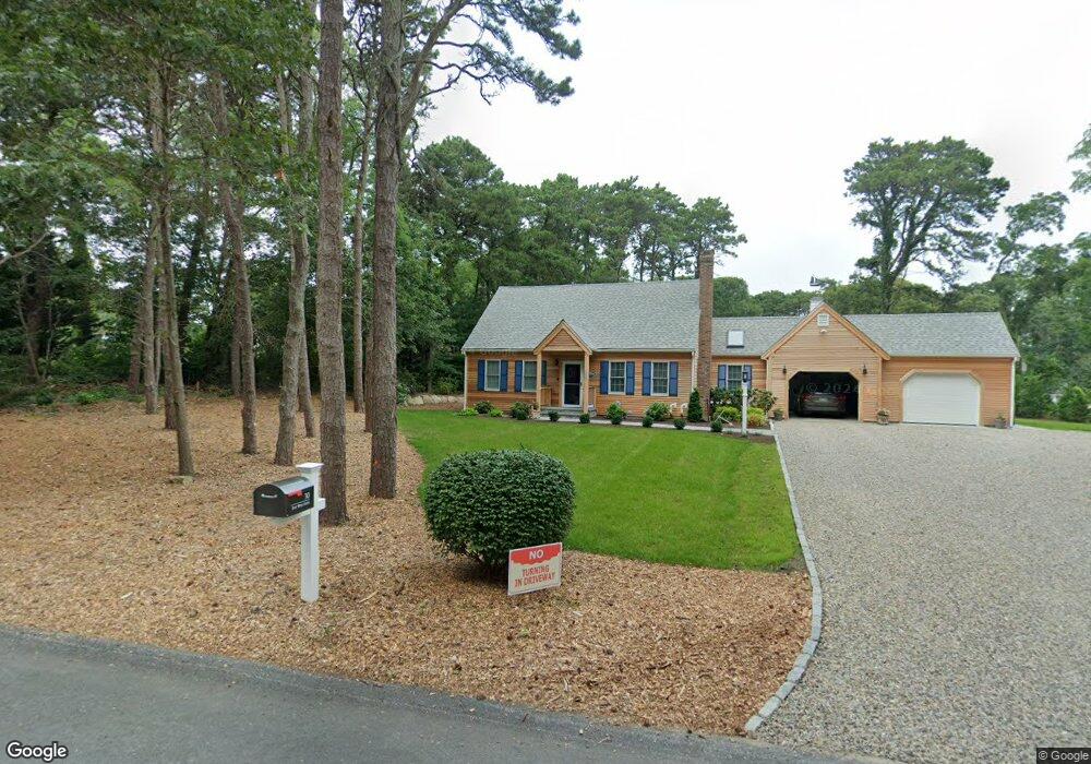
30 Eastwind Dr Eastham, MA 02642
Estimated Value: $733,425 - $831,000
3
Beds
2
Baths
1,548
Sq Ft
$505/Sq Ft
Est. Value
About This Home
This home is located at 30 Eastwind Dr, Eastham, MA 02642 and is currently estimated at $782,356, approximately $505 per square foot. 30 Eastwind Dr is a home located in Barnstable County with nearby schools including Eastham Elementary School, Nauset Regional Middle School, and Nauset Regional High School.
Create a Home Valuation Report for This Property
The Home Valuation Report is an in-depth analysis detailing your home's value as well as a comparison with similar homes in the area
Home Values in the Area
Average Home Value in this Area
Tax History
| Year | Tax Paid | Tax Assessment Tax Assessment Total Assessment is a certain percentage of the fair market value that is determined by local assessors to be the total taxable value of land and additions on the property. | Land | Improvement |
|---|---|---|---|---|
| 2025 | $4,712 | $611,200 | $214,400 | $396,800 |
| 2024 | $4,167 | $594,400 | $208,200 | $386,200 |
| 2023 | $3,830 | $529,000 | $192,800 | $336,200 |
| 2022 | $3,572 | $416,300 | $172,100 | $244,200 |
| 2021 | $3,473 | $378,300 | $156,400 | $221,900 |
| 2020 | $3,203 | $367,300 | $159,700 | $207,600 |
| 2019 | $2,963 | $359,200 | $155,000 | $204,200 |
| 2018 | $2,756 | $330,000 | $131,700 | $198,300 |
| 2017 | $2,556 | $323,500 | $129,100 | $194,400 |
| 2016 | $2,811 | $377,800 | $184,400 | $193,400 |
| 2015 | $2,617 | $368,600 | $180,800 | $187,800 |
Source: Public Records
Map
Nearby Homes
- 1061 State Hwy Unit 4
- 1061 State Hwy Unit 1061
- 20 Kittiwake Ln
- 25 Twin Rocks Dr
- 330 Hay Rd
- 55 Grandfathers Way
- 320 State Hwy
- 46 Freeman Ln
- 343 Tonset Rd
- 10 Cartway N
- 40 Bayview Rd
- 2 Reilly Run
- 3 Reilly Run
- 188 Rock Harbor Rd
- 181 Rock Harbor Rd
- 13 S Orleans Rd Unit 28
- 32 Locust Rd
- 339 Dyer Prince Rd
- 2705 State Hwy
- 2705 State Hwy Unit 1-8
- 40 Eastwind Dr
- 965R State Hwy Unit 965
- 963R State Hwy Unit 963
- 975R State Hwy Unit 975
- 985R State Hwy Unit 985
- 983R State Hwy Unit 983
- 975 State Hwy
- 963 State Hwy Unit 5
- 963 State Hwy Unit C-5
- 963 State Hwy
- 20 Eastwind Dr
- 985 State Hwy Unit 2
- 985 State Hwy Unit B
- 985 State Hwy
- 973 State Hwy Unit 3
- 973 State Hwy Unit C & D
- 973 State Hwy
- 983 State Hwy Unit A
- 983 State Hwy
- 25 Eastwind Dr
Your Personal Tour Guide
Ask me questions while you tour the home.