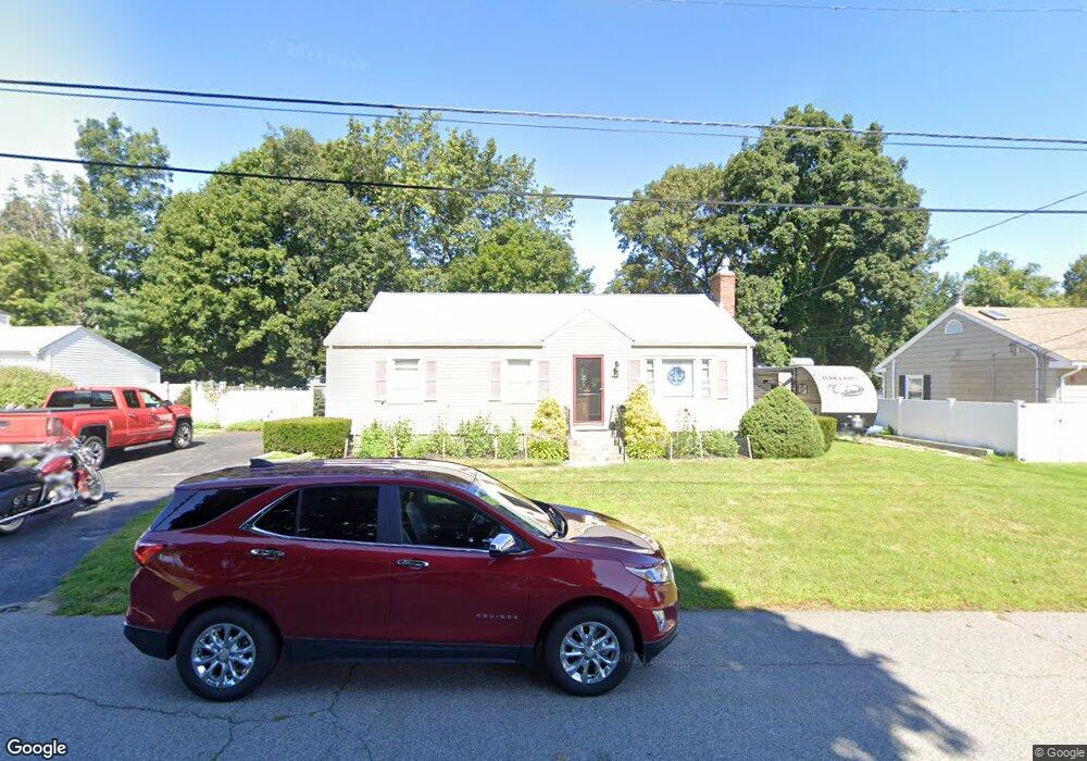
30 Farview Ave Shrewsbury, MA 01545
Estimated Value: $458,000 - $502,000
2
Beds
1
Bath
1,106
Sq Ft
$436/Sq Ft
Est. Value
About This Home
This home is located at 30 Farview Ave, Shrewsbury, MA 01545 and is currently estimated at $482,445, approximately $436 per square foot. 30 Farview Ave is a home located in Worcester County with nearby schools including Floral Street School, Sherwood Middle School, and Oak Middle School.
Ownership History
Date
Name
Owned For
Owner Type
Purchase Details
Closed on
May 23, 2023
Sold by
Pratt Bruce E and Pratt Elizabeth C
Bought by
Pratt Farview Rt and Pratt
Current Estimated Value
Purchase Details
Closed on
Feb 12, 2013
Sold by
Pratt Earle E
Bought by
Earle E Pratt Jr T E and Earle Pratt
Purchase Details
Closed on
Jul 12, 1977
Bought by
Earle E Pratt Jr T
Create a Home Valuation Report for This Property
The Home Valuation Report is an in-depth analysis detailing your home's value as well as a comparison with similar homes in the area
Home Values in the Area
Average Home Value in this Area
Purchase History
| Date | Buyer | Sale Price | Title Company |
|---|---|---|---|
| Pratt Farview Rt | -- | None Available | |
| Pratt Farview Rt | -- | None Available | |
| Pratt Farview Rt | -- | None Available | |
| Earle E Pratt Jr T E | -- | -- | |
| Earle E Pratt Jr T E | -- | -- | |
| Earle E Pratt Jr T E | -- | -- | |
| Earle E Pratt Jr T | $29,500 | -- |
Source: Public Records
Mortgage History
| Date | Status | Borrower | Loan Amount |
|---|---|---|---|
| Previous Owner | Earle E Pratt Jr T | $30,000 |
Source: Public Records
Tax History Compared to Growth
Tax History
| Year | Tax Paid | Tax Assessment Tax Assessment Total Assessment is a certain percentage of the fair market value that is determined by local assessors to be the total taxable value of land and additions on the property. | Land | Improvement |
|---|---|---|---|---|
| 2025 | $51 | $420,300 | $247,000 | $173,300 |
| 2024 | $4,527 | $365,700 | $235,200 | $130,500 |
| 2023 | $4,593 | $350,100 | $235,200 | $114,900 |
| 2022 | $4,717 | $334,300 | $235,200 | $99,100 |
| 2021 | $3,698 | $280,400 | $188,200 | $92,200 |
| 2020 | $3,432 | $275,200 | $188,200 | $87,000 |
| 2019 | $5,428 | $257,500 | $172,200 | $85,300 |
| 2018 | $3,107 | $245,400 | $162,900 | $82,500 |
| 2017 | $2,944 | $229,500 | $147,000 | $82,500 |
| 2016 | $2,891 | $222,400 | $137,300 | $85,100 |
| 2015 | $2,922 | $221,400 | $132,000 | $89,400 |
Source: Public Records
Map
Nearby Homes
- 39 Old Brook Rd
- 36 Francis Ave
- 18 Eastwood Rd
- 114 Grafton St
- 9 Arnold Rd
- 13 Kenilworth Rd
- 7 Wesleyan St
- 39 Harvard Ave
- 38 Wesleyan St
- 11 Harvard Ave
- 29 Elma Cir
- 46-50 Wesleyan St
- 7 Holman Heights Cir
- 60 Harrington Farms Way Unit 60
- 515 Main St
- 102 Harrington Farms Way
- 33 Shady Lane Ave
- 148 Spring St
- 28 Cherry St
- 129 Maple Ave
- 34 Farview Ave
- 2 Golden Hill Ave
- 22 Farview Ave Unit 24
- 14 Flanagan Dr
- 1 Golden Hill Ave
- 36 Farview Ave
- 16 Flanagan Dr
- 35 Farview Ave
- 6 Golden Hill Ave
- 5 Golden Hill Ave
- 4 Upland Ave
- 4 Upland Ave Unit 2
- 4 Upland Ave Unit 1
- 10 Flanagan Dr
- 9 Golden Hill Ave
- 42 Farview Ave
- 8 Upland Ave
- 8 Golden Hill Ave
- 15 Flanagan Dr
- 14 Farview Ave